- Obluchye
-
Obluchye (English)
Облучье (Russian)- Town[citation needed] - 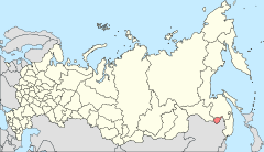
Location of the Jewish Autonomous Oblast in Russia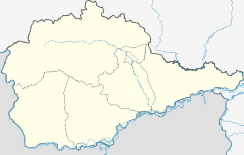
 Obluchye
Coordinates: 49°00′00″N 131°04′59″E / 49°N 131.08306°ECoordinates: 49°00′00″N 131°04′59″E / 49°N 131.08306°E Administrative status Country Russia Federal subject Jewish Autonomous Oblast Administrative district Obluchensky District[citation needed] Administrative center of Obluchensky District[citation needed] Statistics Population (2002 Census) 11,069 inhabitants[1] Time zone VLAST (UTC+11:00)[2] Founded 1911[citation needed] Postal code(s) 679100–679104[citation needed] Dialing code(s) +7 42666[citation needed] Obluchye (Russian: Облу́чье) is a town in the Jewish Autonomous Oblast, Russia, located on the Amur 159 kilometers (99 mi) west of Birobidzhan. Population: 10,425 (2010 est.);[3] 11,069 (2002 Census);[1] 12,016 (1989 Census).[4]
History
Construction on a section of the Trans-Siberian Railway connecting Chita and Vladivostok began in 1898, starting at each end and meeting halfway. The project produced a large influx of new settlers and in 1911 a village was founded around the Obluchye railway station, named for the Russian word roughly meaning the route passing around as the railway at this point travels through a large curve around the mountains.
The railroad was completed in October 1916.[5]
Town status was granted to Obluchye in 1938.
Economy and infrastructure
The gold mining company Zoloto Zutary is based in the town. Other employers include the railway workshops connected to the town's station on the Trans-Siberian Railway.
References
- ^ a b Федеральная служба государственной статистики (Federal State Statistics Service) (2004-05-21). "Численность населения России, субъектов Российской Федерации в составе федеральных округов, районов, городских поселений, сельских населённых пунктов – районных центров и сельских населённых пунктов с населением 3 тысячи и более человек (Population of Russia, its federal districts, federal subjects, districts, urban localities, rural localities—administrative centers, and rural localities with population of over 3,000)" (in Russian). Всероссийская перепись населения 2002 года (All-Russia Population Census of 2002). Federal State Statistics Service. http://www.perepis2002.ru/ct/doc/1_TOM_01_04.xls. Retrieved 2010-03-23.
- ^ Правительство Российской Федерации. Постановление №725 от 31 августа 2011 г. «О составе территорий, образующих каждую часовую зону, и порядке исчисления времени в часовых зонах, а также о признании утратившими силу отдельных Постановлений Правительства Российской Федерации». Вступил в силу по истечении 7 дней после дня официального опубликования. Опубликован: "Российская Газета", №197, 6 сентября 2011 г. (Government of the Russian Federation. Resolution #725 of August 31, 2011 On the Composition of the Territories Included into Each Time Zone and on the Procedures of Timekeeping in the Time Zones, as Well as on Abrogation of Several Resolutions of the Government of the Russian Federation. Effective as of after 7 days following the day of the official publication).
- ^ Федеральная служба государственной статистики (Federal State Statistics Service). Численность постоянного населения Российской Федерации по городам, посёлкам городского типа и районам на 1 января 2010 г. (Permanent Population of the Russian Federation by Cities/Towns, Urban-Type Settlements, and Districts as of January 1, 2010) (Russian)
- ^ "Всесоюзная перепись населения 1989 г. Численность наличного населения союзных и автономных республик, автономных областей и округов, краёв, областей, районов, городских поселений и сёл-райцентров. (All Union Population Census of 1989. Present population of union and autonomous republics, autonomous oblasts and okrugs, krais, oblasts, districts, urban settlements, and villages serving as district administrative centers.)" (in Russian). Всесоюзная перепись населения 1989 года (All-Union Population Census of 1989). Demoscope Weekly (website of the Institute of Demographics of the State University—Higher School of Economics. 1989. http://demoscope.ru/weekly/ssp/rus89_reg.php. Retrieved 2010-03-23.
- ^ [1]
Cities and towns in the Jewish Autonomous Oblast Administrative center: Birobidzhan Obluchye
 Categories:
- Cities and towns in the Jewish Autonomous Oblast
- Populated places established in 1911


Wikimedia Foundation. 2010.