- Baucau (district)
Infobox East Timor District
name = Baucau
tetum = Baukau
capital =Baucau
area = 1,494
arearank = 4th
population = 100,326
population_as_of = 2004
populationrank = 3rd
density = 67.2
densityrank = 5th
households = 22.659
households_as_of = 2004
householdsrank = 3rd
isocode = TL-BA
subdistricts =Baguia ,Baucau , Laga,Quelicai ,Vemasse ,Venilale
map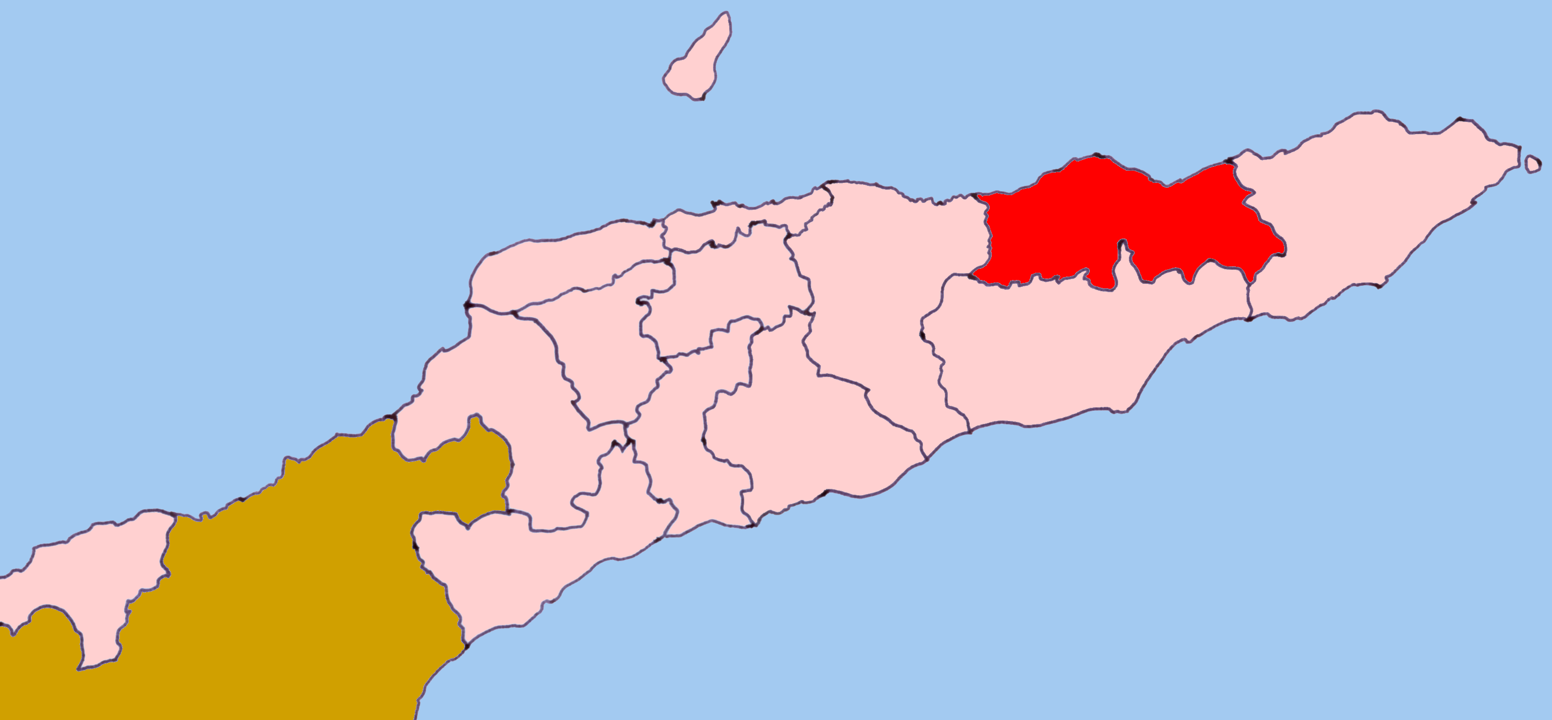
Baucau (
Tetum : Baukau), is a district of East Timor, on the northern coast in the eastern part of the country. The capital is also calledBaucau (formerly Vila Salazar). The population of the district is 104,571 (census 2004) and it has an area of 1,494 km². The subdistricts areBaguia ,Baucau , Laga,Quelicai ,Vemasse , andVenilale (formerly known as Vila Viçosa). The district was the same during the colonial era. Its north edge is to theWetar Strait ; it also borders the districts ofLautém to the east, Viqueque to the south, and Manatuto to the west.Besides the national official languages of
Tetum and Portuguese, most of the inhabitants speak thePapuan language Makasae . While most of the inhabitants areRoman Catholics , a few Muslims also live there.Baucau is has the most highly developed agriculture in East Timor. Besides the staples
rice andcorn , Baucau producesbeans ,peanuts ,sweet potatoes ,copra ,candlenut andmanioc . It also raises buffalo andgoats . A shortage of transportation links and the unpredictability of energy availability stymie the development of emerging industries.In the subdistrict Venilala are tunnels that the
Japan ese built during their occupation in theSecond World War . Also in this subdistrict is an ongoing project to reconstruct and renovate the Escola do Reino de Venilale (School of the Kingdom of Venilale). [http://gertil.fa.utl.pt/projectos/SW-A00-13/]Baucau also has a wide coastline with sandy beaches, ideal for swimming and other watersports.
Baucau has the country's longest airport runway, in
Cakung Airport , as currently,Dili 's Nicolau Lobato International Airport can only serve small airliners like theBoeing 737 . The airport is located six km from the city of Baukau. It served as the country's principal airport before theIndonesia n invasion in1975 , when it was taken over by the Indonesian military.
Wikimedia Foundation. 2010.