- River Nile (state)
-
River Nile
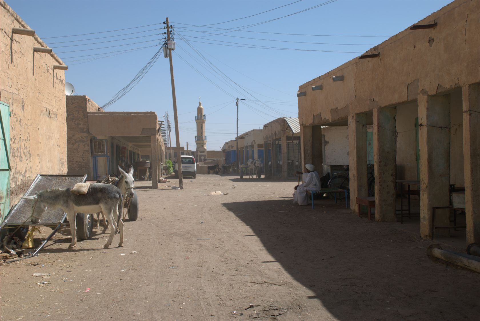
ولاية نهر النيل— State — Market street in Ad-Damir

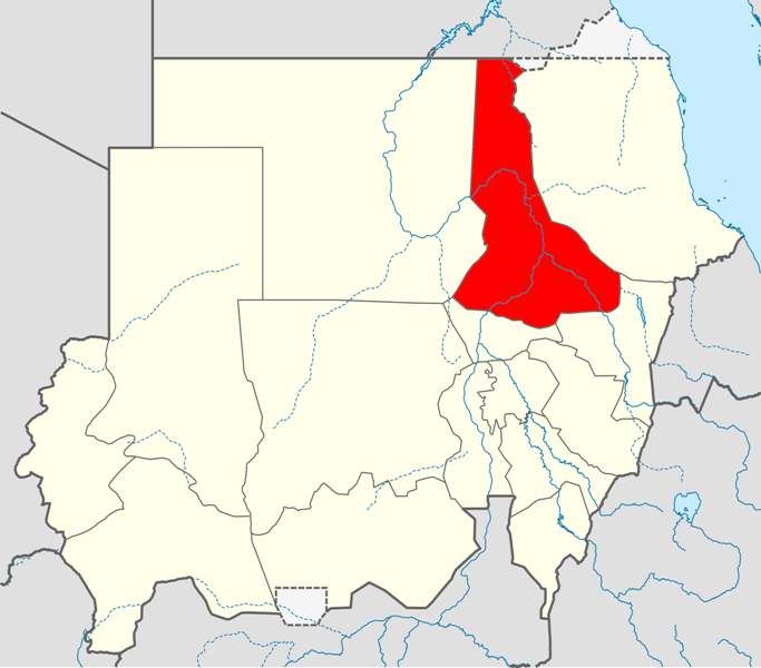
SealLocation in Sudan.
Coordinates: 18°27′N 33°23′E / 18.45°N 33.383°ECoordinates: 18°27′N 33°23′E / 18.45°N 33.383°E Country  Sudan
SudanRegion Northern No. of counties: Capital Ad-Damir Area – Total 122,123 km2 (47,152 sq mi) Population (2006 (est.)) – Total 1,027,534 Time zone EAT (UTC+3) River Nile (Arabic: ولاية نهر النيل Naḥr an Nīl) is one of the 15 wilayat or states of Sudan. It has an area of 122,123 km² (47,152 mi²) and an estimated population of 1,027,534 (2006). It consists of 6 localities (according to the latest political mapping) Ad-Damir is the capital city of the state. Slightly north of Ad-Damir is the important rail junction town of Atbarah; the other towns (localities) are Shendi, Al-Matamma, Berber and Abu Hamed. It also embraces the largest electricity generating project in the country, Alex Tanfield which is situated north of Abu Hamed.
External links
- en.nahralnileinvest.gov.sd, Ministry of Investment, Industry, Tourism & Mining River Nile State
States of Sudan States under administration of the Republic of SudanAl Jazirah · Kassala · Khartoum · North Darfur · North Kurdufan · Northern · Al Qadarif · Red Sea · River Nile · Sennar · South Darfur · West Darfur · White Nile
 States to hold "popular consultations"
Blue Nile (status unclear) · South Kordofan (process suspended)
Special administration area to hold referendum (postponed indefinitely)Abyei (part of both South Kordofan and Northern Bahr el Ghazal (South Sudan))Categories:- States of Sudan
- River Nile (state)
- Sudan geography stubs
Wikimedia Foundation. 2010.