Maio Airport

Maio Airport
Maio Airport
IATA: MMOICAO: GVMA
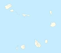
Maio  Airport is located in Cape Verde
{{{alt}}}
Maio
Airport
Location of Maio Airport
Summary
Airport type Public (ASA)
Operator Aeroportos Segurança Aera
Location Maio, Cape Verde
Elevation AMSL 36 ft / 11 m
Coordinates 15°9′20″N 23°12′50.04″W / 15.15556°N 23.2139°W / 15.15556; -23.2139Coordinates: 15°9′20″N 23°12′50.04″W / 15.15556°N 23.2139°W / 15.15556; -23.2139
Runways
Direction Length Surface
ft m
02/20 3,924 1,196 Asphalt

The Maio Airport (Portuguese Aeroporto do Maio) (IATA: MMOICAO: GVMA) is an airport in Cape Verde located in the island of Maio, about 3 km north of the island capital Vila do Maio. Its IATA code means the letter M and Maio, the last two letters of the ICAO code is Maio (the first two letters of the island name). The airport was inaugurated in the late-20th century.

Contents

Airlines and destinations

Airlines Destinations
Cabo Verde Express Sal
Halcyonair Sal, Praia
TACV Praia

See also

External links

References


Wikimedia Foundation. 2010.

Игры ⚽ Поможем сделать НИР

Look at other dictionaries:

  • Maio, Cape Verde — For other uses, see Maio (disambiguation). Maio Native name: Dja r’ Mai’ …   Wikipedia

  • Amílcar Cabral International Airport — Infobox Airport name = Amílcar Cabral International Airport nativename = nativename a = nativename r = image width = caption = IATA = SID ICAO = GVAC type = Public owner = operator = Aeroportos Seguranca Aera (ASA) city served = Espargos location …   Wikipedia

  • Mossoró Airport — Gov. Dix Sept Rosado Airport Aeroporto Gov. Dix Sept Rosado IATA: MVF – ICAO: SBMS Summary Airport type Public Serves Mossoró …   Wikipedia

  • Praia International Airport — Infobox Airport name = Praia International Airport nativename = nativename a = nativename r = image width = caption = IATA = RAI ICAO = GVNP type = Public owner = operator = Aeroportos Segurança Aérea (ASA) city served = location = Praia, Cape… …   Wikipedia

  • TACV — Infobox Airline airline=TACV Cabo Verde Airlines logo=TACV Logo.png logo size=200 fleet size=5 destinations=20 IATA=VR ICAO=TCV callsign=CABOVERDE parent= founded=1958 headquarters= flagicon|Cape VerdePraia key people= hubs=Sal Airport and Praia… …   Wikipedia

  • Cape Verde — This article is about the country. For the surface feature on Mars, see Cape Verde (Mars). For weather pattern, see Cape Verde type hurricane. Republic of Cape Verde República de Cabo Verde   (Portuguese) …   Wikipedia

  • Cape Verde — Cape Verdean /verr dee euhn/. /verrd/ a republic consisting of a group of islands (Cape Verde Islands) in the Atlantic, W of Senegal in W Africa: formerly an overseas territory of Portugal; gained independence in 1975. 393,843; 1557 sq. mi. (4033 …   Universalium

  • Transport in Cape Verde — In Cape Verde, most of the transportation between islands is done by plane. There are regular flights to and from the major islands (Santiago, Sal and São Vicente), with less frequent flights to the other islands. Boat transportation is also… …   Wikipedia

  • Anexo:Aeropuertos de África — La siguiente es una lista de aeropuertos de África ordenados por países. Contenido 1  Angola 2  Argelia 3  Botsuana 4 …   Wikipedia Español

  • Póvoa de Varzim — ] Culture and contemporary lifeJunqueira is Póvoa de Varzim s busiest and most traditional shopping district, the main street opened in the 18th century and is a pedestrian area since 1955. Currently, it has about 1 km (or 0.62 mi) of pedestrian… …   Wikipedia

Share the article and excerpts

Direct link
Do a right-click on the link above
and select “Copy Link”