- Okaihau
-
Okaihau 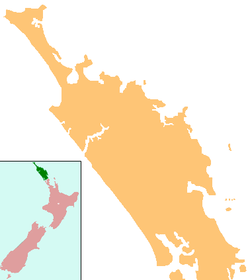
 Okaihau
Coordinates: 35°19′S 173°47′E / 35.317°S 173.783°E Country New Zealand Region Northland Region District Far North District Population (2006) - Total 717 Okaihau is a small town in the Northland Region of New Zealand's North Island, just north of Kaikohe. State Highway 1 passes through the town. The 2006 New Zealand Census of Population and Dwellings recorded Okaihau's population as 717, an increase of 30 people since the 2001 census.[1]
Contents
Transport
On 29 October 1923, a branch line railway was opened to Okaihau from the junction with the North Auckland Line at Otiria. Work on an extension of the line beyond Okaihau to the Hokianga Harbour and Kaitaia proceeded slowly, and in 1936, the line was essentially complete to Rangiahua. However, it was decided that construction beyond Rangiahua would be excessively expensive and the steep section from Okaihau to Rangiahua was seen as unnecessary and accordingly removed. The railway line thus became known as the Okaihau Branch and Okaihau became New Zealand's northernmost railway terminus. With Okaihau being on the main State Highway north (SH1) it became the transshipping point for goods from rail onto road and vice versa.
For the Okaihau Branch's first few decades of operation, passengers were catered for by mixed trains that carried freight as well and ran to slow timetables. These mixed services offered connections with the Northland Express passenger train that ran thrice weekly between Auckland and Opua, but in November 1956, the carriage train was replaced by a railcar service run by RM class 88 seaters. The northern terminus was changed from Opua to Okaihau, and the railway line rose in prominence and importance. The railcars provided a considerable improvement in service and were very popular throughout their service duration. However, mechanical faults plagued the railcars and they were cancelled in July 1967. Mixed trains continued to operate to Whangarei until 21 June 1976, when the line became freight-only. However, declining freight volumes due to deregulation of the transport industry in 1983 meant that the line did not last much longer, and it closed on 1 November 1987.
Today, the Okaihau railway station platform edge remains in its former location beside a flat area that was once the railway yard, and just to the north of the town is a tunnel on the ill-fated section to Rangiahua, New Zealand's northernmost railway tunnel.
There have been calls and proposals to reopen the Okaihau Branch to carry forestry traffic but to date nothing has yet come to fruition.
Education
History
The earliest official record of a school in Okaihau was in 1874, prior to this, school had been taught by Mr. Joseph Harrison from 1870 or 1871. The earliest date is not known. The settlers, through Mr. McCloud the M.P for the Bay of Islands at the time arranged to provide the timber for a school and the government would erect it and pay the teacher in full. The school was built in 1874, opening with a roll of 21 pupils.[2]
By 1889 the school building was too small and was shifted down to serve as the Upper Waihou School. A larger one was built in its place. This bigger school was known continuously as the "Main School" until consolidation over forty years later. Other schools opened in the area at later dates were; Upper Waihou, Rangi Point, Cooks Road, Utakura, Okaihau East and Okaihau Public Works School. Due to the large influx of workers on the proposed railway line to Kaitaia the Public Works School became necessary.[3] It grew to have three teachers.
Prior to 1938 there was no secondary education available to those in the Okaihau area. Students would either have to board in Auckland or Whangarei, or travel to Kaikohe by train. The trip to Kaikohe was an endurance test for students as they would often not get home until 6pm or later. On the 4th of April, 1938 a consolidated school was opened with a roll of 180. The first headmaster was Mr. A. Burnett.[2]
In 1947 the roll had increased to such an extent the Consolidated School became a District High School and with the addition of two prefabricated buildings served as both primary and secondary schools. The first headmaster was Mr. J. Lee and Mr. T. Batty assisted in the High School department. Further expansion took place in 1963 when a separate Infant Block was erected across the road from the Main School.
Okaihau College
Main article: Okaihau CollegeIn 1973 the High School was granted Form 1-7 (Year 7-13) status and became Okaihau College with Mr. Laurenson as first principal.[4] At the same time a full primary school was completed around the Infant Block with Mr. N. Thomson becoming the first headmaster. At the end of 1973 there were 263 pupils attending the college and 219 at the primary school.
Okaihau College has grown to a current student roll of 427 pupils.[5]
The name "Okaihau" is a Maori name which means "Feast of the winds", which is relevant to the location of the area on a ridge over 200 m above sea level. This part of New Zealand was originally a dense tree landscape, and even today huge old trees such as the puriri are found in the area of the school.
Okaihau Primary School
Okaihau Primary School is located in Northland, approximately 20 minutes from both Kaikohe and Kerikeri. It is a decile 4 school which caters for children between Years 1 and 6 and a roll of 157.[6]
Notes
- ^ Quickstats about Okaihau
- ^ a b Okaihau and districts schools centenary 1874-1974. Okaihau : Okaihau & Districts Schools Centennial Committee. 1974.
- ^ Centennial history of Okaihau / Compiled by Lesley Cameron Powell. Okaihau : Okaihau Centennial Committee. 1968.
- ^ "Okaihau College Home Page". Okaihau College. http://www.okaihau-college.school.nz.
- ^ "Te Kete Ipurangi". Ministry of Education. http://www.tki.org.nz/e/schools/display_school_info.php?school_id=7.
- ^ "Te Kete Ipurangi". Ministry of Education. http://www.tki.org.nz/e/schools/display_school_info.php?school_id=1059.
References
External links
Categories:- Populated places in New Zealand
- Far North District

Wikimedia Foundation. 2010.