- Hastings Mill
-
Coordinates: 49°17′10″N 123°05′42″W / 49.286°N 123.095°W
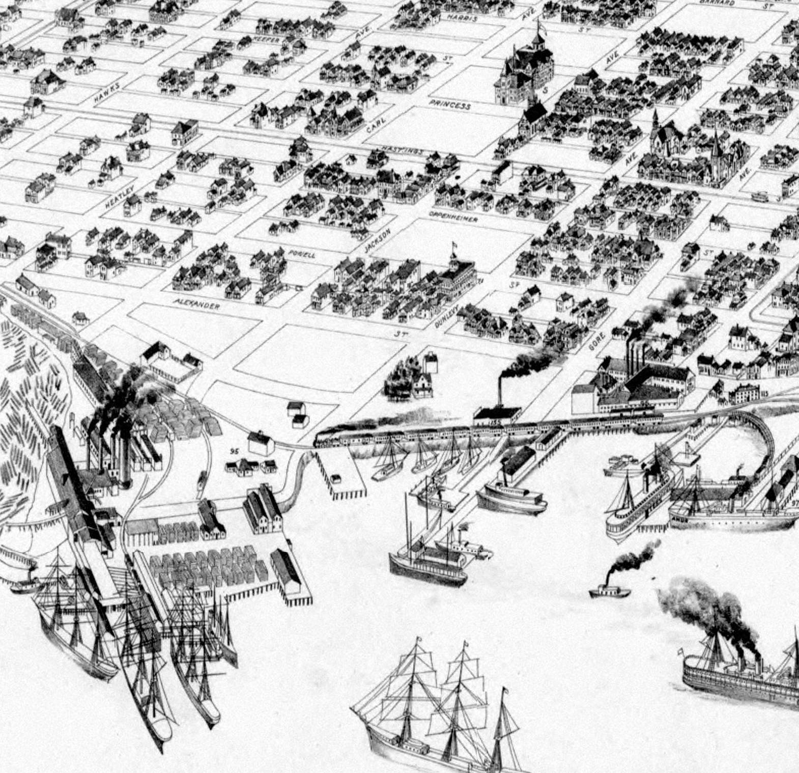
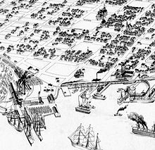 Drawing from 1898 showing Hastings Mill at the foot of Dunlevy Avenue
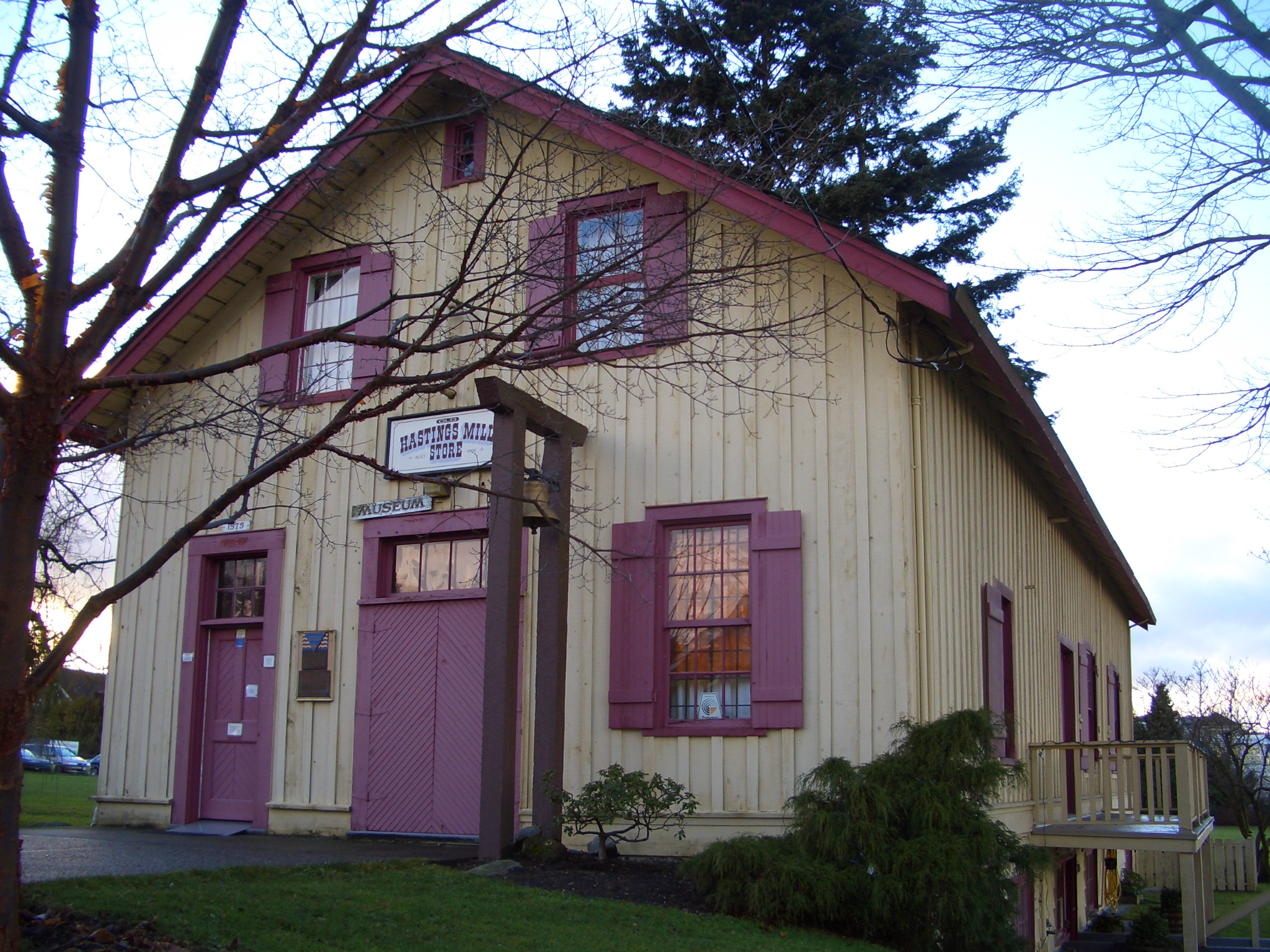
 Hastings Mill store museum, now on Point Grey Road
Hastings Mill was a sawmill on the south shore of Burrard Inlet and was the first commercial operation around which the settlement that would become Vancouver developed in British Columbia, Canada.
In 1867, Captain Edward Stamp began producing lumber in Stamp's Mill at the foot of what is now Dunlevy Avenue after a planned site at Brockton Point proved unsuitable due to difficult currents and a shoal. Stamp's efforts in developing the mill are summarized by Robert Macdonald in Making Vancouver: Class, Status and Social Boundaries, 1863-1913:
In 1865 he formed a company in England, backed by capital of $100,000 , to produce lumber in British Columbia. Stamp also secured from the colonial government of British Columbia the right to purchase or lease 16,000 acres (65 km2) of timber on the lower coast, and selected a mill site on a point of land along Burrard Inlet's south shore. Delayed by the failure of crucial machinery parts to arrive from England, Stamp did not begin cutting lumber for export until June 1867. After managing the firm for less than two years he retired, and shortly thereafter his company went into liquidation in England. The mill closed for a period in 1870 but opened again in August after being purchased by Dickson, DeWolf and Company of San Francisco. Known at first as Stamp's Mill, it now became the Hastings Sawmill Company, or Hastings Mill.[1]
The early settlement was in effect a company town. People shopped at the Hastings Mill Store and sent their children to the Hastings Mill School, which included students from Moodyville on the opposite side of the inlet. This would change after the CPR chose Vancouver as the terminus for the transcontinental railway. Nevertheless, the lumber industry remained the backbone of the new settlement's economy, and Hastings Mill was "the nucleus around which the city of Vancouver grew up in the 1880s" and remained important to the local economy until it closed in the 1920s.[2]
When Hastings Mill closed, the building that housed the Hastings Mill Store was transported by barge to the foot of Alma Street to begin a new life as the Old Hastings Mill Store Museum. Operated by the Native Daughters of British Columbia, the museum features Native American, pioneer and immigrant artifacts.[3]
This was also one of the only structures to survive the great fire in 1886 and was used as a hospital and morgue for the fire's victims.[4]
References
- ^ McDonald, R. A. (1996). Making Vancouver: Class, status and social boundaries, 1863-1913. Vancouver, BC, Canada: UBC Press, p 7.
- ^ Chuck Davis, "A Brief History of Greater Vancouver," from The History of Metropolitan Vancouver website.
- ^ http://www.venturevancouver.com/old-hastings-mill-store-vancouver-oldest-building Venture Vancouver
- ^ "The Old Hastings Mill Store Museum," Walking tours of Vancouver with John Atkin website.
See also
Categories:- Museums in Vancouver
- History museums in Canada
- Companies based in Vancouver
- Companies established in 1867
- History of British Columbia
- Defunct companies of Canada
- History of Vancouver
- Vancouver stubs
Wikimedia Foundation. 2010.