- Ohio State Route 142
-
State Route 142
Route information Maintained by ODOT Length: 13.6 mi[2] (21.9 km) Existed: 1926[1] – present Major junctions West end: 


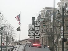
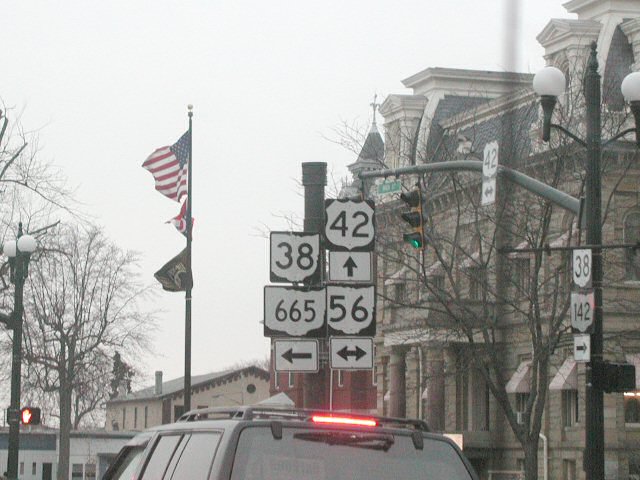
 US 42 / SR 38 / SR 56 / SR 665 at London
East end:  I-70/Madison CR 7 near West Jefferson
Location Counties: Madison Highway system Ohio highways
Interstates • U.S. Routes • State Routes←  SR 141
SR 143  →
→ Western terminus in London
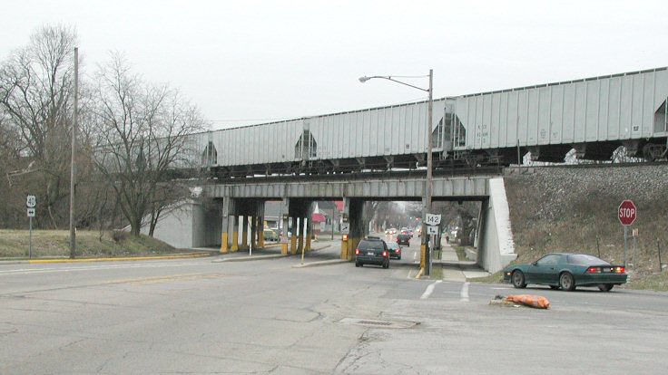
 JCT with US 40 in West Jefferson
State Route 142 Begins in London and acts as a spur of US 42 serving West Jefferson, although its interchange with I-70 primarily provides Interstate access to West Jefferson and nearby Lake Darby rather than as a connection to US 42. Sometimes the road (Plain City-Georgesville Rd) from that interchange northward to Plain City is also incorrectly referred to as Route 142 by locals. This road is actually designated as Madison CR 7, although a small portion of the road is a part of SR 142 from US 40 to I-70.
Contents
Junctions
County Location Mile Destinations Notes Madison London 0.0 SR 56
SR 665Western terminus of both SR 142 and SR 665 0.0 US 42
SR 38US 42 and SR 38 split south of this point 0.2 US 42
SR 38West Jefferson 10.1  US 40
US 40Former eastern terminus Jefferson Township 11.2 US 4013.6 I-70Diamond interchange; I-70 Exit 85 1.000 mi = 1.609 km; 1.000 km = 0.621 mi History
Originally, the eastern terminus was at West Jefferson[1] The route was extended to meet I-70 when it opened in 1971.[1][3] According to West Jefferson locals, ODOT hadn't originally planned for the SR 142 extension or its interchange with I-70, and felt the town would be adequately served by SR 29. The citizens protested, and gained the support of the Battelle Memorial Institute, located on Plain City-Georgesville Rd between US 40 and the proposed I-70. As a result, ODOT added an interchange at Plain City-Georgesville Rd to their plans, and extended SR 142 past Battelle to that interchange.[citation needed]
Sources
External links
Categories:- State highways in Ohio

Wikimedia Foundation. 2010.