- Ak-Sar-Ben Bridge
-
Coordinates: 41°15′35″N 95°55′16″W / 41.2598°N 95.9210°W
 Douglas Street Bridge about 1909
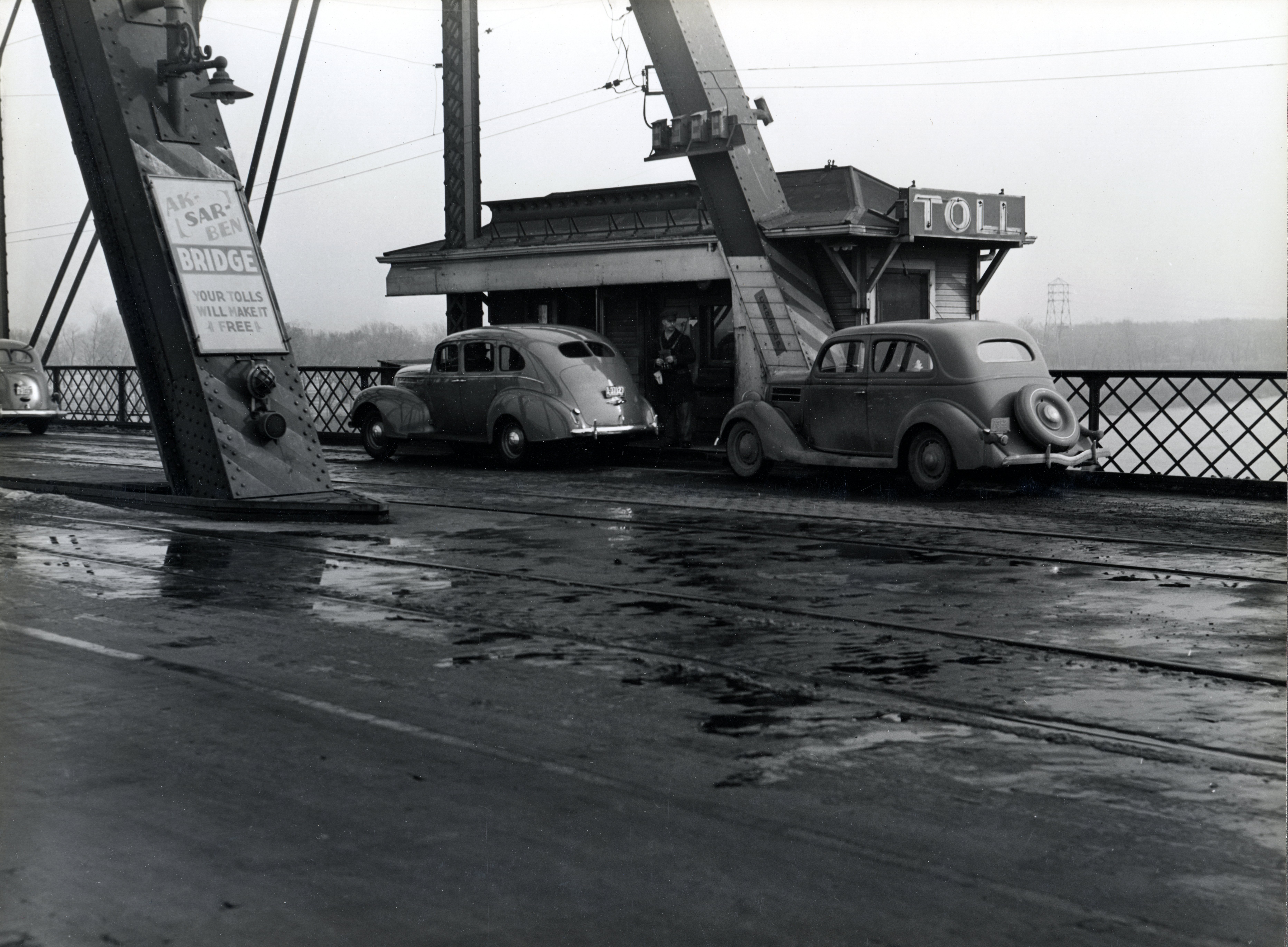
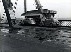 Bridge toll in November, 1938
The Ak-Sar-Ben Bridge was a truss bridge that was the first road bridge to cross the Missouri River connecting Omaha, Nebraska and Council Bluffs, Iowa. It was replaced in 1966 by the Interstate 480 girder bridge.
Originally called the Douglas Street Bridge, the bridge was built by the Omaha and Council Bluffs Street Railway Company in 1888 and was designed to handle street cars. It was a toll bridge. As automobiles became more popular, there were resentments about the tolls. A group of businessmen formed the "Knights of Ak-Sar-Ben" ("Nebraska" spelled backwards) to buy the bridge with the intentions of making it a free bridge. They continued to charge tolls until 1947 when it along with the South Omaha Bridge became free bridges. The hated toll booths were paraded through Omaha to celebrate Free Bridge Day on September 25, 1947.
It was replaced in November 1966 with an unnamed I-480 girder bridge (I-480 was to go on and be named the "Gerald R. Ford Freeway" after the native son President). Attempts were made to salvage the bridge as a pedestrian walkway but it was demolished in 1968 although the east pier remains in the river just south of the interstate on the Council Bluffs side.
U.S. Route 6 overlaps the interstate to cross the river.
See also
External links
Nebraska State Fair • Ak-Sar-Ben Bridge • Omaha Ak-Sar-Ben Knights • Ak-Sar-Ben 4-H Livestock Show • River City Roundup • Ak-Sar-Ben Coronation BallBridges in Omaha, Nebraska Bridges Union Pacific Missouri River Bridge · Douglas Street Bridge · Mormon Bridge · South Omaha Bridge · I-480 bridge · East Omaha BridgeOther types Related templates: Transportation • Boulevards • Railroads • Streetcars • Streets • ExpresswaysCrossings of the Missouri River Upstream
Interstate 480 bridge


Ak-Sar-Ben Bridge Downstream
Union Pacific Missouri River Bridge
Union Pacific RailroadCategories:- Bridges in Omaha, Nebraska
- Road bridges in Nebraska
- Council Bluffs, Iowa
- Bridges over the Missouri River
- Bridges completed in 1888
- Former buildings and structures of Omaha, Nebraska
- Demolished bridges in the United States
- Bridges in Pottawattamie County, Iowa
- Road bridges in Iowa

Wikimedia Foundation. 2010.