Merkys River

Merkys River
Merkys

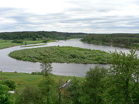
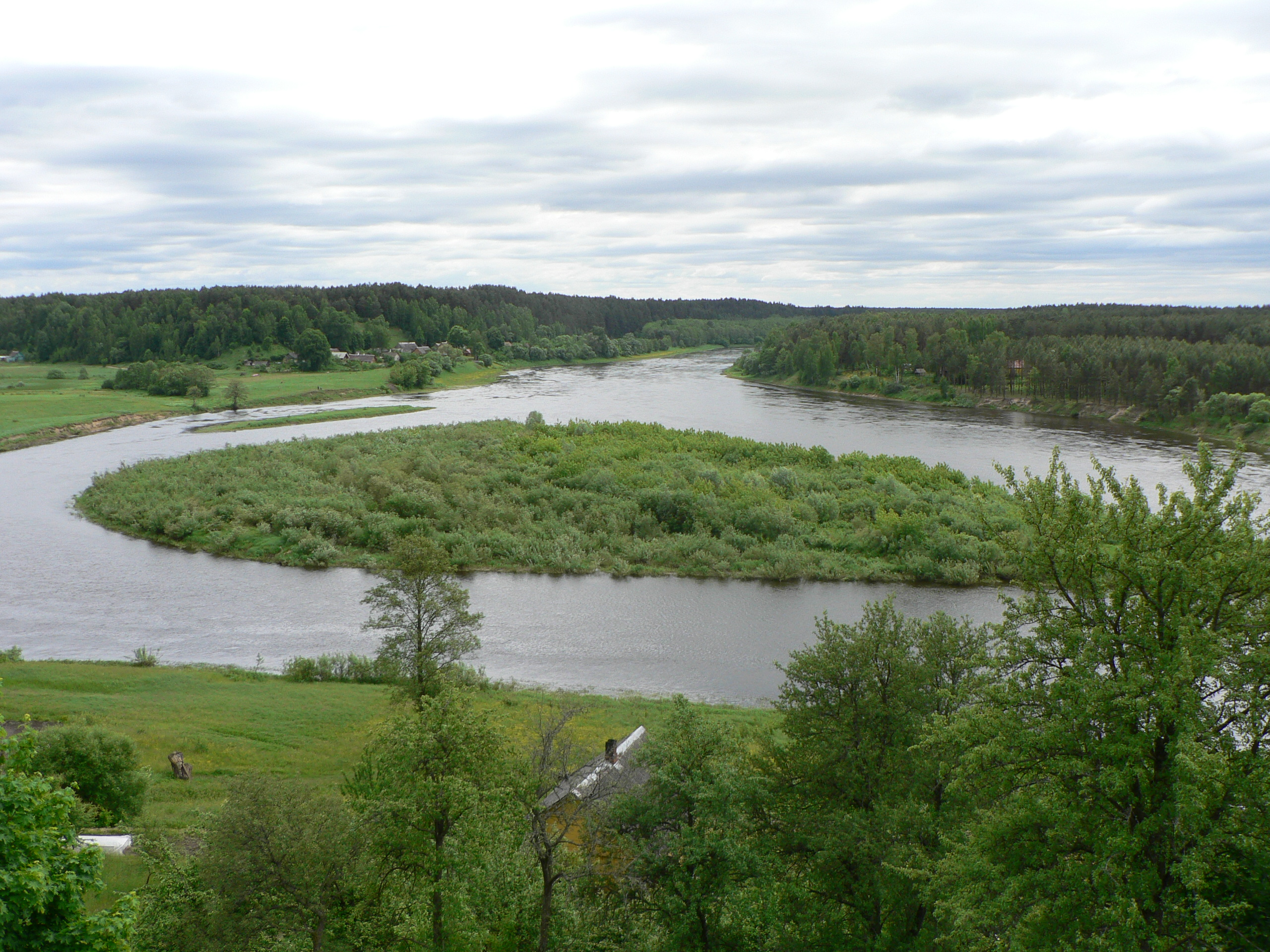
Confluence of the Merkys and Neman at Merkinė
Origin 18 km (11 mi) southwest from Ašmiany, Belarus
Mouth Neman River near Merkinė
Basin countries Lithuania (3,781 km2/1,460 sq mi), Belarus (635 km2/245 sq mi)
Length 213 km (132 mi)
Source elevation 136 m (446 ft)
Avg. discharge 21 cubic metres per second (740 cu ft/s) (near Varėna)
Basin area 4,416 km2 (1,705 sq mi)

The Merkys is a river in southern Lithuania and northern Belarus. It flows for 13 km (8.1 mi) through Belarus, 5 km (3.1 mi) along the Belarusian–Lithuanian border, and 195 km (121 mi) through Lithuania before joining the Neman River near Merkinė.

Merkys is mostly fed by underground streams and therefore is cooler during summers and has smaller fluctuations in water level than other rivers in Lithuania.[1] Near Žagarinė (128 km before its mouth) the Merkys is connected with Lake Papys by a canal. The Vokė River originates from this lake and consumes most of the Merkys' water. Before the canal average discharge of the Merkys is 3 m³/s and below it only 0.7 m³/s.[1] At the end of the 19th century the drainage basin of the Merkys grew by some 410 km² as its tributary Ūla River overtook some of the Kotra River's watershed area.[1]

The Merkys is a popular destination among water tourism enthusiasts as part of it belongs to the Dzūkija National Park and it flows into the Neman near the historical site of Merkinė. Archaeological findings show that people inhabited the area as early as the Mesolithic period. The Merkys is known for its diverse fauna, being declared a reservoir for trout in 1974.[1]

Name

The name of the river, Merkys, originate from merkti, an appellative word in the Lithuanian language meaning to soak.[2]

References

  1. ^ a b c d (Lithuanian) Jonas Zinkus, et al., ed (1987). "Merkys". Tarybų Lietuvos enciklopedija. III. Vilnius, Lithuania: Vyriausioji enciklopedijų redakcija. pp. 54–55. 
  2. ^ Zinkevičius, Zigmas (2007). Senosios Lietuvos valstybės vardynas. Vilnius: Science and Encyclopaedia Publishing Institute. p. 48. ISBN 5420016060. 

Coordinates: 54°09′23″N 24°11′07″E / 54.15639°N 24.18528°E / 54.15639; 24.18528


Wikimedia Foundation. 2010.

Игры ⚽ Нужно решить контрольную?

Look at other dictionaries:

  • Ūla River — Infobox River | river name = Ūla River caption = A bend of river Ūla origin = Grodno Oblast mouth = Merkys River basin countries = Lithuania and Belarus length = 84 km elevation = discharge = 5.58 m³/s watershed = 753 km² Ūla is a river in… …   Wikipedia

  • Kotra River — Infobox River river name = Kotra River caption = origin = 22 km southeast from Varėna mouth = Neman River basin countries = Belarus, Lithuania length = 109 km elevation = mouth elevation = discharge = 12.8 m³/s watershed = 2010 km²Kotra River (… …   Wikipedia

  • Šalčia — Infobox River | river name = Šalčia River caption = origin = Šalčininkai district mouth = Merkys River basin countries = Lithuania and Belarus length = 76 km elevation = discharge = 5,72 m³/s watershed = 749 km² Šalčia is a river in Lithuania. It …   Wikipedia

  • Suwałki Agreement — The Suwałki Agreement, Treaty of Suvalkai [cite web|title=The Polish Lithuanian Crisis of 1938|author=Robert A. Vitas|publisher=Lituanus|url=http://www.lituanus.org/1984 2/84 2 03.htm|date=1984 02 03|accessdate=2008 04 23] , or Suwalki Treatycite …   Wikipedia

  • Valkininkai —   Town   Church of Valikininkai …   Wikipedia

  • List of rivers of Belarus — Longest rivers= List of Rivers in Belarus*Dnieper River **Drut River (R) **Sozh (L) ***Iput River ***Pronya ***Besed **Berezina River (R) ***Svislach River ****Niamiha ***Babrujka River **Pripyat River (R) ***Horyn River ***Styr River ***Ubarts… …   Wikipedia

  • Names of Lithuanian places in other languages — This page lists some names of places in Lithuania, as they are called in Lithuanian, and as they are called or were formerly called in other languages spoken by ethnic groups which are or have been represented within Lithuanian territory.… …   Wikipedia

  • Dainava Forest — and Ūla River The Dainava Forest (Lithuanian: Dainavos giria) is the largest forest in Lithuania. Located in Dzūkija region in southern Lithuania, it covers the total area of 1,450 km2 (560 sq mi) of which 1,145 km2… …   Wikipedia

  • Sena Varėna — Infobox Settlement name = Sena Varėna nickname = settlement type = Village pushpin pushpin map caption = Location of Sena Varėna pushpin label position = left image shield = Marcinkonys COA.gif latd=54|latm=15|lats=|latNS=N|longd=24|longm=33|longs… …   Wikipedia

  • Senoji Varėna — Sena Varėna   Village   …   Wikipedia

Share the article and excerpts

Direct link
Do a right-click on the link above
and select “Copy Link”