- Karesuando
Infobox Settlement
official_name = Karesuando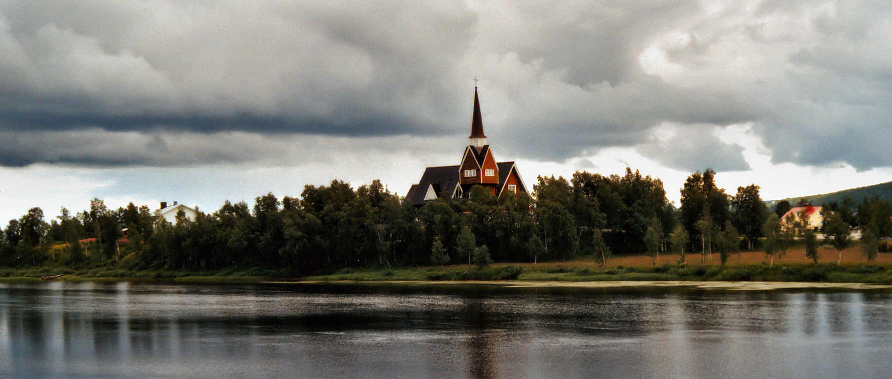
image_caption = Karesuando church
pushpin_
subdivision_type = Country
subdivision_name =Sweden
subdivision_type1 = Municipality
subdivision_name1 =Kiruna Municipality
subdivision_type2 = County
subdivision_name2 =Norrbotten County
subdivision_type3 = Province
subdivision_name3 =Lappland
area_footnotes = cite web |title=Tätorternas landareal, folkmängd och invånare per km2 2000 och 2005 |publisher=Statistics Sweden |url=http://www.scb.se/statistik/MI/MI0810/2005A01B/T%E4torternami0810tab1.xls |format=xls |language=Swedish |accessdate=2008-05-15]
area_total_km2 = 0.9
population_as_of = 2005-12-31
population_footnotes =
population_total = 313
population_density_km2 = 348
timezone = CET
utc_offset = +1
timezone_DST = CEST
utc_offset_DST = +2
latd=68 |latm=27 |lats= |latNS=N
longd=22 |longm=29 |longs= |longEW=E
website =Karesuando (Finnish "Kaaresuvanto", Sami "Karesuanto", "Gárasavvon" or "Karasavvon") is the northernmost locality (pop. 313 in 2005) and church village of
Sweden , located at theMuonio River on the border to Finland. The village is inKiruna Municipality ,Norrbotten County .On the Finnish side of the river, the Finnish village of
Kaaresuvanto is located (pop. about 140). According to Finnish tradition they are one and the same village (with pop. about 470), but they are usually considered different, since there is a national border in between.The village got its first buildings in
1670 , whenMåns Mårtensson Karesuando , called "Hyvä Maunu Martinpoika" in Finnish and "Good Maunu, Son of Martin" in English, bought land from SamiHenrik Nilsson Nikkas . Thevicar and botanistLars Levi Laestadius worked in Karesuando where he foundedlaestadianism named after him.The area is traditionally Finnish speaking and the border was drawn for political reasons in 1809, not because of any cultural border. Later of course a cultural and language difference has grown because of school and church influence.
Karesuando/Kaaresuvanto is the northernmost point on the
European route E45 .References

Wikimedia Foundation. 2010.