- Old Buckenham Airport
-
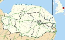
Old Buckenham Airfield IATA: none – ICAO: EGSV Summary Airport type Private Operator Touchdown Aero Centre Limited Location Norwich Elevation AMSL 194 ft / 59 m Coordinates 52°29′51″N 001°03′07″E / 52.4975°N 1.05194°ECoordinates: 52°29′51″N 001°03′07″E / 52.4975°N 1.05194°E Website Map Location in Norfolk Runways Direction Length Surface m ft 07/25 800 2,625 Asphalt 07/25 472 1,549 Grass 02/20 451 1,480 Grass Sources: UK AIP at NATS[1] Old Buckenham Airport (ICAO: EGSV), formerly RAF Old Buckenham, is located 12 NM (22 km; 14 mi) southwest of Norwich,[1] East Anglia, England.
Old Buckenham Aerodrome has a CAA Ordinary Licence (Number P826) that allows flights for the public transport of passengers or for flying instruction as authorised by the licensee (Touchdown Aero Centre Limited). The aerodrome is not licensed for night use.[2]
References
External links
Categories:- Airports in England
- Transport in Norfolk
- United Kingdom airport stubs
Wikimedia Foundation. 2010.

