- Anacostia (Washington Metro)
Infobox Station
name = Anacostia

logo_size = 50px
image_size =
image_caption =
address = 1101 Howard Road, SoutheastWashington, DC 20020
line =
other =
platform = 1island platform
tracks = 2
parking = 808 spaces
bicycle = 13 racks, 8 lockers
passengers = 2.637 million
pass_year = 2001
pass_percent = 0
pass_system =
opened =December 28 ,1991
rebuilt =
ADA = Yes
code = F06
owned =Washington Metropolitan Area Transit Authority
zone =
services =
mpassengers =Anacostia is a
Washington Metro station inWashington, DC on the Green Line.The station is located in the
Anacostia neighborhood of Southeast Washington, with entrances at Shannon Place and Howard Road, near Martin Luther King, Jr. Avenue a major street servicing the southern portion of the city.Anacostia was the Green Line's southern terminus from
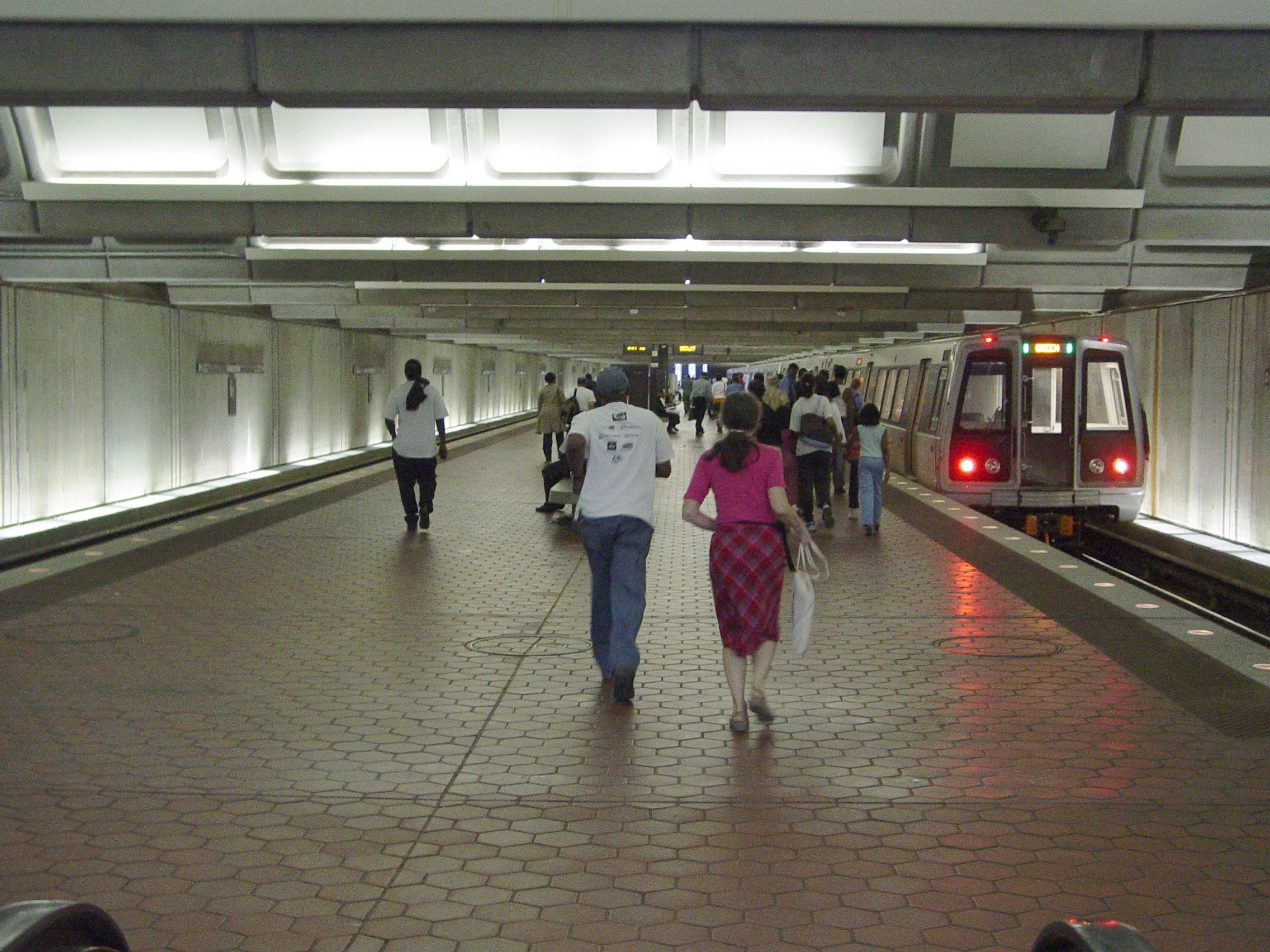
December 28 ,1991 , when Green Line service first began to Anacostia, toJanuary 13 ,2001 , with the opening of the line to Branch Avenue. Many people still depart here to ride on bus lines that serve the southeast neighborhoods better than the newer stations.The architecture at Anacostia is unusual. Due to the shallow depth of the station, the usual arched ceiling would have been impractical. Instead, the architecture consists of flat concrete walls, and a ceiling consisting of multiple small barrel vaults similar to the upper
coffer s in the six-coffer arch station design, oriented perpendicular to the tracks. Also because of the water table from the nearbyAnacostia River and DC-295/I-295 (Anacostia Freeway), Anacostia has a slightly longer platform. In addition, there are no pylons on the platform at Anacostia.Connections can be made to buses on Routes 90, 94, etc. [http://www.wmata.com/metrorail/Stations/station.cfm?station=85 Metro - Anacostia Metrorail station] , accessed
May 27 ,2007 ] Most of these routes were truncated or otherwise routed to Anacostia when it opened in 1991. John R. Butler,Washington Post , At Long Last, Green Line Comes South,January 2 ,1992 ] WMATA had planned to shift all routes to Anacostia, but decided to continue ten routes into downtown, due to complaints of the higher cost of transferring to Metrorail by Southeast residents as well of complaints from Prince George's County residents of crime in Anacostia. [Stephen C. Fehr,Washington Post , Metro Shifts Stand On SE, P.G. Buses,October 25 ,1991 ]Bus routes
Metrobus
* 90
* 94
* A2, A6, A7, A8, A42, A46, A48
* A33
* A4, A5
* B2
* P1, P2, P6
* P18
* U2
* W14
* W2, W3
* W4
* W6, W8References
External links
* StationMasters Online: [http://www.stationmasters.com/System_Map/ANACOSTI/anacosti.html Anacostia Station]
* The Schumin Web Transit Center: [http://transit.schuminweb.com/rail/washington/green-line.asp?station=F06 Anacostia Station]
Wikimedia Foundation. 2010.