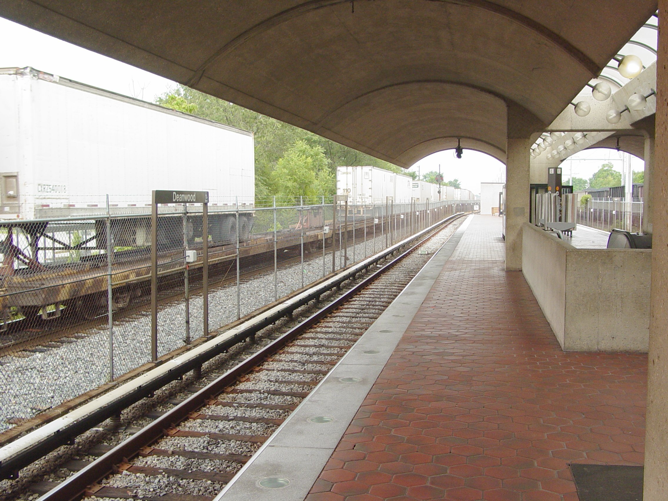
Deanwood (Washington Metro)
- Deanwood (Washington Metro)
Infobox Station
name = Deanwood

logo_size = 50px
image_size =
image_caption =
address = 4720 Minnesota Avenue, Northeast
Washington, D.C. 20019
line =
other =
platform = 1 island platform
tracks = 2
parking = 194 spaces
bicycle = 8 racks, 4 lockers
passengers = 676,710
pass_year = 2001
pass_percent = 0
pass_system =
opened = November 20, 1978
rebuilt =
ADA = Yes
code = D10
owned =Washington Metropolitan Area Transit Authority
zone =
services =
mpassengers = Deanwood is a Washington Metro station in Washington, D.C., on the Orange Line.
The station is in the Deanwood neighborhood in Northeast Washington at Minnesota Avenue and 48th Street. Service began on November 20, 1978.
The Deanwood Station services the east corner of Washington, D.C., and it is architecturally similar to her sister station, Minnesota Avenue.
Bus routes
Metrobus
* R12
* V14, V15
* V7, V8
* W4
External links
* WMATA: [http://www.wmata.com/metrorail/Stations/station.cfm?station=65 Deanwood Station]
* StationMasters Online: [http://www.stationmasters.com/System_Map/DEANWOOD/deanwood.html Deanwood Station]
* The Schumin Web Transit Center: [http://transit.schuminweb.com/rail/washington/orange-line.asp?station=D10 Deanwood Station]
* Deanwood is at coordinates Coor at dms|38|54|28.8|N|76|56|7.5|W
Wikimedia Foundation.
2010.
Look at other dictionaries:
Deanwood (WMATA station) — Deanwood Station statistics Address 4720 Minnesota Avenue, Northeast W … Wikipedia
Orange Line (Washington Metro) — Orange Line … Wikipedia
Washington, D.C. — This article is about the place. For the novel, see Washington, D.C. (novel). Washington, D.C. Federal district … Wikipedia
Deanwood — This article is about the neighborhood. For the Metro station, see Deanwood (WMATA station). Map of Washington, D.C., with Deanwood highlighted in red Deanwood is a neighborhood in Northeast Washington, D.C., bounded by Eastern Avenue to the… … Wikipedia
Streetcars in Washington, D.C. — This article refers to the streetcars that existed in Washington prior to 1962. For information on the proposed new streetcar lines, see DC Streetcar. Washington Streetcars 15th Street NW in the early 20th century Info … Wikipedia
Línea Naranja (Metro de Washington) — Línea Naranja Tren de la línea Naranja en West Falls Church Station Lugar Ubicación Condado de F … Wikipedia Español
Columbia Heights (Washington, D.C.) — This article is about the neighborhood. For the Metro station, see Columbia Heights (WMATA station). The Tivoli Theatre, a renovated landmark on 14th Street NW, is a symbol of Columbia Heights. Columbia Heights is a neighborhood in central… … Wikipedia
Chinatown (Washington, D.C.) — Map of Washington, D.C., with Chinatown highlighted in red Chinatown in Washington, D.C., is a small, historic neighborhood east of downtown consisting of about 20 ethnic Chinese and other Asian restaurants and small businesses along H and I… … Wikipedia
North Cleveland Park, Washington, D.C. — Map of Washington, D.C., with North Cleveland Park highlighted in red North Cleveland Park is a neighborhood in the Northwest quadrant of Washington, D.C. It s home to the Van Ness campus of the University of the District of Columbia and the… … Wikipedia
Near Northeast, Washington, D.C. — Map of Washington, D.C., with Near Northeast highlighted in red Near Northeast is a neighborhood in Northeast Washington, D.C.. It is bounded by North Capitol Street to the west, Florida Avenue to the north, H Street to the south, and 15th Street … Wikipedia