- Monte Argentario
-
Monte Argentario — Comune — Comune di Monte Argentario Cala Grande Location of Monte Argentario in Italy
 Monte Argentario
Coordinates: 42°26′N 11°7′E / 42.433°N 11.117°E Country Italy Region Tuscany Province Grosseto (GR) Frazioni Cala Moresca, Cala Piccola, Carrubo, Porto Santo Stefano, Porto Ercole, Pozzarello, Santa Liberata, Sbarcatello, Terrarossa Government - Mayor Arturo Cerulli Area - Total 60.3 km2 (23.3 sq mi) Elevation 5 m (16 ft) Population (2009)[1] - Total 13,023 - Density 216/km2 (559.4/sq mi) Demonym Santostefanesi Time zone CET (UTC+1) - Summer (DST) CEST (UTC+2) Postal code 58019 Dialing code 0564 Patron saint Sts. Erasmus and Stephen Saint day June 2 Website Official website Monte Argentario is a comune (municipality) and a peninsula belonging to the Province of Grosseto in the Italian region Tuscany, located about 150 km south of Florence and about 35 km south of Grosseto. The peninsula is connected with the mainland by three spits of land which form two lagoons, the Laguna di Ponente on the west side and the Laguna di Levante on the east side of the middle dam. The two main villages on Monte Argentario are Porto Santo Stefano, facing north, and Porto Ercole facing south.
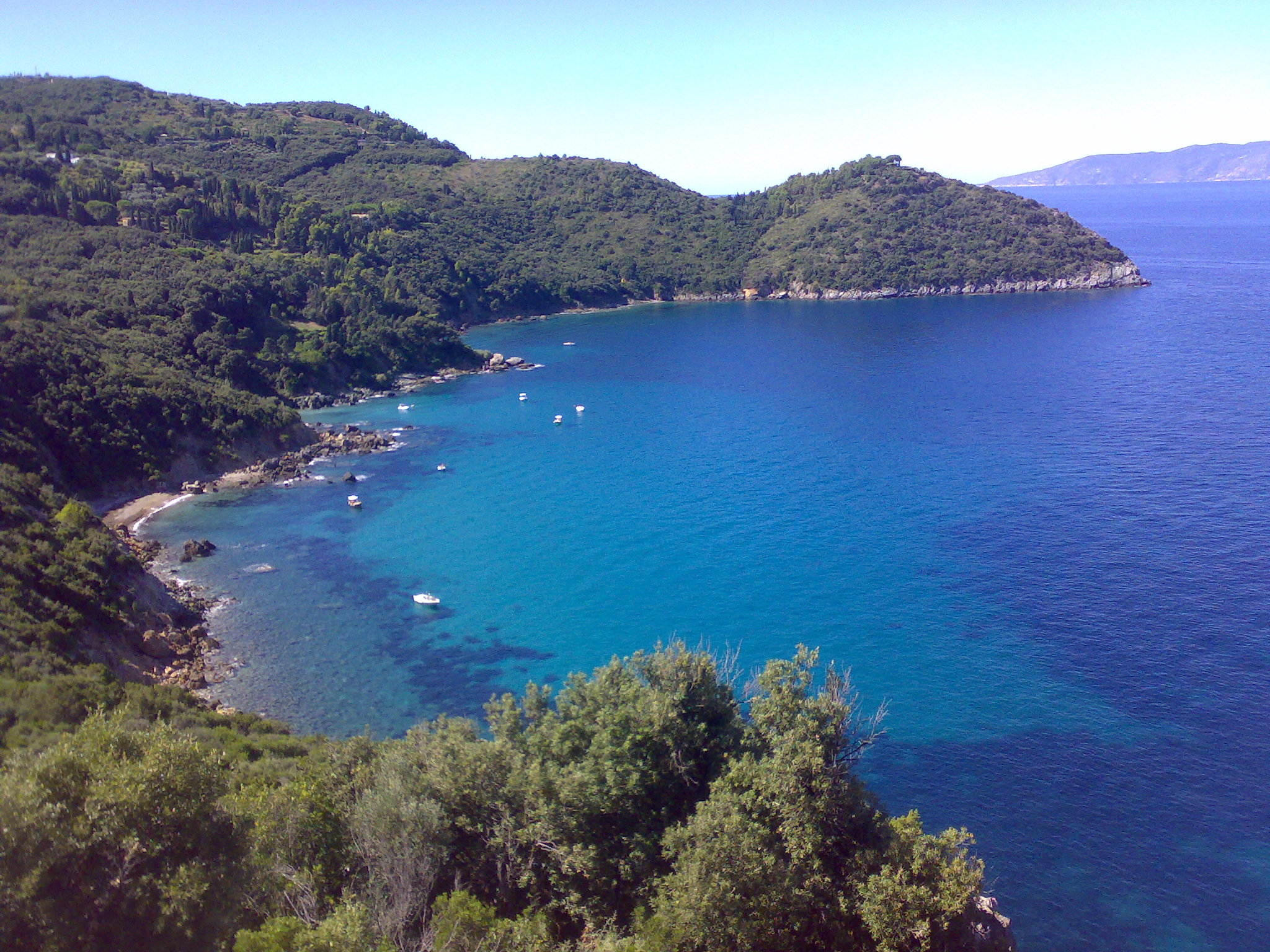
The panoramic road Strada panoramica starts in Porto Santo Stefano allowing splendid views of the coast and the Tuscan Archipelago.
Monte Argentario borders the comune of Orbetello, which is located on the middle dam between the two lagoons.
Contents
Geography
Monte Argentario is a promontory stretching towards the Tyrrhenian Sea in correspondence of the two southernmost islands of the Tuscan Archipelago, Giglio and Giannutri. The promontory was an island in the past, but the sea currents and the Albegna river joined it with the mainland through two so-called tomboli (stretches of land), The Tombolo of Giannella and the Tombolo of the Feniglia.
The highest peak of Monte Argentario is the Punta Telegrafo (635 m). The landscape and the coast are mainly rocky; numerous harbors, usually with rock beaches, are present. The municipal seat is in the northern settlement, Porto Santo Stefano.
History
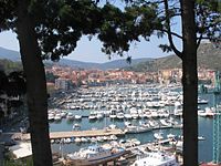
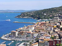 Porto Santo Stefano
 Porto Ercole
The promontory, probably already inhabited by the Etruscans, was a personal property of the Domitii Aenobarbi family, who obtained it in return for the money they lent to the Roman Republic in the Punic Wars. The current name stems probably from this origin, since Arganterii was the name of money lenders in ancient Rome.
Later an imperial possession, it was ceded to the church by Constantine the Great in the 4th century AD. In the Middle Ages, due to the reduced traffic passing on the nearby Via Aurelia, the area was sparsely settled. Following the history of Orbetello, the promontory was a possession of the Aldobrandeschi, Orsini, King Ladislaus of Naples and Siena, until Spain acquired it in the late 16th century. The Spaniards heavily fortified the two ports, as the main stronghold of the State of Presidi. After Napoleon's defeat, in 1815 the Argentario was handed over to the Grand Duchy of Tuscany, to which it remained until 1860, when it became part of the newly united Kingdom of Italy.
During World War II, the settlements of Argentario were heavily bombed, with numerous losses. The port of Santo Stefano was destroyed, and was rebuilt only in the 1950s. The railway that connected Orbetello to the mainland was never rebuilt.
Main sights
- Rocca Spagnola (Spanish Fortress), in Porto Santo Stefano
- Forte Filippo and Forte Stella, in Porto Ercole
- The church of St. Erasmus, in the historical centre of Porto Ercole, not far from the Porta Pisana
- The Via panoramica (Panoramic Road), running alongside the coast.
Demographic evolution

References
External links
Tuscany · Comuni of the Province of Grosseto Arcidosso · Campagnatico · Capalbio · Castel del Piano · Castell'Azzara · Castiglione della Pescaia · Cinigiano · Civitella Paganico · Follonica · Gavorrano · Grosseto · Isola del Giglio · Magliano in Toscana · Manciano · Massa Marittima · Monte Argentario · Monterotondo Marittimo · Montieri · Orbetello · Pitigliano · Roccalbegna · Roccastrada · Santa Fiora · Scansano · Scarlino · Seggiano · Semproniano · SoranoCategories:- Cities and towns in Tuscany
- Communes of the Province of Grosseto
- Peninsulas of Italy
- Geographical, historical and cultural regions of Italy


Wikimedia Foundation. 2010.