- Cerreto Guidi
-
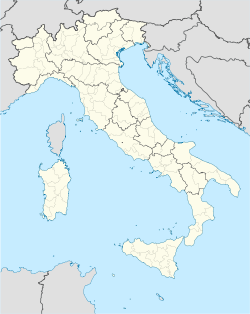
Cerreto Guidi — Comune — Comune di Cerreto Guidi Location of Cerreto Guidi in Italy Coordinates: 43°46′N 10°53′E / 43.767°N 10.883°ECoordinates: 43°46′N 10°53′E / 43.767°N 10.883°E Country Italy Region Tuscany Province Province of Florence (FI) Area - Total 49.3 km2 (19 sq mi) Elevation 123 m (404 ft) Population (Dec. 2004) - Total 10,126 - Density 205.4/km2 (532/sq mi) Time zone CET (UTC+1) - Summer (DST) CEST (UTC+2) Postal code 50050 Dialing code 0571 Website Official website Cerreto Guidi is a comune (municipality) in the Province of Florence in the Italian region Tuscany, located about 30 km west of Florence. As of 31 December 2004, it had a population of 10,126 and an area of 49.3 km².[1]
Cerreto Guidi borders the following municipalities: Empoli, Fucecchio, Lamporecchio, Larciano, San Miniato, Vinci.
Demographic evolution

References
External links
Tuscany · Comuni of the Province of Florence Bagno a Ripoli · Barberino Val d'Elsa · Barberino di Mugello · Borgo San Lorenzo · Calenzano · Campi Bisenzio · Capraia e Limite · Castelfiorentino · Cerreto Guidi · Certaldo · Dicomano · Empoli · Fiesole · Figline Valdarno · Florence · Firenzuola · Fucecchio · Gambassi Terme · Greve in Chianti · Impruneta · Incisa in Val d'Arno · Lastra a Signa · Londa · Marradi · Montaione · Montelupo Fiorentino · Montespertoli · Palazzuolo sul Senio · Pelago · Pontassieve · Reggello · Rignano sull'Arno · Rufina · San Casciano in Val di Pesa · San Godenzo · San Piero a Sieve · Scandicci · Scarperia · Sesto Fiorentino · Signa · Tavarnelle Val di Pesa · Vaglia · Vicchio · Vinci
Categories:- Cities and towns in Tuscany
- Communes of the Province of Florence
- Tuscany geography stubs
Wikimedia Foundation. 2010.

