- Maymana
-
Maymana
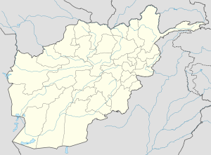
میمنهLocation in Afghanistan Coordinates: 35°56′N 64°45′E / 35.933°N 64.75°E Country  Afghanistan
Province Faryab Province District Elevation 2,877 ft (877 m) Population (2004) - Total 75,900 Time zone UTC+4:30 Maymana, Meymaneh or Maimana (Persian: میمنه) is the capital of Faryab province, northern Afghanistan, near the Turkmenistan border. It is approximately 400 km northwest of the Afghan capital Kabul. Coordinates: 35°56′N 64°45′E / 35.933°N 64.75°E
Contents
Location
Maymana is located at the northern foot of the Torkestan Range at an elevation of 877 m on the old terrace of the Qeysar or Maymana River. This river branches off of the Band-e Turkistan River 50 km south of the city. The highlands of the Maymana region generally possess a very rich topsoil which supports the seasonal agricultural activities.
Climate
Climatic Data Jan Feb Mar Apr May Jun Jul Aug Sep Oct Nov Dec Temperature (°C) 2 4 8 15 20 26 28 25 21 15 9 5 Precipitation (mm) 50 60 82 60 26 1 0 0 0 10 21 45 Sunshine (hrs/day) 4 4 6 7 10 12 12 11 10 8 5 4 Population
During the 19th century, the population of the settlement was estimated at 15,000-18,000, the majority being of Uzbek descent, in addition to, Pashtun and Tajiks minority. In 1958 the population was estimated to be 30,000, by 1979 this had risen to 38,250, by 1982 to 56,973.[1] In 2004 Maymana has a population of 75,900.[citation needed]
History
The town is of ancient origin. It seems clear that Maymana citadel dates back to the early Iron Age. Ceramic materials in a nearby cave at Bilchiragh are from the Paleolithic and late Neolithic-Bronze Age.[citation needed]
In the 10th century it was the residence of the Malik of Guzganan, which was then under the control of the Farighunid native dynasty.
In the 16th century, Uzbek influence came to Maymana with the invasions of Turkistan and Herat by Shaibanid Khan.
During the 18th and 19th centuries, Maymana was the centre of an independent Uzbek khanate and an important centre for commerce, as well as being the gateway to Turkistan from Herat and Persia.
In 1876 the city fell to the Afghans and was put in ruins, and only ten percent of the population was left.
The city was once strongly walled with thick walls and towers and surrounded by a moat, but in the 20th century all this has been reduced to an anonymous mound. In 1934, the rebuilding of the city started, and in 1949 the northern parts of the old city were renewed, the old city citadel changed to a park.
NATO presence through ISAF
As part of the ongoing NATO operation in Afghanistan, there is a Provincial Reconstruction Team based there, led by Norway. This team also includes Latvian troops.
Economy
The town serves an agricultural area irrigated from the Qeysar River and also handles the trade in Karakul sheep with nomads. Maymana is an important livestock centre in Afghanistan. In the 1970s, the wool and cotton processing industry was booming in the city. Maymana is a market for leather goods, silk, carpets, wheat, barley, melons and grapes.
There is also an airport located 2 miles (3.2 km) west of Maimana in a valley surrounded by hills and a range of mountains with some peaks reaching 12,000 ft.; 24 miles (39 km) southeast of the Turkmenistan border; and 64 miles (103 km) south of Andkhoy.The runway is with gravel surface.Maymana is, after Kabul, Mazar-i-Sharif, Herat and Kunduz, the fifth-largest Afghan town with an independent women-managed radio station, Radio Quyaash, established in February 2005.
References
External links
- Dupree, Nancy Hatch (1977): An Historical Guide to Afghanistan. 1st Edition: 1970. 2nd Edition. Revised and Enlarged. Afghan Tourist Organization.
Categories:- Populated places in Faryab Province
Wikimedia Foundation. 2010.


