- Culverden
-
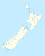
Culverden Coordinates: 42°46′S 172°51′E / 42.767°S 172.85°E Area[1] – Total 22.8465 km2 (8.8 sq mi) Population (2006)[2] – Total 420 – Density 18.4/km2 (47.6/sq mi) Culverden is a small town in the Canterbury region of New Zealand's South Island. The 2006 New Zealand Census of Population and Dwellings had a usually-resident population of 420. This represented an increase of 7% or 27 people from the previous census in 2001.
Culverden is located on State Highway 7 and is roughly an hour north of Christchurch. It was also once an important railway terminus, with the railway line extended from Medbury across the Hurunui River to Culverden on 8 February 1886. It was envisaged that this route would become the Main North Line to Nelson and Blenheim, but a coastal route via Parnassus and Kaikoura was chosen instead. Nonetheless, the branch line to Culverden was extended beyond the town to Waiau in 1919 and it became known as the Waiau Branch. At the line's peak, when it was considered to be part of the Main North Line, multiple trains ran daily between Culverden and Christchurch, including the Culverden Express and a number of slower mixed trains that carried both freight and passengers. However, regular passenger services were replaced by buses on 29 January 1939 and after becoming uneconomic, the railway through Culverden was closed entirely on 15 January 1978. Little now remains of the town's railway except a loading bank at the site of the old station.
References
External links
Towns in the Hurunui District, Canterbury, New Zealand Main Towns Amberley (seat) · Cheviot · Culverden · Hanmer Springs · Waiau · Waipara
Minor towns Domett · Greta Valley · Hawarden · Leithfield · Motunau · Omihi · Parnassus · Rotherham · Waikari ·
Localities Amberley Beach · Balcairn · Balmoral · Beckenham Hills · Blythe Valley · Boyle Village · Broomfield · Caverhill · Claverley · Conway Flat · Davaar · Engineers Camp · Ferniehurst · Glasnevin · Gore Bay · Hawkswood · Horsley Down · Hurunui · Hundalee · Lake Sumner · Leamington · Leithfield Beach · Lewis Pass · Marble Point · Masons Flat · Medbury · Mina · Motunau Beach · Mount Lyford · Mouse Point · Napenape · Nonoti · Pahau · Phoebe · Port Robinson · Pyramid Valley · Scargill · Spotswood · Spye · Teviotdale · The Peaks · Virginia · Weka PassCategories:- Populated places in New Zealand
- Hurunui District
- Canterbury Region geography stubs
Wikimedia Foundation. 2010.

