- Eagle Farm railway station, Brisbane
Citytrain Station
closed = yes
station_name = Eagle Farm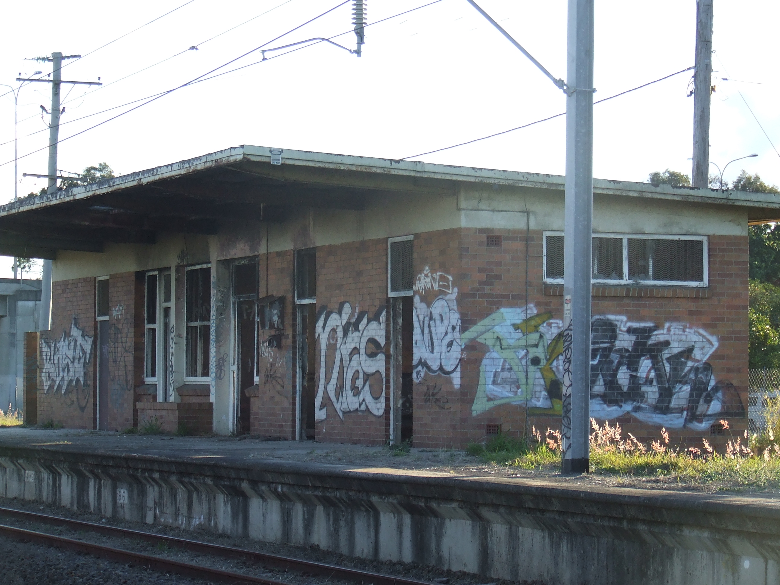
region = Brisbane North
street = Between Acacia Street and Lamington Avenue
suburb = Eagle Farm
brisway = http://www.street-directory.com.au/sd_new/genmap.cgi?x=153.0828&y=-27.4303&sizex=650&sizey=650&level=6&star=1
zone = 2
distance = 10.9
platforms = 1
platform_arch = 1 side platforms
access =
trainconnect = No
busconnect = Yes
tvm = No
disability = No
facilities = [http://www.citytrain.com.au/stations/station_details/eagle_farm.asp Link]
servicearea1 = Pinkenba
IB1 = Doomben
OB1 =BunourEagle Farm railway station is an abandoned passenger railway station on the Pinkenba railway line, only 6.8 km (4.2 mi) from the
Brisbane central business district ; 10.9 km from Central station by rail.History
Opened in
1952 as Baraini railway station, it was renamed a few months later to Airport railway station since it was located near the oldBrisbane Airport at Eagle Farm before it moved to its current location, north, at the demolished suburb Cribb Island. Airport station was unpopular with airport passengers, mostly due to very infrequent services and significant walking distance to the airport terminal. It was renamed Eagle Farm railway station in1988 along with the electrification of the line, only until a few metres past the station.All passenger services on the line were suspended on
27 September 1993 by the Goss Labor Party state government rationalisation of the rail network throughoutQueensland , with the suspending or closing of unprofitable and under-utilised rail lines.In
1998 the line re-opened to passenger services, but only operate as far as Doomben, the station immediately prior, with connecting bus services to the former railway stations between Doomben and Pinkenba.Current status
The Eagle Farm railway station building is still standing, however badly damaged and neglected.
Replacement bus service
The bus stop for the replacement TransLink bus service (303) is near Eagle Farm station in Kingsford Smith Drive. All available bus services are:
*TL Route Display | 302
*TL Route Display | 303
*TL Route Display | 304Original Eagle Farm station
The original Eagle Farm railway station opened in
1897 just 90 metres past Airport, east of the corner of Want Street and Schneider Road, behind theFord Motor Company of Australia site, today home of G. James glass. It closed in1977 with the opening of Whinstanes-Doomben station.cite book | last = Hallam | first = Greg | title = Brisbane's Biography (Steamtrain Sunday) | publisher = QR Limited | date = 2005 ]ee also
*
Citytrain
*TransLink (South East Queensland) References
Wikimedia Foundation. 2010.