- Franklin Square (Philadelphia)
Infobox_nrhp | name =Franklin Square
nrhp_type =
caption =
location= Race and 6th Sts.Philadelphia, Pennsylvania
lat_degrees = 39
lat_minutes = 57
lat_seconds = 19.83
lat_direction = N
long_degrees = 75
long_minutes = 9
long_seconds = 2.84
long_direction = W
locmapin = Pennsylvania
area =
built =1683
architect=Thomas Holme
architecture=
added =September 14 ,1981
governing_body = Local
mpsub=Four Public Squares of Philadelphia TR
refnum=81000556cite web|url=http://www.nr.nps.gov/|title=National Register Information System|date=2007-01-23|work=National Register of Historic Places|publisher=National Park Service]Franklin Square is one of the five original open-space parks planned by
William Penn during the late 17th century in centralPhiladelphia, Pennsylvania .History
Originally called Northeast Square, Franklin Square was renamed in 1825, to honor
Benjamin Franklin , one of the most prominent Founding Fathers of theUnited States and a leading printer, scientist, inventor, civic activist and diplomat. The myth persists that Franklin conducted his famous "kite and key" experiment on this spot, no doubt encouraged by the presence of Bolt of Lightning,Isamu Noguchi ’s the massive steel sculpture that faces the Square across 6th Street and erected in 1984. seealso|St. Stephen's Episcopal Church, PhiladelphiaIn its early years, the square was an open common used for grazing animals, storing
gun powder (during theAmerican Revolution ) drilling soldiers (during theWar of 1812 ). From 1741 to 1835, a portion of the Square was used as a cemetery by the German Reform Church; some of the graves still remain.In the 1920s, a series of events corresponding with the rise of the automobile initiated the decline of the Square and its surrounding neighborhood. The construction of the
Ben Franklin Bridge , from 1922-26, leveled blocks of buildings; the Bridge begins at the Square’s eastern boundary, 6th Street. The steady flow of cars over the bridge made the Square’s northern boundary, Vine Street, into one of the city’s busiest thoroughfares, effectively cutting off pedestrian access on two of the Square's sides. The neighborhood’s residential character was further eroded by the federal government’s plans to establish Independence Mall: in the 1950s and 1960s, the government acquired the private land below Race Street. The construction of theVine Street Expressway in the late 1980s exacerbated the problem. In 1961, architecture writer Jane Jacobs labeled Franklin Square a “skid row park,” a description that fit for over four decades. Franklin Square had become the least-used of Penn’s original five squares, mainly an encampment for the homeless.In 1976, the city dedicated the "Living Flame Memorial" to the city's fallen policemen and firefighters, centered on a sculpture by local sculptor
Reginald E. Beauchamp .The park was refurbished and rededicated in July 2006, Franklin’s tercentenary year, by Once Upon A Nation and
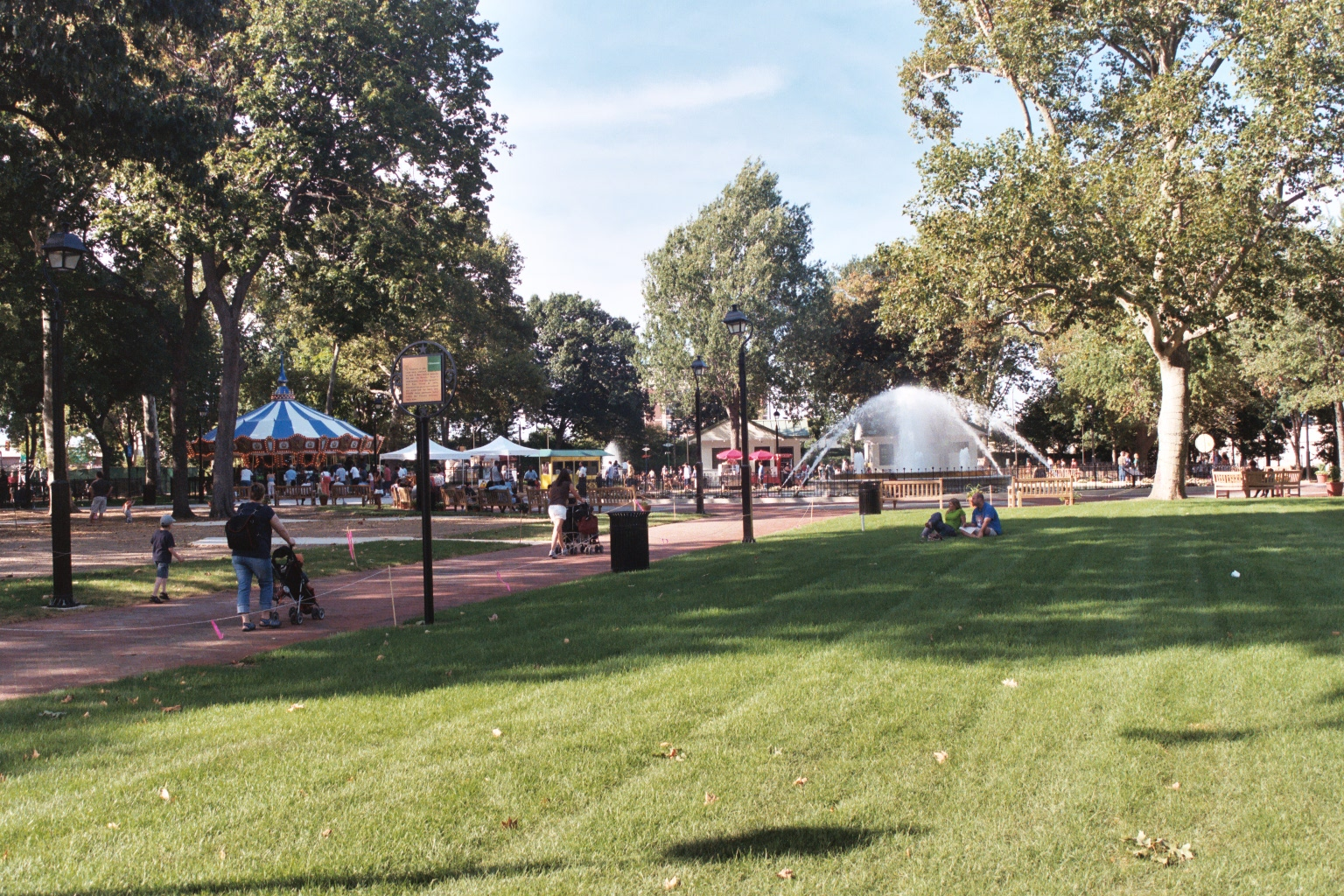
Fairmount Park . Complete with the Philadelphia Park Liberty Carousel, Philly Miniature Golf, new playgrounds and a restored 19th-century fountain, Franklin Square is now touted as an entertainment destination nearIndependence National Historical Park .Gallery
References
*cite web|url=http://www.phila.gov/fairpark/squares/franklin.html
title=Philadelphia Squares – Franklin Square
publisher=Fairmount Park Commission
accessdate=2006-07-27*cite web|url=http://www.ushistory.org/Franklin/philadelphia/park.htm
title=Philadelphia Squares – Franklin Square
publisher=www.ushistory.org
accessdate=2006-07-27*cite web|url=http://www.citypaper.net/articles/2004-07-01/cityspace.shtml
title=Forlorn Franklin Park
publisher=Philadelphia City Paper
accessdate=2006-07-27ee also
*
Franklin Square (PATCO station)
* [http://www.onceuponanation.org Once Upon A Nation]
* [http://www.phila.gov/fairpark/ Fairmount Park Commission, City of Philadelphia]
Wikimedia Foundation. 2010.