University Heights (Metro-North station)
- University Heights (Metro-North station)
Infobox Station
name=University Heights
style=MNRR Hudson
logo=
logo_size=
image_size=250
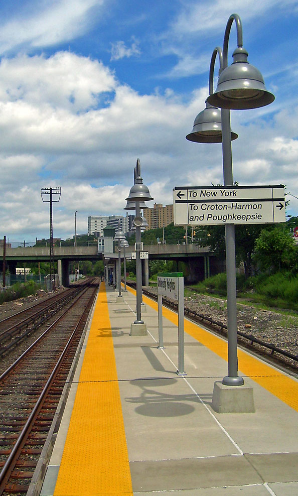
image_caption=The University Heights Metro-North station, on the Hudson Line.
address=West Fordham Road
at the Major Deegan Expressway
Bronx, NY,10468
line=rail color box|system=MNRR|line=Hudson
other=NYCT Bus: Bx12
platform=1 island platform
tracks=3
parking=
bicycle=
passengers=5720
pass_year=2006
pass_percent=0
opened=
rebuilt=
ADA=
code=
owned=
zone=2
services=The University Heights Metro-North Railroad station serves residents of the University Heights neighborhood of the Bronx, New York City, via the Hudson Line. Trains leave for Manhattan every 25 to 35 minutes on weekdays. It is 8.69 miles (14 km) from Grand Central Terminal, and travel time to Grand Central is approximately 19 minutes.
It is located between the Harlem River and the Major Deegan Expressway. Access to the platform is via a staircase from the pedestrian walkway on the south side of University Heights Bridge.
The station has operated since the days of the New York and Putnam Railroad early in the 20th century, though not in its present form.
External links
* [http://as0.mta.info/mnr/stations/station_detail.cfm?key=6 Metro-North Railroad - University Heights]
Wikimedia Foundation.
2010.
Look at other dictionaries:
Morris Heights (Metro-North station) — Morris Heights The Morris Heights Metro North station … Wikipedia
University Heights — may refer to:PlacesUnited States;Towns or cities *University Heights, Iowa *University Heights, Ohio;Neighborhoods *University Heights, San Diego, California *University Heights, Gainesville, Florida *University Heights, Indianapolis, Indiana… … Wikipedia
University Heights Bridge — Infobox Bridge bridge name= University Heights Bridge caption= Seen from the Harlem River official name= also known as= 207th Street Bridge carries=207th Street crosses= Harlem River locale= Manhattan and the Bronx, in New York City maint= New… … Wikipedia
Marble Hill (Metro-North station) — Marble Hill A train arrives at the temporary station, since rebuilt on the other side of the mezzanine. The Henry Hudson Bridge can be seen in … Wikipedia
Hudson Line (Metro-North) — Infobox rail line name = Hudson Line (Metro North) image width = 250px caption = Metro North #208 pushes Train #872 from Croton Harmon, bound for Grand Central. type = Commuter rail line system = Metro North status = locale = New York City,… … Wikipedia
North Charleston, South Carolina — North Charleston City City of North Charleston The new City Hall for the … Wikipedia
University (Metro Rail) — Infobox Station name = University type = Buffalo Metro Rail Station style = NFTA image size = image caption = address = Main St. near Niagara Falls Blvd. coordinates = coord|42.954705|N|78.820556|W|type:railwaystation line = rail color box|system … Wikipedia
North Park, San Diego — Coordinates: 32°44′26.99″N 117°07′46.99″W / 32.7408306°N 117.1297194°W / 32.7408306; 117.1297194 … Wikipedia
North Albany, Albany, New York — Coordinates: 42°40′01″N 73°44′13″W / 42.66694°N 73.73694°W / 42.66694; 73.73694 … Wikipedia
North York — This article is about the dissolved municipality in Toronto. For other uses, see North York (disambiguation). North York Dissolved municipality North York … Wikipedia