Naval Live Oaks Reservation
- Naval Live Oaks Reservation
-
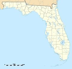
The Naval Live Oaks Reservation (also known as Deer Point Live Oaks Reservation or Deer Point Plantation) is part of the Gulf Islands National Seashore, and is near Gulf Breeze, Florida. The Reservation was included in the Seashore's establishment on January 8, 1971, and added to the U.S. National Register of Historic Places on September 28, 1998.
History
The U.S. Government purchased the tract of land making up the Naval Live Oaks Reservation in 1828 for use in experimenting with the cultivation of live oaks from acorns. Before the Civil War, Live Oak wood was the primary material of choice for shipbuilders, thus the protection and cultivation of the trees for Naval use was vital.
Currently, the land comprises over 1300 acres (5.3 km²) in Gulf Islands National Seashore and is owned by the Department of the Interior, National Park Service. U.S. Route 98 goes through the southern portion of the land. To the south of Highway 98 is a visitor's center for the Gulf Islands National Seashore and some public beach areas. On the north side there is one picnic area with a trail to a bluff overlooking Pensacola Bay. There are trails throughout the park.
External links
 Media related to Naval Live Oaks Reservation at Wikimedia Commons
Gallery
-
Highway 98 going through the Naval Live Oaks.
-
View from the top of the bluff in the Naval Live Oaks, looking south on the rest of the reservation.
Categories:
- Archaeological sites in Florida
- National Seashores of the United States
- National Register of Historic Places in Santa Rosa County, Florida
- Wilderness Areas of Florida
- Protected areas established in 1971
- Protected areas of Santa Rosa County, Florida
- Florida protected area stubs
Wikimedia Foundation.
2010.
Look at other dictionaries:
National Register of Historic Places listings in Santa Rosa County, Florida — Location of Santa Rosa County in Florida This is a list of the National Register of Historic Places listings in Santa Rosa County, Florida. This is intended to be a complete list of the properties and districts on the National Register of… … Wikipedia
Oriole Beach, Florida — Oriole Beach is an unincorporated community located in Santa Rosa County, Florida on Santa Rosa Sound. It lies east of Gulf Breeze, Florida along Santa Rosa Sound on the Fairpoint Peninsula. Oriole Beach is part of the Pensacola–Ferry Pass–Brent… … Wikipedia
Fort Irwin Military Reservation — Fort Irwin The National Training Center San Bernardino County, California NTC Shoulder Sleeve Insignia … Wikipedia
Gulf Breeze, Florida — The Gulf Breeze was also a passenger train run by Amtrak. Infobox Settlement official name = Gulf Breeze, Florida other name = native name = nickname = settlement type = City motto = flag size = image seal size = image shield = shield size =… … Wikipedia
Gulf Islands National Seashore — Infobox Protected area name = Gulf Islands National Seashore iucn category = V caption = locator x = 195 locator y = 141 location = Escambia Okaloosa counties, Florida Jackson Harrison counties, Mississippi, USA nearest city = Pensacola, FL… … Wikipedia
Fairpoint Peninsula — The Fairpoint Peninsula is a peninsula located in the Florida Panhandle (Northwest Florida, United States). It separates Santa Rosa Sound to the south from Pensacola Bay to the north. The Gulf Intracoastal Waterway is routed south of the… … Wikipedia
National Register of Historic Places Multiple Property Submissions in Florida — This is a list of the 53 Multiple Property Submissions on the National Register of Historic Places in Florida. They contain approximately 400 individual listings of the more than 1,500 on the National Register for the state. MPS name # of… … Wikipedia
United States — a republic in the N Western Hemisphere comprising 48 conterminous states, the District of Columbia, and Alaska in North America, and Hawaii in the N Pacific. 267,954,767; conterminous United States, 3,022,387 sq. mi. (7,827,982 sq. km); with… … Universalium
Mississippi — /mis euh sip ee/, n. 1. a state in the S United States. 2,520,638; 47,716 sq. mi. (123,585 sq. km). Cap.: Jackson. Abbr.: MS (for use with zip code), Miss. 2. a river flowing S from N Minnesota to the Gulf of Mexico: the principal river of the… … Universalium
South Carolina — South Carolinian. a state in the SE United States, on the Atlantic coast. 3,119,208; 31,055 sq. mi. (80,430 sq. km). Cap.: Columbia. Abbr.: SC (for use with zip code), S.C. * * * State (pop., 2000: 4,012,012), southeastern U.S. It covers 31,113… … Universalium

 Media related to Naval Live Oaks Reservation at Wikimedia Commons


