- Iberville Projects
Geobox Neighborhood
name = Iberville Projects
native_name =
other_name =
other_name1 =
category = New Orleans Neighborhood
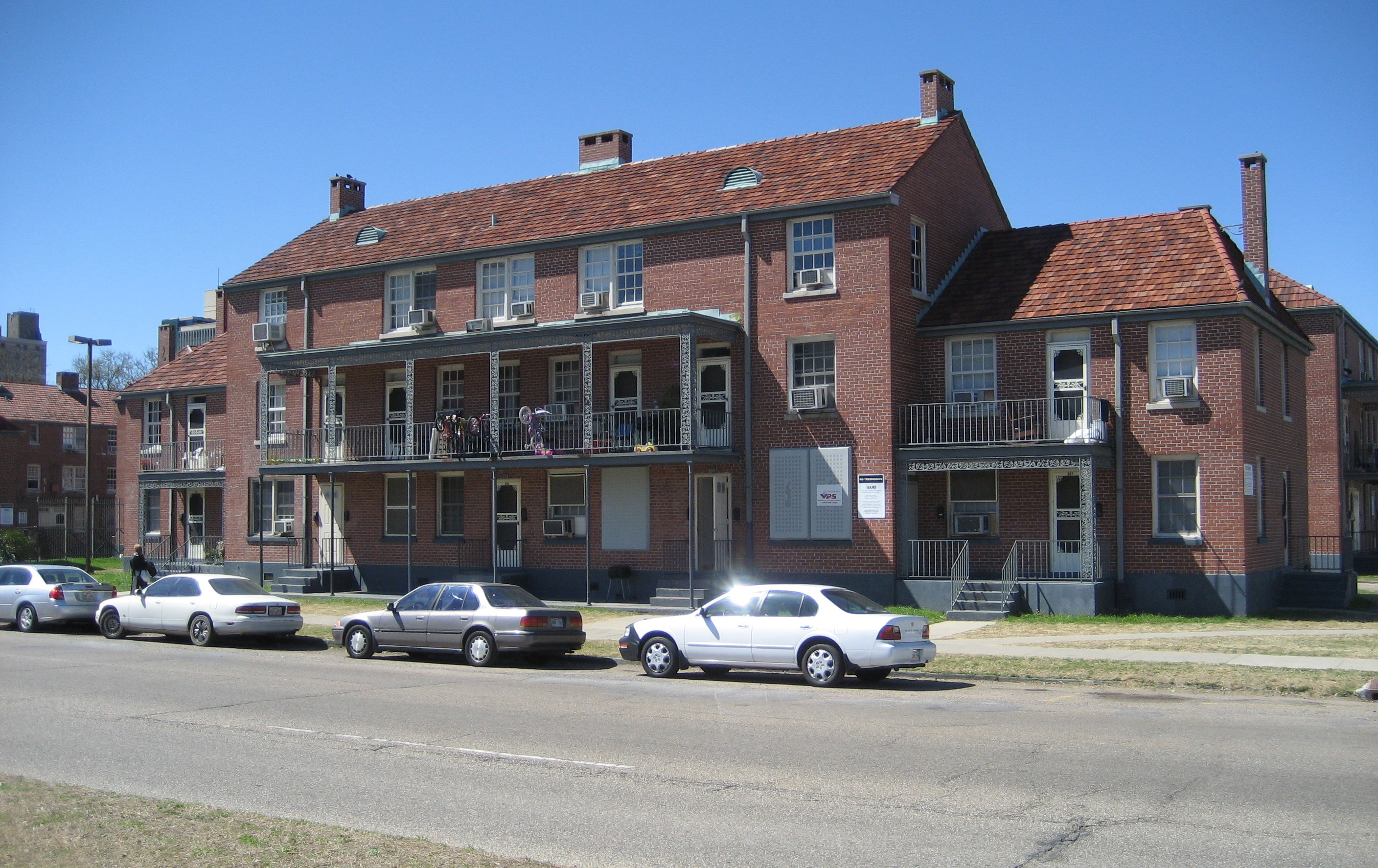
image_caption = Iberville Projects on Basin Street
flag_size =
symbol =
symbol_size =
etymology_type =
etymology =
nickname =
motto =
country = United States
state = Louisiana
region_type = City
region = New Orleans
district_type = Planning District
district = District 4, Mid-City District
area_imperial = 0.06
area_land_imperial = 0.06
area_water_imperial = 0.00
area_water_percentage = auto
area_percentage_round = 2
area_round = 1
location =
lat_d = 29
lat_m = 57
lat_s = 34
lat_NS = N
long_d = 90
long_m = 04
long_s = 25
long_EW = W
elevation_imperial = 0
elevation_round = 1
population_as_of = 2000
population = 2540
population_density_imperial = auto
established_type =
established =
mayor =
timezone = CST
utc_offset = -6
timezone_DST = CDT
utc_offset_DST = -5
postal_code =
postal_code_type = ZIP Codes
area_code = 504
area_code_type =
code2_type =
code2 =
free_type =
free =
free1_type =
free1 =
map_size =
map_caption =
map_locator =
map_locator_x =
map_locator_y =
website =Iberville Projects is a neighborhood of the city of New Orleans and one of the
Housing Projects of New Orleans . A subdistrict of the Mid-City District Area, its boundaries as defined by the City Planning Commission are: St. Louis Street to the north,Basin Street to the east, Iberville Street to the south and North Claiborne Avenue to the west. It is located in the4th Ward ofdowntown New Orleans on the former site of the famousStoryville district.Geography
Iberville Projects is located at coor dms|29|57|34|N|90|04|25|W|city GR|1 and has an elevation of convert|0|ft|1GR|3. According to the
United States Census Bureau , the district has a total area of convert|0.06|mi2|1. convert|0.06|mi2|1 of which is land and convert|0.00|mi2|1 (0.0%) of which is water.Adjacent Neighborhoods
*
Tremé (north)
*French Quarter (east)
* Central Business District (south)
* Tulane/Gravier (west)Boundaries
The City Planning Commission defines the boundaries of Iberville Projects as these streets: St. Louis Street, Basin Street, Iberville Street and North Claiborne Avenue. [cite web|url=http://gnocdc.org/orleans/4/41/index.html|title=Iberville Development Neighborhood|author=Greater New Orleans Community Data Center|accessdate=2008-06-21]
Demographics
As of the
census GR|2 of 2000, there were 2,540 people, 830 households, and 689 families residing in the neighborhood. Thepopulation density was 42,333 /mi² (12,700 /km²).History
The Iberville was built on a ten block site in the early 1940s as part of the
Wagner Bill . In 1940, the city declared 95% of the structures substandard, clearing the way for construction of the project. There are 858 units in the Iberville.During segregation, the Iberville was occupied by whites, while the nearby
Lafitte Projects served the black tenants.While the Iberville was closed following
Hurricane Katrina , the project was one of the first to reopen. There was no significant damage.ee also
*
New Orleans neighborhoods References
Wikimedia Foundation. 2010.