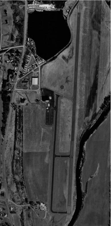
Norwich Lt. Warren Eaton Airport
- Norwich Lt. Warren Eaton Airport
-
Norwich Lt. Warren Eaton Airport (IATA: OIC, ICAO: KOIC) is a small general aviation airport located two miles (3.2 km) north of the City of Norwich, in Chenango County, New York, USA. The airport covers 147 acres (59 ha) and has one runway. It has no scheduled commercial operations, but PrivatAir operates flights to Cincinnati for Procter & Gamble employees.
References
External links
- Resources for this airport:
Categories: - Airports in New York
- Northeastern United States airport stubs
- New York building and structure stubs
Wikimedia Foundation.
2010.
Look at other dictionaries:
Eaton — may refer to:Buildings*Eaton Centre, the name of various shopping malls across Canada *Toronto Eaton Centre, a large retail and office complex in Toronto, Ontario *Eaton s / John Maryon Tower, a cancelled skyscraper in Toronto *Eaton Center… … Wikipedia
Norwich Airport — may refer to: Norwich International Airport in Norwich, Norfolk, England Norwich Lt. Warren Eaton Airport in Norwich, New York, United States Norwich Airport (Kansas) in Norwich, Kansas, United States This disambiguation page lists articles about … Wikipedia
Norwich (city), New York — This article is about the city. For the surrounding town, see Norwich (town), New York. Norwich City … Wikipedia
North Norwich, New York — For UK constituency, see Norwich North (UK Parliament constituency). North Norwich, New York Town … Wikipedia
New York State Route 12 — NY 12 redirects here. NY 12 may also refer to New York s 12th congressional district. NYS Route 12 Map of Upstate New York with NY 12 highlighted in … Wikipedia
Liste der IATA-Codes/O — IATA Codes aller größeren internationalen Flughäfen. IATA Codes A B C D E F G H I J … Deutsch Wikipedia
Liste Des Codes AITA Des Aéroports/O — Liste des codes AITA des aéroports internationaux. Le code de deux lettres qui suit la ville est la subdivision du pays (région, État…) selon la norme ISO 3166 2. Liste des codes AITA des aéroports : A B C D E F G H I J K L M N O P Q R S T … Wikipédia en Français
Liste des codes AITA des aeroports/O — Liste des codes AITA des aéroports/O Liste des codes AITA des aéroports internationaux. Le code de deux lettres qui suit la ville est la subdivision du pays (région, État…) selon la norme ISO 3166 2. Liste des codes AITA des aéroports : A B… … Wikipédia en Français
Liste des codes AITA des aéroports/O — Liste des codes AITA des aéroports internationaux. Le code de deux lettres qui suit la ville est la subdivision du pays (région, État…) selon la norme ISO 3166 2. Liste des codes AITA des aéroports : A B C D E F G H I J K L M N O P Q R S T … Wikipédia en Français
Liste des codes aita des aéroports/o — Liste des codes AITA des aéroports internationaux. Le code de deux lettres qui suit la ville est la subdivision du pays (région, État…) selon la norme ISO 3166 2. Liste des codes AITA des aéroports : A B C D E F G H I J K L M N O P Q R S T … Wikipédia en Français

