- Lake Van
Infobox_lake
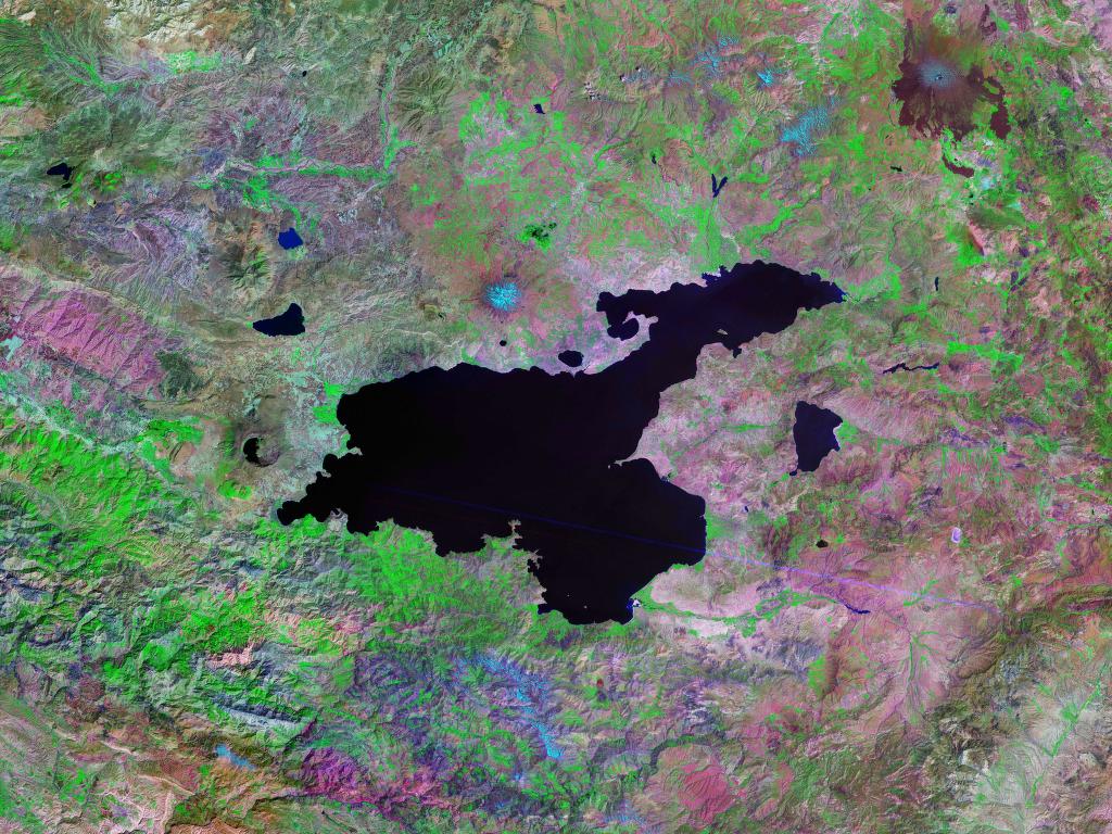
lake_name = Lake Van
image_lake = Van golu.jpg
caption_lake = From space, September 1996
(top of image is roughly northwest)
image_bathymetry =
caption_bathymetry =
location =
coords = coord|38|38|N|42|49|E|region:TR_type:waterbody|display=inline,title|format=dm
type =saline lake
inflow = Karasu, Hoşap, Güzelsu, Bendimahi, Zilan and Yeniköprü streams
outflow = none
catchment = convert|12500|km2|sqmi|0|abbr=on
basin_countries = Turkey
length = convert|119|km|mi|0|abbr=on
width =
area = convert|3755|km2|sqmi|0|abbr=on
depth = convert|171|m|ft|0|abbr=on
max-depth = convert|451|m|ft|0|abbr=on
volume = convert|607|km3|cumi|abbr=on
residence_time =
shore = convert|430|km|mi|0|abbr=on
elevation = convert|1640|m|ft|0|abbr=on
islands = Akdamar,
Çarpanak Adası (İçeriçarpanak),Adır Adası (Lim),
Kuş Adası (Arter)
cities = Van,Tatvan ,Ahlat ,Erciş Lake Van ( _tr. Van Gölü, _ku. Gola Wanê, _hy. Վանա լիճ, _fa. Daryacheye Van ("Lake of Van")) is the largest
lake inTurkey , located in the far east of the country. It is a saline and soda lake, receiving water from numerous small streams that descend from the surrounding mountains. Lake Van is one of the world's largestendorheic lake s (having no outlet). The original outlet from the basin was blocked by an ancient volcanic eruption.Hydrology and chemistry
Lake Van is 119 km across at its widest point, averaging a depth of convert|171|m|ft|0 with a maximum recorded depth of convert|451|m|ft|0.Citation|last=Degens|first=E.T.| last2=Wong|first2=H.K.| last3=Kempe|first3=S.| last4=Kurtman|first4=F.| title=A geological study of Lake Van, eastern Turkey | url=http://www.springerlink.com/content/x5285613642v3665/| journal=International Journal of Earth Sciences| publisher=Springer|date=June 1984| volume=73| issue=2| page=701-734| doi=10.1007/BF01824978] The lake surface lies convert|1640|m|ft|0 above sea level and the shore length is convert|430|km|mi|0. Lake Van has an area of convert|3755|km2|sqmi|0|abbr=on and a volume of km3 to mi3|607|abbr=mos|wiki=yes.
The western portion of the lake is deepest, with a large basin deeper than convert|400|m|ft|0|abbr=on lying northeast of
Tatvan and south ofAhlat . The eastern arms of the lake are shallower. The Van-Ahtamar portion shelves gradually, with a maximum depth of about convert|250|m|ft|0|abbr=on on its northwest side where it joins the rest of the lake. The Erciş arm is much shallower, mostly less than convert|50|m|ft|0|abbr=on, with a maximum depth of about convert|150|m|ft|0|abbr=on.Citation| last=Wong| first=H.K. |last2=Degens| first2=E.T.| contribution=The bathymetry of Lake Van, eastern Turkey| title=Geology of Lake Van| page=6-10| publisher=General Directorate of Mineral Research and Exploration| place=Ankara|date=1978| issue=169| doi=] Citation|last=Tomonaga| first=Yama| last2=Brennwald| first2=Matthias S.| last3=Kipfer| first3=Rolf| title=Spatial variability in the release of terrigenic He from the sediments of Lake Van (Turkey) | url=http://www.internal.eawag.ch/~tomonaga/pdf/MINOGA_2007_Poster.pdf| publisher=4th Mini Conference on Noble Gases in the Hydrosphere and in Natural Gas Reservoirs|date=2007| doi=10.2312/GFZ.mga.045 ]The lake water is strongly
alkaline (pH 9.7–9.8) and rich insodium carbonate and othersalt s, which are extracted by evaporation and used asdetergent s.Fact|date=November 2007Geology
[
left|thumb|270px|right|Lake_Van_Landsat photo] The lake's outlet was blocked at some time during thePleistocene , whenlava flows from Nemrut volcano blocked westward outflow towards the Muş Plain. Now dormant, Nemrut Dağı is close to the western shore of the lake, and another dormantstratovolcano , Süphan Dağı dominates the northern side of the lake.The water level of the lake has often altered dramatically: near Tatvan, Oswald (see Geology of Armenia, 1901) noted a raised beach high above the present level of the lake as well as recently drowned trees. Investigation by Degens and others in the early 1980s determined that the highest lake levels (72m above the current height) had been during the last ice age, about 18,000 years ago. About 9,500 years ago there was a dramatic drop to more than 300m below the present level. This was followed by an equally dramatic rise around 6,500 years ago.
Similar but smaller fluctuations have been seen recently. The level of the lake rose by at least three metres during the 1990s, drowning much agricultural land, and (after a brief period of stability and then retreat) seems to be rising again. The level has risen about two meters in the ten years immediatey prior to 2004.Citation|last=Coskun| first=M.| last2=Musaoğlu| first2=N.| contribution-title=Investigation of Rainfall-Runoff Modelling of the Van Lake Catchment by Using Remote Sensing and GIS Integration | url=http://www.isprs.org/istanbul2004/comm7/papers/52.pdf| title=Proceedings of the 20th Congress of the International Society for Photogrammetry and Remote Sensing|date=2004]
As a deep lake with no outlet, Lake Van has accumulated great amounts of sediment washed in from surrounding plains and valleys, and occasionally deposited as ash from eruptions of nearby volcanoes. This layer of sediment is estimated to be up to 400m thick in places, and has attracted climatologists and vulcanologists interested in drilling cores to examine the layered sediments.
In 1989 and 1990, an international team of geologists led by Dr. Stephan Kempe from the University of Hamburg (now Professor at the Technische Universität Darmstadt) retrieved ten sediment cores from depths up to convert|446|m|ft|0|abbr=on. Although these cores only penetrated the first few meters of sediment, they provided sufficient
varves to give climate data for up to 14,570 years BP.Citation| first=Günter| last=Landmann| first2=Andreas| last2=Reimera| first3=Gerry| last3=Lemcke| first4=Stephan| last4=Kempe| title=Dating Late Glacial abrupt climate changes in the 14,570 yr long continuous varve record of Lake Van, Turkey | journal=Palaeogeography, Palaeoclimatology, Palaeoecology | publisher=Elsevier Science B.V.|date=June 1996| volume=122| issue=1-4| page=107-118| doi=10.1016/0031-0182(95)00101-8]A team of scientists headed by palaeontologist Professor Thomas Litt at the
University of Bonn has applied for funding from theInternational Continental Scientific Drilling Program (ICDP) for a new, deeper drilling project to examine the lake's sediments. Litt expects to find that "Lake Van stores the climate history of the last 800,000 years—an incomparable treasure house of data which we want to tap for at least the last 500,000 years."Citation|title=Turkey's Lake Van Provides Precise Insights Into Eurasia's Climate History | url=http://www.sciencedaily.com/releases/2007/03/070314110552.htm| work=Science Daily |date=15 March 2007] A test drilling in 2004 detected evidence of 15 volcanic eruptions in the past 20,000 years.Ecology
The only
fish known to live in thebrackish water of Lake Van is "Chalcalburnus tarichi " the Pearl Mullet or "inci kefalı", [ [http://www.springerlink.com/content/p4050j7u81790t3k/ Journal; Fish Physiology and Biochemistry] ] aCyprinid fish related tochub anddace , which is caught during the spring floods. In May and June, these fish migrate from the lake to less alkaline water, spawning either near the mouths of the rivers feeding the lake or in the rivers themselves. After spawning season it returns to the lake. [ [http://www.incikefali.net/ozet-en.htm Inci kefali summary] ]103 species of
phytoplankton have been recorded in the lake includingDiatome ,Bacteriophyta ,Cyanophyta ,Chlorophyta ,Flagellata andPhaeophyta . 36 species ofzooplankton have also been recorded includingRotatoria ,Cladocera andCopepoda in the lake. [Selçuk 1992]In 1991, researchers reported the discovery of convert|40|m|ft|0|abbr=on tall microbialites in Lake Van. These are solid towers on the lake bed created by mats of coccoid
cyanobacteria ("Pleurocapsa " group) that createaragonite in combination withcalcite precipitating out of the lake water.Citation|last=Kempe|first=S.| last2=Kazmierczak |first2=J. |last3=Landmann |first3=G. |last4=Konuk |first4=T. |last5= Reimer |first5=A. |last6=Lipp |first6=A. | title=Largest known microbialites discovered in Lake Van, Turkey | url=http://www.nature.com/nature/journal/v349/n6310/abs/349605a0.html| journal=Nature|date=14 February 1991| volume=349| | page=605-608| doi=10.1038/349605a0]The Lake Van region is the home of the rare
Van Kedisi breed ofcat , noted for among other things its unusual fascination with water.Since about 1995 there have been reported sightings of a 'Lake Van monster' about convert|15|m|ft|0 in length named "Van Canavarı" ("Monster of Van").
The lake is surrounded by
fruit and grain-growingagricultural areas.History
Tushpa , the capital ofUrartu , was located near the shores of Lake Van, on the site of what became medieval Van's castle, west of present-day Van city. [The Concise Encyclopædia of Archaeology - Page 488 by Leonard Cottrell - 1960] The ruins of the medieval city of Van are still visible below the southern slopes of the rock on whichVan Castle is located.Armenian kingdoms
The lake was the centre of the Armenian kingdom of Ararat from about 1000 BC, afterwards of the Satrapy of Armina, Kingdom of Greater Armenia, and the Armenian Kingdom of
Vaspurakan .Along with
Lake Sevan in today'sArmenia andLake Urmia in today'sIran , Van was one of the three great lakes of the Armenian Kingdom, referred to as "the seas ofArmenia " (in ancient Assyrian sources: "tâmtu ša mât Nairi" (Upper Sea of Nairi), the Lower Sea beingLake Urmia ). Over time, the lake was known by various Armenian names, including _hy. Վանա լիճ (Lake of Van), Վանա ծով (Sea of Van), Արճեշի ծով (Sea of Arčeš), Բզնունեաց ծով (Sea of Bznuni), Ռշտունեաց ծով (Sea of Rshtuni), and Տոսպայ լիճ (Lake of Tosp).Byzantine empire
By the 11th century the region around Lake Van was on the border between the
Byzantine empire, with its capital atConstantinople , and theSeljuk Turkish empire, with its capital atIsfahan . In the uneasy peace between the two empires, local Armenian-Byzantine landowners employedTurcoman gazi s and Byzantineakritoi for protection. However, these mercenaries often turned to looting for their own benefit.In the second half of the 11th century the situation on the southeast border of the Byzantine empire had reached such a point that Emperor
Romanus IV Diogenes launched a campaign to re-conquer Armenia and head off growing Seljuk control. Diogenes and his large army crossed theEuphrates and confronted a much smaller Seljuk force led byAlp Arslan at theBattle of Manzikert , north of Lake Van on26 August 1071 . Despite their greater numbers, the cumbersome Byzantine force was defeated by the more mobile Turkish horsemen and Diogenes was captured.eljuk empire
Alp Arslan divided the conquered eastern portions of the Byzantine empire among his Turcoman generals, with each ruled as a hereditary
beylik , under overall sovereignty of theGreat Seljuq Empire . Alp Arslan gave the region around Lake Van to his commander Sökmen el Kutbî (literally "Sökmen the Slave"), who set up his capital at Ahlat on the western side of the lake. The dynasty ofAhlatshahs (also known as "Sökmenler") ruled this area from 1085 to 1192.The Ahlatshahs were succeeded by the
Ayyubid dynasty.Architecture
Near the
Van Castle and the southern shore, onAkdamar Island lies the Church of the Holy Cross (Armenian: Սուրբ Խաչ, Surb Khach), which served as a royal church to the ArmenianVaspurakan kingdom.The Ahlatshahs left a large number of historic
tombstones in and around the town ofAhlat . Local administrators are currently trying to have the tombstones included inUNESCO 'sWorld Heritage List , [ cite web | url = http://www.losangeleschronicle.com/articles/viewArticle.asp?articleID=26515 (article)| title = On the Roads of Anatolia - Van|author=Yüksel Oktay| publisher= [http://www.losangeleschronicle.com Los Angeles Chronicle] | access date= ] where they are currently listed tentatively. [ cite web | url = http://whc.unesco.org/en/tentativelists/1401/ (List) | title = Tentative World Heritage Sites|author=| publisher=UNESCO | access date= ]Transportation
The railway connecting Turkey and
Iran built in the 1970s uses atrain ferry across Lake Van between the citiesTatvan and Van, rather than building railway tracks around the rugged shore line. Transfer from train to ship and back again limits the total carrying capacity.In May, 2008 talks started between Iran and Turkey to upgrade the ferry to a double track electrified railway. [ [http://yenisafak.com.tr/English/?t=27.07.2007&i=58392 Turkey, Iran agree on joint railway - 27.07.2007 - English - Yeni Åafak ] ] [ [http://www.railpage.com.au/f-t11332640.htm Iran - Turkey project - Railpage Australia™ Forums (South Asia and Middle East) ] ]
Islands
*
Arter
*Lim
*Akdamar Island
*Charpanak See also
*
Lakes of Turkey
*Geography of Turkey
*Transportation in Turkey References
External links
* [http://www.pointsfromturkey.com/van_lake_and_citadel.html Van Lake]
* [http://www.adiyamanli.org/vangolu.html Description of Lake Van]
* [http://www.tatvan.net/galeri4.htm Pictures of Lake Van]
* [http://www.allaboutturkey.com/vanlake.htm All About Turkey - Lake Van]
* [http://www.tulpart.com/pic.asp?cmd=2&cid=14&sid=51 High Resolution Pictures of Van Castle]
Wikimedia Foundation. 2010.