- Mount Jamanota
-
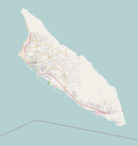
Mount Jamanota Location of Mount Jamanota in Aruba Elevation 188 m (617 ft) Location Location  Aruba
ArubaCoordinates 12°29′15″N 69°56′26.5″W / 12.4875°N 69.940694°WCoordinates: 12°29′15″N 69°56′26.5″W / 12.4875°N 69.940694°W Mount Jamanota (188 m) (620 ft) is the highest point on the island of Aruba and is visible from the entire island. Wild goats and donkeys roam free on the mountain. The panorama from its summit includes Frenchman's Pass on the south coast, where Indians defended their island against the French. The area is known for its wild parakeets.
12°29′15″N 69°56′27″W / 12.4875°N 69.9407°W
Categories:- Mountains and hills of Aruba
- Highpoints in the Caribbean
- Aruba geography stubs
Wikimedia Foundation. 2010.

