- Motuihe Island
-
Motuihe Island Maori: Te Motu-a-Ihenga 
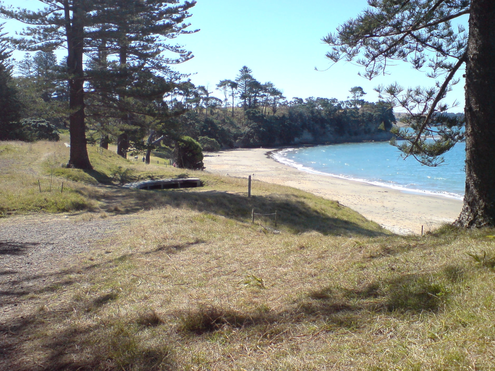
The beach on the northern side of the narrow western neck, separated from the southern beach by about 30 m (33 yd).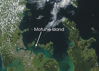
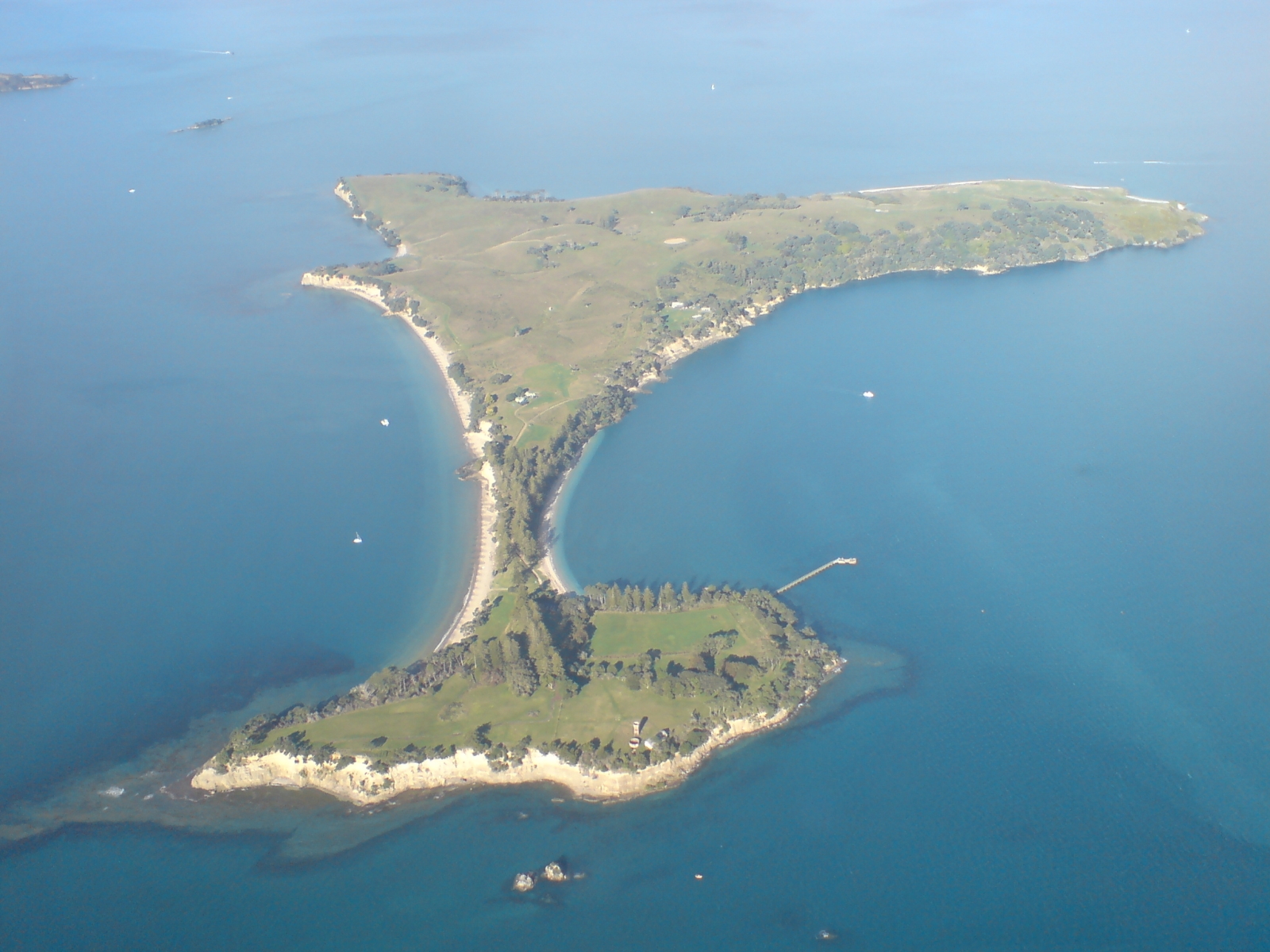
Location of Motuihe Island in the Hauraki Gulf.Geography Coordinates 36°48′37″S 174°56′49″E / 36.810212°S 174.947019°E Area 179 ha (440 acres) Country Demographics Population 1 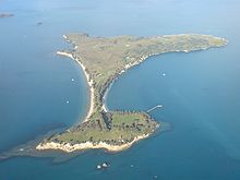 The island from the air, looking east.
Motuihe Island lies between Motutapu and Waiheke islands in the Hauraki Gulf of New Zealand, near Auckland. The island measures about 179 ha (440 acres), of which around 18 ha (44 acres) are remnants of coastal forest. The island is a recreation reserve controlled by the Department of Conservation (DOC) and administered by the Motuihe Trust. It is a popular spot for day trips, either by 30-minute ferry trip from Auckland or by private boat. The island is known for its beautiful beaches.[1][2]
The name comes from Te Motu-a-Ihenga, meaning 'Ihenga's Island' in Māori.[3]
Coordinates: 36°48′37″S 174°56′49″E / 36.810212°S 174.947019°E
Contents
History
The small island has had a colourful human history. Starting out as a Māori settlement place, at least two pā fortification sites are known on the island. The locals are said to have grown gourds and taro. Very soon after arrival of the Europeans in the area, in 1839, the island was purchased, and farming began in the 1840s. Groves of Norfolk pines and olive trees are remnants of this time.[3]
A quarantine station was built on the western section of the island in 1873. It was first used in 1874 for scarlet fever arriving on an inbound ship and operated for almost 50 years, slowly growing in size. During the First World War, the station was used as an internment camp whose most famous prisoner was Count Felix von Luckner and his crew of the commerce raider SMS Seeadler. Luckner organised an escape from the island in 1917, took over a scow and sailed to the Kermadec Islands where he was recaptured (and escaped again),[3] though not before becoming something of an odd type of hero in the eyes of many New Zealanders, for the fact that his numerous and daring wartime escapades had killed only a single person.
With the outbreak of World War II, the buildings became a naval training base, North Shore mainland.[3]
Conservation
The island's trust organises an active programme of pest eradication, and is slowly replanting sections of the island with native trees. Rats and mice were eradicated in 1996 and rabbits in 2004.[4] The conservation programme has reintroduced native species like the North Island Saddleback (Tieke).[5] The Trust maintains a small conservation presence on the island, and usually has a number of volunteers working at the local tree nursery or in other conservation programmes.
In early 2008, rat footprints were found in a tracking tunnel (a device to check for the presence of certain animals) on the island. This set off a substantial effort by the trust and DOC to catch the rodent, which was feared to be part of a larger infestation. The Norwegian rat was eventually trapped by a special hunting dog, allowing plans to release native Red-fronted Parakeets (Kākāriki) to continue as planned[4] in May 2008, when 31 were brought by helicopter from Little Barrier Island, where there is a relatively large population.[6]
In March 2009, fifteen Little Spotted Kiwi were released on the island.[7]
In May 2009, 350 'agents' of The Nikolai Organisation planted 22,400 native trees on Motuihe Island in just one day, which was 40% of the 2009 planting programme.[8][9][10]
See also
References
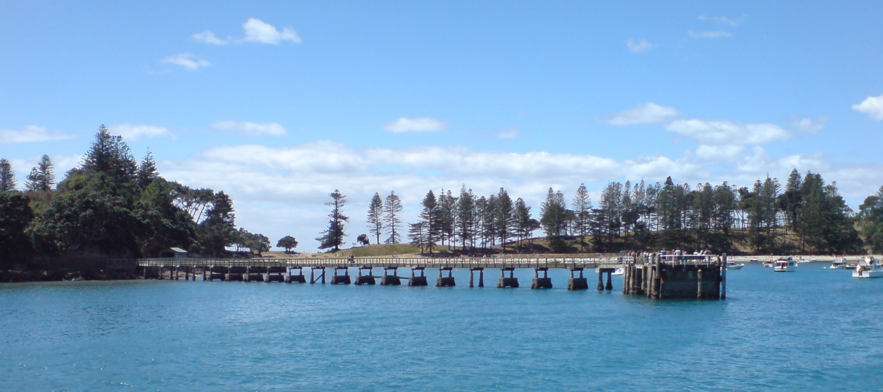
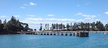 The wharf on the southern side of the island, with the bay behind filled with day-tripper boats.
- ^ "Motuihe Recreation Reserve". Department of Conservation. Accessed 2008-02-27.
- ^ "Motuihe Project". Motuihe Trust. Accessed 2008-02-27.
- ^ a b c d "Motuihe Recreation Reserve: History". Department of Conservation. Accessed 2008-02-27.
- ^ a b Eriksen, Alanah (24 April 2008). "Dog traps rat on 'pest-free' gulf island". The New Zealand Herald. http://www.nzherald.co.nz/section/1/story.cfm?c_id=1&objectid=10505909. Retrieved 26 October 2011.
- ^ "Motuihe Recreation Reserve: Features". Department of Conservation. Accessed 2008-02-27.
- ^ "Kakariki spread wings on new island home". Massey University. 20 May 2008.
- ^ Gibson, Eloise (23 March 2009). "Tiny kiwi move into a new island home". The New Zealand Herald. http://www.nzherald.co.nz/environment/news/article.cfm?c_id=39&objectid=10563029. Retrieved 26 October 2011.
- ^ Scoop Independent News talks about The Nikolai Organisation planting 22,400 trees to beat Eco-Record
- ^ Hume, Tim (10 May 2009). "Do-good 'secret society' to invade Hauraki Gulf". The Sunday Star-Times. http://www.stuff.co.nz/sunday-star-times/news/2398674/Do-good-secret-society-to-invade-Hauraki-Gulf. Retrieved 26 October 2011.
- ^ "Secret Agents' Storm New Eco-Record And Plant A 22,400-tree Forest In A Day On Motuihe Island". Voxy Online News. http://www.voxy.co.nz/category/organization/nikolai-organisation. Retrieved 13 July 2010.
External links
Categories:- Uninhabited islands of New Zealand
- Hauraki Gulf
- Forts in New Zealand
- Quarantine facilities
- Internment camps
- Royal New Zealand Navy bases
- Island restoration

Wikimedia Foundation. 2010.