- Nongmynsong
-
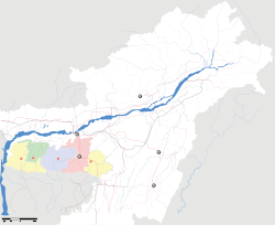
Nongmynsong — city — Coordinates 25°35′49″N 91°52′32″E / 25.596880°N 91.875580°ECoordinates: 25°35′49″N 91°52′32″E / 25.596880°N 91.875580°E Country India State Meghalaya District(s) East Khasi Hills Population 11,362 (2001[update]) Time zone IST (UTC+05:30) Nongmynsong is a census town in East Khasi Hills district in the Indian state of Meghalaya.
Demographics
As of 2001[update] India census[1], Nongmynsong had a population of 11,362. Males constitute 52% of the population and females 48%. Nongmynsong has an average literacy rate of 69%, higher than the national average of 59.5%: male literacy is 74%, and female literacy is 64%. In Nongmynsong, 15% of the population is under 6 years of age.
Nongmynsong was known as Lalchan formerly. Khasi administration has replaced Lalchan with Nongmynsong. It is situated in Shillong-11.
Nongmynsong can be reacehd by local taxi (Maruti 800 and Maruti Alto). It takes approximately 20 minutes from Civil Hospital and for Rs. 5-10 each. Civil Hospital is reached by inter-state taxis (TATA SUMO and Mahindra BOLERO) from Guwahati for Rs. 110-120. It will take around 3 hours to reach Shillong Civil Hospital, Laitmukhra or Police Bazar. The beautiful route covers legendary Barapani River and Jorabat.
Nongmynsong is small and beautiful. Except the scarcity of water, Nongmynsong is photogenic.
References
- ^ "Census of India 2001: Data from the 2001 Census, including cities, villages and towns (Provisional)". Census Commission of India. Archived from the original on 2004-06-16. http://web.archive.org/web/20040616075334/http://www.censusindia.net/results/town.php?stad=A&state5=999. Retrieved 2008-11-01.
Categories:- East Khasi Hills
- Cities and towns in East Khasi Hills district
- India geography stubs
- Meghalaya stubs
Wikimedia Foundation. 2010.


