- Muthupet
-
Muthupet — city — Coordinates 10°24′N 79°30′E / 10.4°N 79.5°ECoordinates: 10°24′N 79°30′E / 10.4°N 79.5°E Country India State Tamil Nadu District(s) Thiruvarur Population 19,000 (2001[update]) Time zone IST (UTC+05:30) Muthupet is a panchayat town in Thiruvarur district in the Indian state of Tamil Nadu.
Contents
Demographics
As of 2001[update] India census,[1] Muthupet had a population of 19,000. Males constitute 47% of the population and females 53%. Muthupet has an average literacy rate of 71%, higher than the national average of 59.5%: male literacy is 78%, and female literacy is 65%.
Geography
Muthupet is a town in Tiruvarur District. It is located between Thirutturaipoondi and Pattukkotai, and around 360 km away from Chennai. The town lies adjacent to the Bay of Bengal and is in the southernmost part of the Cauvery delta. Muthupet is bounded by Korayar and Bamaniyar rivers to the east and west respectively. The rivers Koriayar and Pamaniyar join near Muthupet, and there is a lagoon, which is rich in fish.
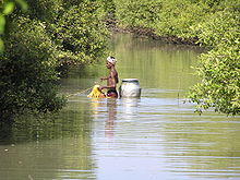
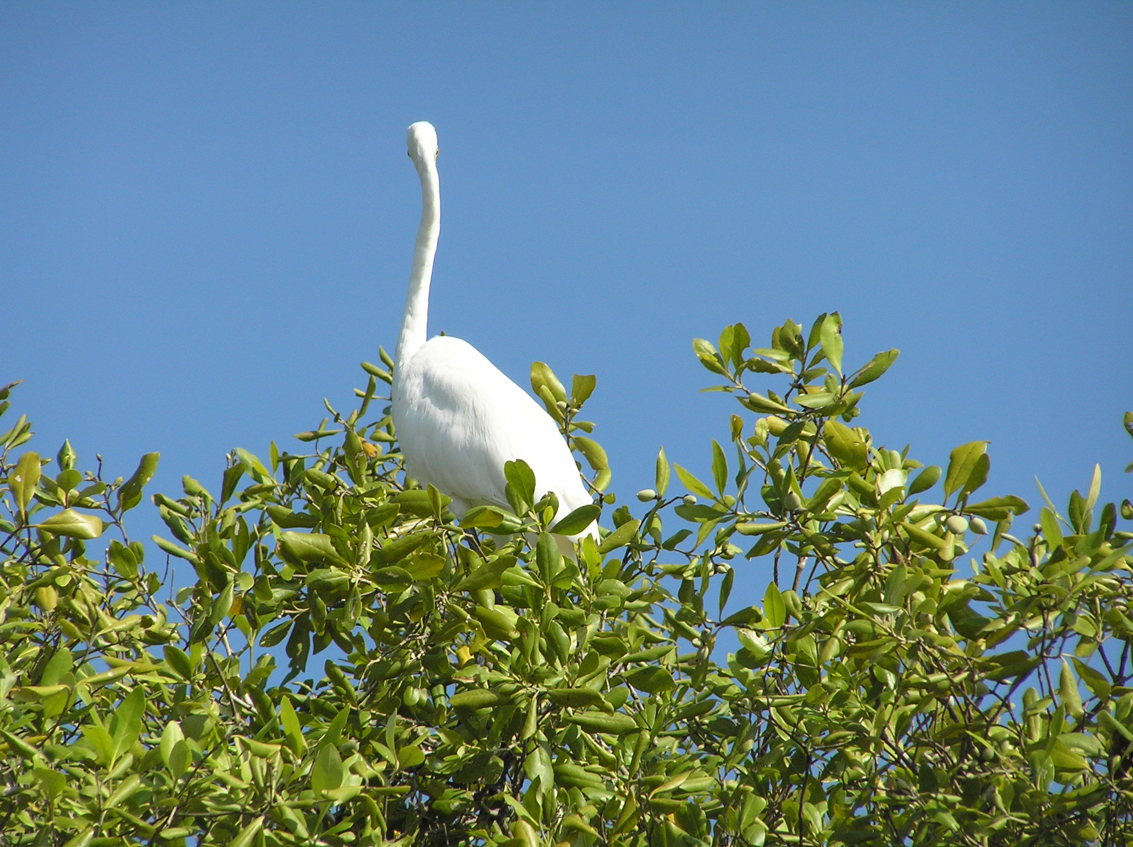
Muthupet is an ideal place for fishing, pearl hunting and bird hunting. It is well known for its fishing industries such as finfish (koduva), shrimp and crab. A natural mangrove forest, Alayathi Kadu, is one of the largest of its kind in India.
Culture
Muthupet has equal amount of Hindu as well as Muslim community people. Nearby Muthupet there are so many famous temples like Kovilur Shiva temple, Pettai Shiva temple and Thillaivilagam Kothanda Ramar Temple and a famous Dargha in Jambuvanodai.
As Muthupet is surrounded by villages, most of the people are farmer. People wear vesti, saree, shirt, lungi as well as pant-shirt. People live a quite nice life despite of the community problem.
Life of Muslim people in Muthupet revolves around calls to prayer: Adhan. The people, particularly women, heavily depend on Adhan to keep their regular activities on track. The Adhan for early morning prayer well before sunrise acts as a wake-up call. It is followed by four prayer calls a day. Friday is observed as public and commercial holiday in Muthupet like many Gulf countries.Wearing pants is seen as strange in Muslim community. However, schoolchildren wear such dress despite the fact that it is not advisable in Islam to wear such clothes. Muslim women observe purdah and a significant number of women wear niqab. Like any other Marakkar society, it is a close-knit society where people in general do not want to have marital relationships outside the town.
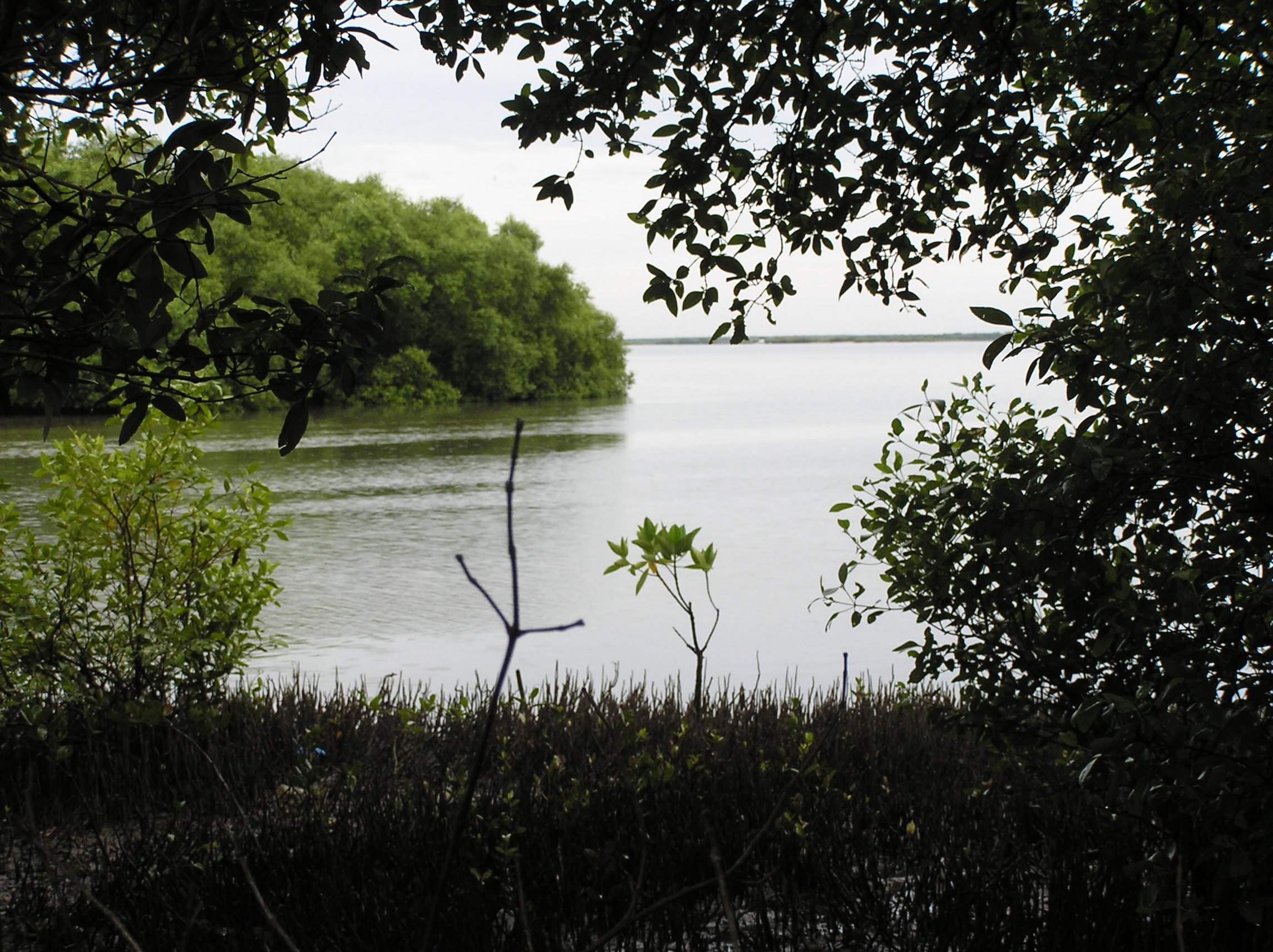
Muthupet mangroves and lagoon
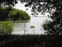

Muthupet mangrove forest is located at the southern end of the Cauvery delta, covering an area of approximately 6,803.01 ha of which only 4% is occupied by well-grown mangroves. The rivers Paminiyar, Koraiyar, Kilaithankiyar, Marakkakoraiyar and other tributaries of the river Cauvery flow through Muthupet and adjacent villages. At the tail end, they form a lagoon before meeting the sea.
The northern and western borders of the lagoon are occupied by muddy silt ground which is devoid of mangroves. The mangroves beyond Muthupet Lagoon are discontinuously found along the shore and extended up to Point Calimere. Muthupet mangrove forest was under the control of Chatram Department from 1853 to 1912 (Chengappa, 1918). The government of the presidency of Madras Gazette (1937) shows, from 1923 to 1936, half of the revenue obtained from selling mangrove products was paid to the revenue department and the remaining half was spent to maintain the “Chatrams” (Charity homes). The government declared the Muthupet mangrove forest as revenue forest in February 1937 and, accordingly, the mangrove forest was handed over to the forest department of the Madras presidency.
The forest is maintained by the Tamil Nadu Forest Department. The mangrove forest is divided into the Palanjur, Thamarankottai, Maravakkadu, Vadakadu, Thuraikadu and Muthupet reserve forests.
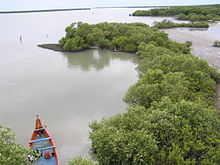
Muthupet reserve forest covers the lagoon, river creeks and the mudflats. Muthupet Lagoon (mullipallam) is a spectacular natural creation, which is 8 km from nearby Muthupet town and can be reached only by boat. The lagoon is shallow with an average depth of 1 m. The bottom of the lagoon is formed of silt clay substratum. The tidal fluctuations can be observed well with the exposure of oyster beds and roots during low tide.
The tidal fluctuations play a major role in dispersing mangrove seeds. Dense mangroves mostly cover the lagoon shore. The islets are found on western side which are submerged during high tide. The salinity is the major environmental factor, controlling zonation of Muthupet mangrove forest. Avicennia marina is the conqueror of the forest which is found as a single dominant species.
The southern mudflat separates the lagoon from the adjacent sea that leaves a permanent mouth of lagoon with seasonally opened shallow waterways. The width of mudflat is increased from lagoon mouth to the eastern direction. The mudflat looks like a desert in summer, but the presence of dead gastropods under the surface soil layer and the erosion of soil at the centre of mudflat reveal the submergence of mudflat during flood. There is a difference between the lagoon shore and seashore of the same mudflat, in the aspect of distance of mangroves from fluctuating water level.
The mangroves have grown close to water level in lagoon side but not in seashore. The reason may be the difference in the nature of fine clayey silt deposition that carried by the rivers. The salt marshes are found as under herb as well as lining the inner side of the forest. In the degraded central part of the mudflat, the soft fine silt is found only around the salt marshes. The remaining barren ground is hard clay which may due to the erosion of surface silt by wind or floodwater. Thousands of partially decomposed rooted trunks found on the southeastern side of Muthupet lagoon are indicating the past, indiscriminate exploitation.

At 100–150 m in width and 5–6 km in length, the density of mangroves in eastern side of Muthupet lagoon is comparatively lower than other areas. Tamil Nadu Forest Department has excavated several canals across the mudflat. Each main canal, which enhances the water movement between sea and lagoon, has several subcanals on either side with a substantial number of mangrove seedlings. The western side has a protruding land pocket has formed an islet-like structure. This part of the lagoon lies near Koraiyar river mouth with small mangrove patches.
Industry
Muthupet is famous for its coconut and fishing. The ancient occupation of the people is fishing.
Muthupet Dargah
The 700-year-old Islamic shrine here has glorious aspects and a traditional background. This dargah, Andavar Sheikh Dawood Khamil Oliyullh, was built using traditional architecture. People irrespective of caste, creed and religion visit this holy place of worship.
Transport
Muthupet Railway Station is on the Karaikkudi-Tiruthuraipoondi line. (Due to railway track modification, [meter gauge to broad gauge] there is no direct train from Chennai to Muthupet.)
Tamil Nadu State Transport Corporation (TSTC) and private buses operate directly from Chennai to Muthupet via National Highway 45. Connecting buses are from neighboring cities such as Thanjavur, Pattukkotai, Mannargudi and Tiruvarur. Private omnibuses run daily night services for passengers as well as freight to Chennai in addition to the state-owned SETC regular passenger services.
The East Coast Road (ECR) from Chennai to Kanyakumari being constructed will connect this small town as well.
Tiruchirapalli is the nearest international airport located around 110 km from Muthupet.
Distance from major cities/towns by rail
- New Delhi > 2563 km
- Mumbai > 1656 km
- Chennai > 373 km
- Karaikudi > 94 km
- Mayiladuthurai > 92 km
- Thiruvarur > 52 km
Distance by road
- Tanjavur > 65 km
- Tiruchirappalli > 116 km
- Chennai > 350 km
- Kumbakonam > 70 km
- Madurai > 171 km
Daily bus trips from Muthupet to Chennai
- MJT Semi Sleeper (via Pattukkottai)
- MJT (via ECR Road)
- SVT (A/C coach) (via ECR)
- SVT Semi Sleeper
- RathiMeena (Semi Sleeper)
- SRM (A/C coach)
- Universal (multi Volvo A/C Coach) (via ECR)
- Universal (Volvo A/C Coach) afternoon (via ECR)
- Universal (Berth Sleeper) (via ECR)
- TNSTC (Super Deluxe)(via Kumbakonam)
Education
- Government Boys Higher Secondary School*
- Kovilur Arulmigu Periyanayaki Girls Higher Secondary School
- Rahmath Girls Matriculation Higher Secondary Schoo* [1]
- Brilliant matriculation school
- Winners matriculation school
- Saraswathi Vidhyalaya Matriculation Higher Secondary School
- A.N Madharasa School
- Tharbiyath-Ul-Banath Arabic Madharasa for Women
- Al'Maha Arabic School, Azad Nagar
- Madhrasathul Mohiadeenya (women's), Bungalow Vasal
- Madhrasathul Mohiadeenya (men's), Bungalow Vasal
- Arab Sahib Masjid Madharasa for Women
- Al'Maha Primary School, New Bustand
References
- ^ "Census of India 2001: Data from the 2001 Census, including cities, villages and towns (Provisional)". Census Commission of India. Archived from the original on 2004-06-16. http://web.archive.org/web/20040616075334/http://www.censusindia.net/results/town.php?stad=A&state5=999. Retrieved 2008-11-01.
External links
Banks and ATMs
- State Bank of India with ATM
- Icici Bank with ATM
- Indian Overseas Bank with ATM
- Indian Bank with ATM
- Lakshmi Vilas Bank with ATM
- Kumbakonam Bank
External links
Categories:- Cities and towns in Tiruvarur district


Wikimedia Foundation. 2010.