- Davaar Island
-
Davaar Island Location 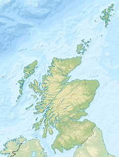
 Davaar Island
Davaar Island shown within Scotland OS grid reference NR760200 Names Gaelic name Eilean Dà Bhàrr Meaning of name "Barr's island" Area and summit Area 52 ha Area rank 195= Highest elevation 115 m Population Population 2 Population rank 88= out of 97 Groupings Island group Firth of Clyde Local Authority Argyll and Bute 

References [1][2][3] If shown, area and population ranks are for all Scottish islands and all inhabited Scottish islands respectively. Population data is from 2001 census.  Davaar Island
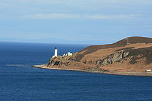 Davaar Island and Lighthouse
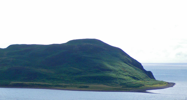
Davaar Island or Island Davaar (Scottish Gaelic: Eilean Dà Bhàrr) is located at the mouth of Campbeltown Loch off the east coast of Kintyre, in Argyll and Bute, Scotland. It is a tidal island, linked to the mainland by a natural shingle causeway called the Dhorlin near Campbeltown at low tide. The crossing can be made in around 40 minutes.
Davaar was known as the island of Sanct Barre between the years 1449 to 1508. The modern form Davaar is from older Do Bharre - thy St Barre. Dr Gillies in his "Place Names of Argyll" appears to accept the popular derivation, Double-pointed (Da-Bharr) Island.
In 1854, a Lighthouse was built on the north of the island by the lighthouse engineers David and Thomas Stevenson. The lighthouse was automated in 1983, and today, Davaar is inhabited by caretakers, sheep, goats and mink.
The island is also known for its seven caves, one of which contains a life size cave painting depicting the crucifixion, painted in 1887 by local artist Archibald MacKinnon after he had a vision in a dream suggesting him to do so. The painting caused uproar in the area as it was seen as a sign from God; it is said that when the townsfolk discovered it was MacKinnon, and not God, he was exiled from the town indefinitely. Restored several times since, including twice by the original artist, the painting was vandalised in July 2006, having a red and black depiction of Che Guevara painted over the original masterpiece. It has since been restored again.[4]
Stamps
Local stamps have been issued for Davaar since 1964. The stamps served the many visitors to the island who wished to have their mail posted there, and carried by the boatman to the nearest GPO Post Box at Campbeltown on the mainland. The boatman service ended some time in the early 1970s. Postage Rates were double those of the UK. These stamps are keenly sought after by collectors of British Locals.[5]
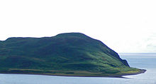 Western end of Davaar Island
Footnotes
- ^ 2001 UK Census per List of islands of Scotland.
- ^ Ordnance Survey
- ^ Iain Mac an Tailleir. "Placenames" (PDF). Pàrlamaid na h-Alba. http://www.scottish.parliament.uk/vli/language/gaelic/pdfs/placenamesC-E.pdf. Retrieved 2007-07-23.
- ^ "Che vandal attacks Christ image". BBC News. 2006-08-01. http://news.bbc.co.uk/1/hi/scotland/glasgow_and_west/5235666.stm. Retrieved 11 December 2007.
- ^ "Modern British Local Posts CD Catalogue, 2009 Edition". Phillips. http://www.seahorsepublishers.com/phillipscatalogues.htm. Retrieved 2008-12-08.
External links
Coordinates: 55°25′22″N 5°32′28″W / 55.42278°N 5.54111°W
Categories:- Islands of the Clyde
- Tidal islands of Scotland
- Argyll and Bute geography stubs
- Lighthouse stubs


Wikimedia Foundation. 2010.