- Manching
-
For the airport, see Ingolstadt Manching Airport.
Manching 

 ManchingLocation of Manching within Pfaffenhofen a.d.Ilm district
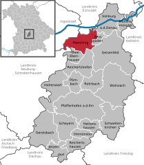
Coordinates 48°43′7″N 11°29′50″E / 48.71861°N 11.49722°ECoordinates: 48°43′7″N 11°29′50″E / 48.71861°N 11.49722°E Administration Country Germany State Bavaria Admin. region Upper Bavaria District Pfaffenhofen a.d.Ilm Mayor Herbert Nerb (Freie Wähler e.V.) Basic statistics Area 35.48 km2 (13.70 sq mi) Elevation 366 m (1201 ft) Population 11,313 (31 December 2010)[1] - Density 319 /km2 (826 /sq mi) Other information Time zone CET/CEST (UTC+1/+2) Licence plate PAF Postal code 85077 Area code 08459 Website www.manching.de Manching is a municipality in the district of Pfaffenhofen, in Bavaria, Germany. It is situated on the river Paar, 7 km southeast of Ingolstadt. In the late Iron Age, there was a Celtic settlement, the Oppidum of Manching, on the location of present-day Manching.
Cassidian (former Military Air Systems department of EADS) has its headquarters here at Manching Airport.
The Barthelmarkt, a well-known beer festival in the area, takes place in the district of Oberstimm on the last weekend of August every year.
Baar-Ebenhausen | Ernsgaden | Geisenfeld | Gerolsbach | Hettenshausen | Hohenwart | Ilmmünster | Jetzendorf | Manching | Münchsmünster | Pfaffenhofen an der Ilm | Pörnbach | Reichertshausen | Reichertshofen | Rohrbach | Scheyern | Schweitenkirchen | Vohburg | Wolnzach
References
- ^ "Fortschreibung des Bevölkerungsstandes" (in German). Bayerisches Landesamt für Statistik und Datenverarbeitung. 31 December 2010. https://www.statistikdaten.bayern.de/genesis/online?language=de&sequenz=tabelleErgebnis&selectionname=12411-009r&sachmerkmal=QUASTI&sachschluessel=SQUART04&startjahr=2010&endjahr=2010.
Categories:- Municipalities in Bavaria
- Pfaffenhofen district
- Upper Bavaria geography stubs


Wikimedia Foundation. 2010.