- Duroc (Paris Métro)
-
Duroc 
Date opened 30 December 1923 Municipality/
Arrondissementthe 7th arrondissement of Paris Fare zone 1 Next stations Paris Métro Line 10 Direction
Boulogne – Pont de Saint-CloudDirection
Gare d'AusterlitzSégur Vaneau Paris Métro Line 13 Direction
Asnières – Gennevilliers or
Saint-DenisDirection
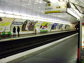
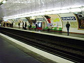
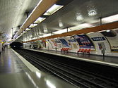
Châtillon – MontrougeSaint-François-Xavier Montparnasse - Bienvenüe List of stations of the Paris Métro Duroc is a station on lines 10 and 13 of the Paris Métro on the borders of the 6th, 7th and 15th arrondissement.
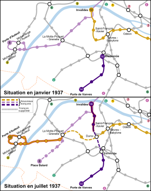
The line 10 station was opened on 30 December 1923 as part of the first section of the ligne circulaire interieur (inner circular line) from Invalides to Croix Rouge (a station east of Sèvres - Babylone, which was closed during World War II). This line was planned by Fulgence Bienvenüe to connect the city's six main railway stations, with Duroc presumably intended to serve the Gare de Montparnasse, although it is 500 metres away. This project was eventually abandoned and on 27 July 1937, the section from Duroc to Invalides was transferred to become the first section of old line 14, which was connected under the Seine and incorporated into line 13 on 9 November 1976. The section between Duroc and Croix Rouge, by that time extended east to Jussieu remained as line 10, which was on the same day (27 July 1937) was extended west from Duroc to La Motte-Picquet - Grenelle.
The station is named after Geraud Duroc, Duke of Friuli (1772–1813), who was one of Napoleon Bonaparte's Generals. It is located close to the location of an old toll gate on the road to Sèvres, part of the Wall of the Farmers-General, which was built around Paris between 1784 and 1791 by the Ferme générale company of tax farmers.
Gallery
Paris Métro Line 10 Boulogne — Pont de Saint-Cloud

 • Boulogne — Jean Jaurès ⇔
Eastbound
→ Michel-Ange — Molitor
 • Chardon Lagache • Mirabeau →
Westbound
← Porte d'Auteuil • Michel-Ange — Auteuil
 • Église d'Auteuil ←
⇔ Javel — André Citroën • Charles Michels • Avenue Émile Zola • La Motte-Picquet — Grenelle


 • Ségur • Duroc
 • Vaneau • Sèvres — Babylone
 • Mabillon • Odéon
 • Cluny — La Sorbonne ⇒

 • Maubert — Mutualité • Cardinal Lemoine • Jussieu
 • Gare d'Austerlitz


Paris Métro Line 13 Northwestern branch
Asnières - Gennevilliers - Les Courtilles • Les Agnettes • Gabriel Péri • Mairie de Clichy • Porte de Clichy
 • Brochant
Northern branch
Saint-Denis - Université • Basilique de Saint-Denis
 • Saint-Denis - Porte de Paris • Carrefour Pleyel • Mairie de Saint-Ouen • Garibaldi • Porte de Saint-Ouen • Guy Môquet
⊃

 • Liège • Saint-Lazare


 • Miromesnil
 • Champs-Élysées - Clemenceau
 • Invalides


 • Varenne • Saint-François-Xavier • Duroc
 • Montparnasse - Bienvenüe


 • Gaîté • Pernety • Plaisance • Porte de Vanves
 • Malakoff - Plateau de Vanves • Malakoff - Rue Étienne Dolet • Châtillon - Montrouge
Coordinates: 48°50′49″N 2°18′59″E / 48.846829°N 2.316479°ECategories:- Paris Métro line 10
- Paris Métro line 13
- Paris Métro stations in the 7th arrondissement of Paris
- Paris Métro stations in the 6th arrondissement of Paris
- Paris Métro stations in the 15th arrondissement of Paris
- Railway stations opened in 1923
Wikimedia Foundation. 2010.


