David Rumsey Historical Map Collection
- David Rumsey Historical Map Collection
-

"
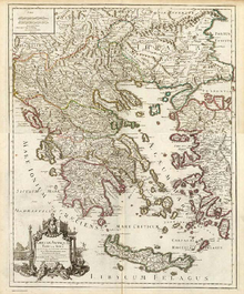
Graeciae Antiquae Tabula Nova"
from 1708
The David Rumsey Historical Map Collection is one of the world's largest private map collections. It has some 150,000 maps and cartographic items. The collection was created by David Rumsey, who after making his fortune in real estate, focused on collecting 18th- and 19th century North and South America as this era "saw the rise of modern cartography."[1]
There are now over 17,000 digitized maps available through his website, http://www.davidrumsey.com, and about a dozen of which are currently being hosted through Google Earth layers. Select maps are also featured at the Rumsey Maps island in Second Life.
The website presents maps using two Insight viewers from Luna Imaging, Inc.—one using Javascript and the other using Java—from files stored in MrSID format on its server. Maps can be exported as JPEG from the Java viewer.
In February 2009, David Rumsey announced that the entire collection would be donated to Stanford University, including 150,000 maps and their digital images, plus the davidrumsey.com web site (where the images are publicly posted on-line), as well as the database used to track the images.[2]
References
External links
Categories: - Map collections
- Historical geographic information systems
- Discipline-oriented digital libraries
Wikimedia Foundation.
2010.
Look at other dictionaries:
David Rumsey — For other people named David Rumsey, see David Rumsey (disambiguation). David Rumsey at the 2005 Where 2.0 Conference. David Rumsey is a map collector and the founder of the David Rumsey Map Collection. He is also the president of Cartography… … Wikipedia
Map collection — Not to be confused with atlas or map series. Visscher, Cl.J., World Map. 1652., in Doncker, Hendrick, Sea Atlas (1659 ed.), from the map collection of the National Library of Australia … Wikipedia
Historical geographic information system — A historical geographic information system (also written as historical GIS or HGIS) is a geographic information system that may display, store and analyze data of past geographies and track changes in time. It can be regarded as a subfield of… … Wikipedia
Parliamentary constituencies in Hertfordshire — The county of Hertfordshire in relation to England The county of Hertfordshire in England is divided into eleven Parliamentary constituencies. Each of the eleven elects a Member of Parliament (MP) to represent it at the United K … Wikipedia
List of maps of the UK and Ireland — Maps of the UK and Ireland are available in various media. Contents 1 Maps on CD ROM 2 Maps on GPS Phones 3 Downloadable Maps 4 Online Maps … Wikipedia
Seattle, Lake Shore and Eastern Railway — Infobox SG rail railroad name=Seattle, Lake Shore and Eastern Railway locale=Washington start year=1885 end year=1896 hq city=Seattle, Washington The Seattle, Lake Shore and Eastern Railway (SLS E) was a railroad founded in Seattle, Washington… … Wikipedia
Charles Wilkes — Born April 3, 1798(1798 04 03) New York City, New York Died February 8, 187 … Wikipedia
Ryer Island — is a name shared by two separate islands in the Sacramento San Joaquin River Delta, each located in Solano County, California.The westernmost island is located in the entrance to the Delta between Suisun Bay and Suisun Cutoff.David L. Durham,… … Wikipedia
Genealogy — (from Greek: el. γενεά, el. genea , descent ; and el. λόγος, el. logos , knowledge ) is the study of families and the tracing of their lineages and history. Genealogists use oral traditions, historical records, genetic analysis, and other records … Wikipedia
Japanese Historical Maps — “Japanese Historical Maps” is a website that allows users to view a collection of approximately 850 early Japanese maps of both Japan and the world. The site is a collaborative effort between David Rumsey of Cartography Associates and the East… … Wikipedia

