- Mainburg
-
Mainburg 

 MainburgLocation of the town of Mainburg within Kelheim district
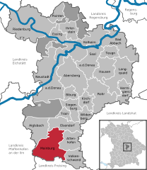
Coordinates 48°39′N 11°47′E / 48.65°N 11.78333°ECoordinates: 48°39′N 11°47′E / 48.65°N 11.78333°E Administration Country Germany State Bavaria Admin. region Lower Bavaria District Kelheim Mayor Josef Reiser ("Stadt-Land-Union") Basic statistics Area 61.65 km2 (23.80 sq mi) Elevation 422 m (1385 ft) Population 14,046 (31 December 2010)[1] - Density 228 /km2 (590 /sq mi) Other information Time zone CET/CEST (UTC+1/+2) Licence plate KEH Postal codes 84042–84048 Area code 08751 Website www.mainburg.de Mainburg is a town in the district of Kelheim, in Bavaria, Germany. It is situated on the river Abens, 30 km northwest of Landshut and 30 km southeast of Ingolstadt.
Abensberg | Aiglsbach | Attenhofen | Bad Abbach | Biburg | Elsendorf | Essing | Hausen | Herrngiersdorf | Ihrlerstein | Kelheim | Kirchdorf | Langquaid | Mainburg | Neustadt an der Donau | Painten | Riedenburg | Rohr in Niederbayern | Saal an der Donau | Siegenburg | Teugn | Train | Volkenschwand | Wildenberg
References
- ^ "Fortschreibung des Bevölkerungsstandes" (in German). Bayerisches Landesamt für Statistik und Datenverarbeitung. 31 December 2010. https://www.statistikdaten.bayern.de/genesis/online?language=de&sequenz=tabelleErgebnis&selectionname=12411-009r&sachmerkmal=QUASTI&sachschluessel=SQUART04&startjahr=2010&endjahr=2010.
Categories:- Geography articles needing translation from German Wikipedia
- Towns in Bavaria
- Lower Bavaria geography stubs


Wikimedia Foundation. 2010.