- Tokyo Subway
Infobox Public transit
name=Tokyo Subway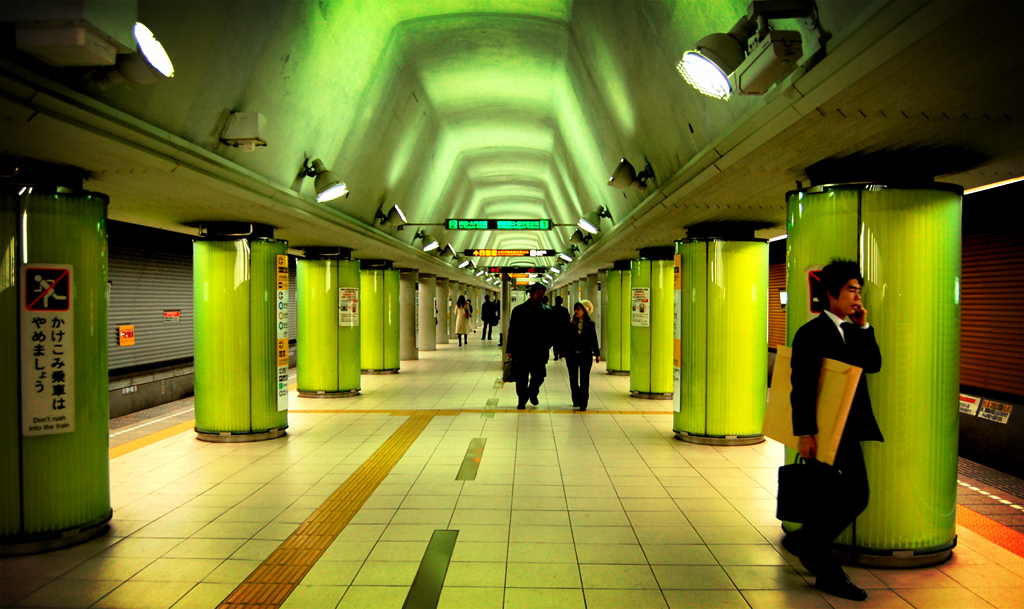
imagesize=250px
locale=Tokyo ,Japan
lines=13
began_operation=December 30 ,1927
system_length = km to mi|328.8|abbr=yes|wiki=yes
stations=282
track_gauge= 1,067 mm (1,435 mm for Ginza, Marunouchi, Toei Asakusa & Toei Ōedo Lines, 1,372 mm forToei Shinjuku Line )
transit_type=Rapid transit
operator=Tokyo Metro Co., Ltd.,Tokyo Metropolitan Bureau of Transportation (Toei),Tokyo Waterfront Area Rapid Transit 
thumb|Tokyo Metro Hibiya Line subway train departing Hiroo StationThe Tokyo subway is an integral part of the world's most extensive
rapid transit system in a single metropolitan area,Greater Tokyo . While the subway system itself is largely within the city center, the lines extend far out via extensive through services ontosuburban rail way lines.Networks
As of June 2008, the entire network of
Tokyo Metro , Tokyo Metropolitan Bureau of Transportation and Tokyo Waterfront Area Rapid Transit has 282 stations and 14 lines. The Tokyo Metro and Toei networks together carry a combined average of close to eight million passengers daily [cite web|url=http://www.japantoday.com/jp/feature/1055|title=Japan Today : Subways keep Tokyo on the move|accessdate=2007-01-24] . Despite being ranked first in worldwide subway usage, subways make up a small fraction of heavy rail rapid transit in Tokyo alone—only 282 out of 882 railway stations, as of 2007. [ [http://net.jmc.or.jp/digital_data_statistics_eki.html 【平成19年版】緯度経度付き全国沿線別駅データ - 地図センターネットショッピング ] ]There are two primary subway operators in Tokyo:
*
Tokyo Metro . Formerly Teito Rapid Transit Authority (Eidan), privatized in 2004 and presently operating 168 stations and nine lines. The minimum price for one ride is 160yen .*
Tokyo Metropolitan Bureau of Transportation (Toei). An arm of theTokyo Metropolitan Government , operates 106 stations in four lines. The minimum price for one ride is 170 yen.In addition, the
Tokyo Waterfront Area Rapid Transit (TWR) operates a single mostly-underground line with eight stations.The
Yamanote Line is not a subway, but an above-ground commuter line operated by JR East. It acts as a key transportation artery in downtown Tokyo; therefore, it is often marked on Tokyo subway maps.Many above-ground and underground lines in the
Greater Tokyo Area operate through services with the Tokyo Metro and Toei lines so that in a broader meaning they consist a part of the Tokyo subway network.The
Yokohama Subway (and the plannedKawasaki Subway ) also operate in the Greater Tokyo Area, but they are not directly linked to the Tokyo subway network. However, on special occasions (typically holiday weekends), theTokyo Metro Hibiya Line and Namboku Line operate special nihongo|"Minato Mirai"|みなとみらい号|Minatomirai-gō direct through services onto Yokohama's fully undergroundMinatomirai Line via theTōkyū Tōyoko Line railway. From 2012, theTokyo Metro Fukutoshin Line will also have regular through service to the Minatomirai Line.ystem administration
All three subway systems are closely integrated with a unified system of line colors, line codes and station numbers. However, the separate administration of metro systems has these ramifications:
* For single rides across Metro and Toei systems, a special transfer ticket is required. It costs 70 yen less than the sum of the Metro fare and the Toei fare, calculated based on the possible shortest route of the ride between the origin and destination stations. [cite web|url=http://www.kotsu.metro.tokyo.jp/english/subway_ride.html|title=Toei Subway Information - How to Ride the Subway|author=Tokyo Metropolitan Bureau of Transportation|accessdate=2008-06-25] However, the
Passnet system got around the issue of ticketing, by allowing one stored-fare card to be used on most of the rail operators in theGreater Tokyo Area (with the noticeable exception of JR East which used its ownSuica system). ThePASMO system introduced in 2007 and completely replaced the Passnet in 2008 finally allowed for one unified stored fare system for most of the Tokyo transit system including JR East. The fare charged by the stored fare system is the same as for the users of paper tickets.* The systems represent the metro network differently in station, train and customer information diagrams. For example, the [http://www.metro.tokyo.jp/SUB/SUBWAY/index.htm Toei map] represents the
Toei Ōedo Line as a circle in the centre; the [http://www.tokyometro.jp/rosen/rosenzu/index.html Tokyo Metro's map] saves the central ring line for the Marunouchi Line and the JRYamanote Line .1995 Sarin Attack
In 1995,
Aum Shinri Kyo , adoomsday cult, attacked the subway system withsarin nerve gas at Kasumigaseki Station and a few others, leading to 12 deaths and 1,034 people injured.ee also
*
Tokyo Metropolitan Subway Construction Company References
External links
* [http://de.geocities.com/tok_subway/tokyo.htm Urbanrail.net page on Tokyo subways]
Wikimedia Foundation. 2010.