- Sauk Rapids Bridge
-
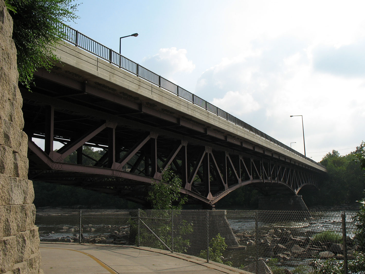
Sauk Rapids Bridge 
The Sauk Rapids Bridge, as viewed from the east bank of the Mississippi River, north of the bridgeCarries Two lanes connecting First Street South, Sauk Rapids, MN and Ninth Avenue North, St. Cloud, MN (previously Minnesota State Highway 152 and Minnesota State Highway 15), pedestrians Crosses Mississippi River Locale Sauk Rapids, Minnesota Maintained by Minnesota Department of Transportation ID number 5947 Design Three-span steel spandrel braced arch bridge Total length 565 feet Width 38 feet Longest span 175 feet Clearance below 12 feet Opened 1942 Closed 2007 (planned) Coordinates 45°35′11″N 94°10′10″W / 45.58639°N 94.16944°W The Sauk Rapids Bridge was a steel spandrel braced arch bridge that spanned the Mississippi River between the cities of St. Cloud and Sauk Rapids in the U.S. state of Minnesota. It was built in 1942 and was designed by the Minnesota Department of Transportation. The bridge consisted of three spans supported by two piers. It crossed the Mississippi River half a mile downstream from the rapids of the Sauk River. The river is still rough and fast-flowing at this location.
With the opening of the new Sauk Rapids Regional Bridge, located a short distance upstream, on October 23, 2007, the Sauk Rapids Bridge had been closed to all traffic.
After the collapse of the I-35W Mississippi River bridge in Minneapolis on August 1, 2007, Minnesota Governor Tim Pawlenty ordered the Sauk Rapids Bridge and two other bridges in Minnesota to be inspected. The three bridges have a design similar to that of the former I-35W bridge.[1]
The bridge was inspected on August 4 and found to be structurally sound.
As of March 2008, the bridge had been completely dismantled.[1]
See also
References
- General references
- Costello, Mary Charlotte (2002). Climbing the Mississippi River Bridge by Bridge, Volume Two: Minnesota. Cambridge, MN: Adventure Publications. ISBN 0-9644518-2-4.
- Cited references
- ^ "Update: St. Cloud's DeSoto bridge slated for immediate inspection". The St. Cloud Times. 2007-08-02. http://www.sctimes.com/apps/pbcs.dll/article?AID=/20070802/NEWS01/108020071. Retrieved 2007-08-02.[dead link]
Bridges of the Mississippi River Upstream
Sauk Rapids Regional BridgeSauk Rapids Bridge Downstream
St. Cloud Rail Bridge
BNSF RailwayCategories:- Deck arch bridges
- Road bridges in Minnesota
- Bridges over the Mississippi River
- Bridges completed in 1942
- Buildings and structures in Benton County, Minnesota
- United States bridge (structure) stubs
- Minnesota building and structure stubs
Wikimedia Foundation. 2010.