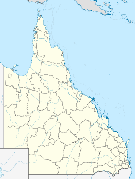
New Mapoon, Queensland

New Mapoon, Queensland
New Mapoon
Queensland
New Mapoon is located in Queensland
{{{alt}}}
New Mapoon
Population: 346[1]
Postcode: 4876
Location:
LGA: Northern Peninsula Area Region
State District: Cook
Federal Division: Leichhardt

New Mapoon is an area South of Seisia and West of Bamaga at the tip of Cape York Peninsula, adjoining the Lockerbie Scrub. At the 2006 census, New Mapoon had a population of 346.[1]

The people who live at New Mapoon were forcibly moved from Marpuna in the early 1960s to accommodate mining expansion on their traditional country. They now have historical association and administrative responsibility for a DOGIT area on the traditional country of the Gudang people. The residents of New Mapoon have a ranger service, which works closely with the Injinoo and other Northern Peninsula Area (NPA) community rangers to undertake land management practices in the NPA.

New Mapoon has a library (Indigenous Knowledge Centre), General store, Arts and Craft and Bait and Tackle shop.

References

Aerial photos & maps


Wikimedia Foundation. 2010.

Игры ⚽ Поможем написать реферат

Look at other dictionaries:

  • Mapoon, Queensland — Mapoon Queensland …   Wikipedia

  • Mapoon Aboriginal Mission Queensland — Mapoon Aboriginal Community is located at Port Musgrave, western Cape York in Queensland. A Presbyterian mission was established at Mapoon in 1891 with the aim of providing education and health services to the Aboriginal people. By 1907, under… …   Wikipedia

  • Bamaga, Queensland — Infobox Australian Place | type = town name = Bamaga state = qld caption = lga = Bamaga Island Council postcode = 4876 est = pop = 784 pop footnotes= elevation= maxtemp = mintemp = rainfall = stategov = Cook fedgov = Leichhardt dist1 = 2677 dir1 …   Wikipedia

  • Local Government Areas in Queensland — Karte der Verwaltungsgebiete in Queensland nach März 2008 Der australische Bundesstaat Queensland ist seit 17. März 2008 nur noch in 53 lokale Verwaltungsgebiete (Local Government Areas) unterteilt. Inhaltsverzeic …   Deutsch Wikipedia

  • Seisia, Queensland — Seisia is an area north of New Mapoon and west of Bamaga at the tip of Cape York Peninsula in Queensland, Australia.Seisia Island Community lies within a small DOGIT area granted in 1986 by the Queensland Government at Red Island Point. The… …   Wikipedia

  • Injinoo Aboriginal Community Queensland — Injinoo Aboriginal Community was an Aboriginal settlement and later Anglican mission established on Cape York by a community led by a Wuthathi man, Allelic Whitesand.Although self sufficient, through fishing and gardening, the Community made… …   Wikipedia

  • Napranum, Queensland — Napranum Queensland Population: 830[1] Postcode: 4874 …   Wikipedia

  • Northern Peninsula Area Region — Queensland Population: 2,389(2010)[1] Established: 2008 …   Wikipedia

  • Northern Peninsula Area Regional Council — Infobox Australian Place | type = lga name = Northern Peninsula Area Region state = qld caption = pop = 1,929 (2006 census) area = 1071.9 est = 2008 seat = Bamaga mayor = Cr Joseph Elu region = Far North Queensland logosize = url = stategov =… …   Wikipedia

  • Cape York Peninsula — This article is about the peninsula located in the Australian state of Queensland; it should not be confused with either Yorke Peninsula in South Australia, or Cape York, Greenland. Cape York Peninsula is a large peninsula located in Far North… …   Wikipedia

Share the article and excerpts

Direct link
Do a right-click on the link above
and select “Copy Link”