Merriam Street Bridge

Merriam Street Bridge
Carries Two lanes of Merriam Street
Crosses East channel of the Mississippi River
Locale Minneapolis-St. Paul, Minnesota
Maintained by City of Minneapolis
ID number 27664
Design Truss bridge
Total length 256.7 feet
Width 34 feet
Longest span 147 feet
Clearance below 14 feet
Opened 1887 as part of the Broadway Avenue Bridge; moved to current location in 1987
Daily traffic 1077 vehicles per day
Coordinates 44°59′09″N 93°15′34″W / 44.985912°N 93.259412°W / 44.985912; -93.259412Coordinates: 44°59′09″N 93°15′34″W / 44.985912°N 93.259412°W / 44.985912; -93.259412

Merriam Street Bridge is a truss bridge that spans the east channel of the Mississippi River between Nicollet Island and the east bank of the river in Minneapolis, Minnesota. The bridge was originally built in 1887 by King Iron Bridge Company as one of the four spans of the Broadway Avenue Bridge. When the Broadway Avenue Bridge was reconstructed in 1987, one span was preserved and moved to Nicollet Island. The truss span is actually decorative; the bridge is supported by a beam from underneath.

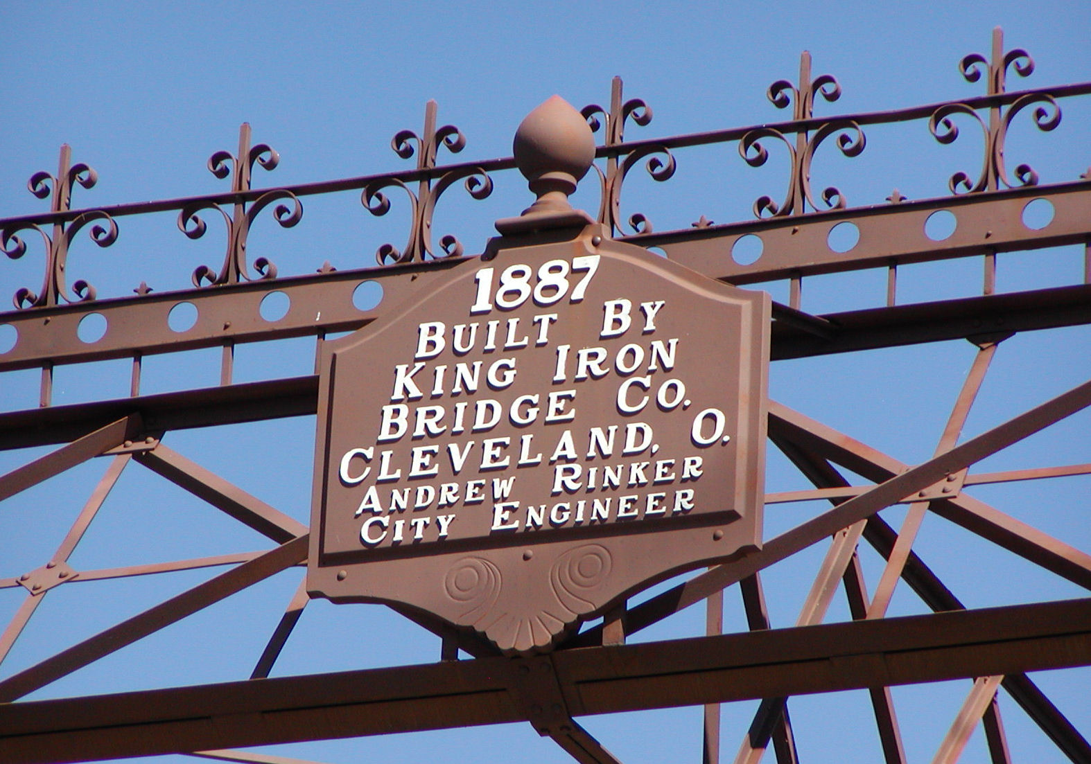
The original Broadway Avenue Bridge was one of the fanciest bridges on the Mississippi River. It featured finials on each top corner and a band of scrolls, crosses, and lines between them. The horizontal struts and guard railings used X-shapes as a pattern. Each end of the bridge has a hexagonal cast iron plate embossed with the date and the designer of the bridge. The bridge now serves as a connector between parkland on Nicollet Island and the Saint Anthony Main development on the east bank, allowing good opportunities for visitors to stroll across the river.
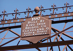
Plaque above bridge
Side view, from Nicollet Island

References

  • Costello, Mary Charlotte (2002). Climbing the Mississippi River Bridge by Bridge, Volume Two: Minnesota. Cambridge, MN: Adventure Publications. ISBN 0-9644518-2-4. 

Wikimedia Foundation. 2010.

Игры ⚽ Нужно сделать НИР?

Look at other dictionaries:

  • Broadway Avenue Bridge — Infobox Bridge bridge name=Broadway Avenue Bridge caption= official name=Broadway Avenue Bridge crosses=Mississippi River carries=Four lanes of West Broadway/Broadway Street Northeast locale=Minneapolis, Minnesota design=Girder bridge… …   Wikipedia

  • King Bridge Company — The King Iron Bridge Manufacturing Company was a late 19th Century bridge building company located in Cleveland, Ohio. It was founded by Zenas King (1818 1892) in 1858 and subsequently managed by his sons, James A. King and Harry W. King and then …   Wikipedia

  • Merriam Park Subdivision — Canadian Pacific Railway Merriam Park Subdivision Legend …   Wikipedia

  • Tower Bridge (California) — Infobox Bridge bridge name = Tower Bridge caption = The Tower Bridge just after sunset carries = Cars, pedestrians, and previously railroad crosses = Sacramento River maint = Caltrans [National Bridge Inventory database, 2006] locale = West… …   Wikipedia

  • 18th Street Expressway — Infobox road marker highway name=18th Street Expressway maint=KDOT length mi= direction a=South direction b=North terminus a= terminus b= in Kansas CityThe 18th Street Expressway (often shortened to 18th Street in everyday speech) is a freeway in …   Wikipedia

  • San Francisco – Oakland Bay Bridge — Infobox Bridge bridge name = San Francisco – Oakland Bay Bridge image size = 260px caption = Western Span of the bridge at night official name = James Sunny Jim Rolph Bridge carries = 10 lanes (5 westbound on upper level, 5 eastbound on lower) of …   Wikipedia

  • I-35W Mississippi River bridge — This article is about the bridge that collapsed in 2007. For the replacement bridge, see I 35W Saint Anthony Falls Bridge. Mississippi River Bridge …   Wikipedia

  • Nicollet Island — Visitors get ready for a ride in a horsedrawn carriage near the Nicollet Island Inn. Nicollet Island is an island in the Mississippi River just north of downtown Minneapolis, Minnesota, named for cartographer, Joseph Nicollet. DeLaSalle High… …   Wikipedia

  • National Register of Historic Places listings in Newton, Massachusetts — Location of Newton in Massachusetts Map of all coordinates from Google …   Wikipedia

  • National Register of Historic Places listings in Middlesex County, Massachusetts — Location of Middlesex County in Massachusetts This is a listing of places in Middlesex County in the U.S. state of Massachusetts that are listed in the National Register of Historic Places …   Wikipedia

Share the article and excerpts

Direct link
Do a right-click on the link above
and select “Copy Link”