- Czarnków
-
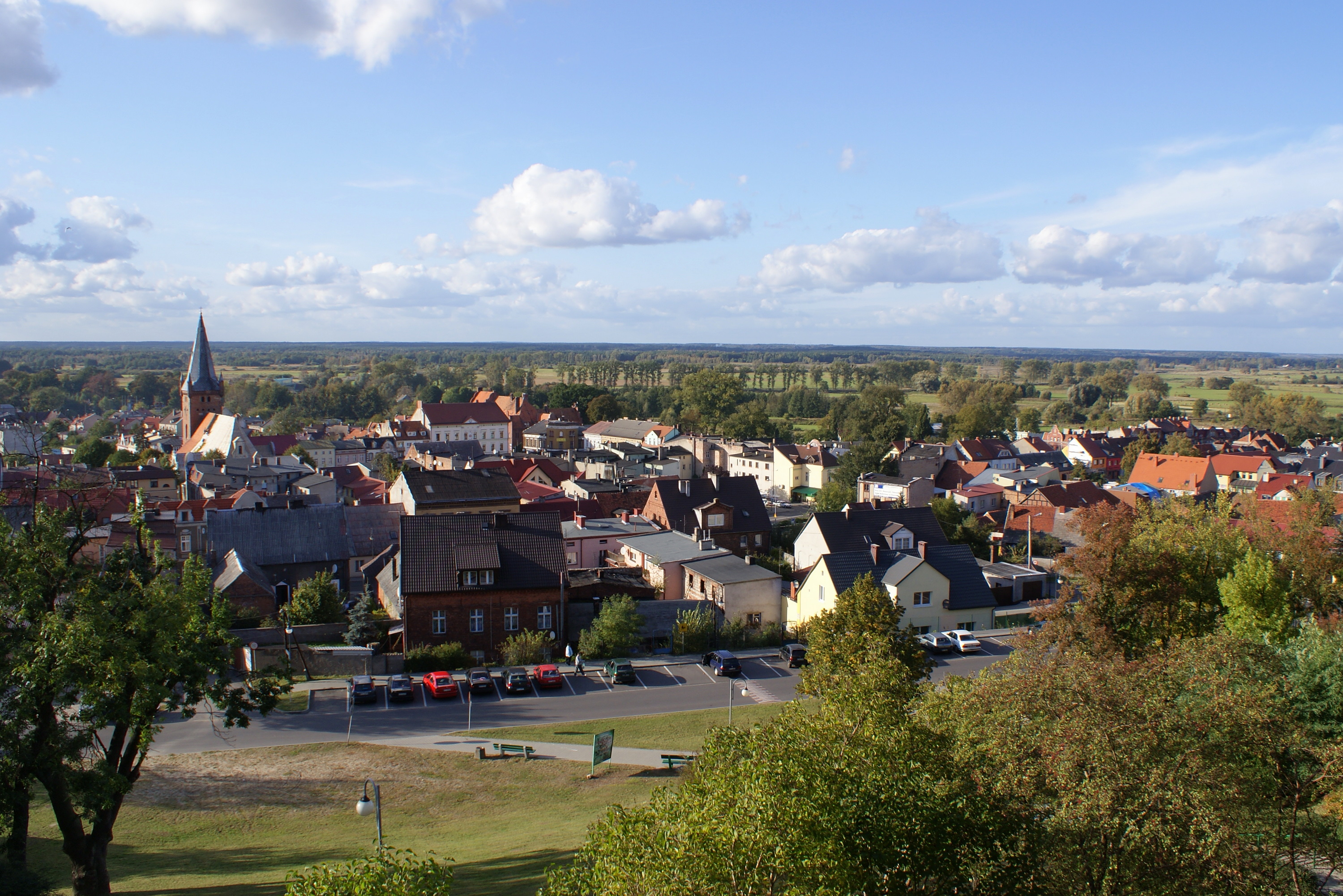
Czarnków View on the Old town
Coat of arms
 Czarnków
Coordinates: 52°54′N 16°34′E / 52.9°N 16.567°E Country  Poland
Voivodeship Greater Poland County Czarnków-Trzcianka Gmina Czarnków (urban gmina) Area - Total 9.7 km2 (3.7 sq mi) Population (2006) - Total 11,356 - Density 1,170.7/km2 (3,032.2/sq mi) Postal code 64-700 Website http://www.czarnkow.pl Czarnków [ˈt͡ʂarŋkuf] (German: until 1940: Czarnikau, between 1940-1945: Scharnikau) is a town in Poland in Czarnków-Trzcianka County in Greater Poland Voivodeship, previously in Piła Voivodeship (1975-1998). It has 12,000 inhabitants.
The town lies on the Noteć river. Because there are many hills around the town, the area is called Szwajcaria Czarnkowska ("Czarnków's Switzerland").
Contents
History
First time noted in early 12th century in Gallus Anonymus Chronicle. At this time Czarnków was grad of pagan Pomeranians and was ruled by local Pomeranian ruler Gniewomir. It was conquered by Polish prince Bolesław III Wrymouth in 1108. From 1244 until 1407 Czarnków was the seat of a castellany. From early 14th until the middle of the 17th century Czarnków was in the hands of the noble family of Nałęcz (they changed name for "Czarnkowski"). The Czarnkowski family build a new castle (first time noted 1331 and destroyed at the end of the 17th century) and established before 1369 town privileges. From 1772-1919 the town belonged to the Kingdom of Prussia and Imperial Germany. After World War I the town became part of the Second Polish Republic.
Historical attractions
- medieval plan of city
- 16th century church of Saint Mary Magdalene
- 19th century city hall
- 18-19th century houses
- remnants of 19th century Jewish cemetery
People
- Wincenty I Niałek - 13th century archbishop of Gniezno
- Jan of Czarnków - Polish 14th century chronicler and Deputy Chancellor of the Crown
- Reinhold Sadler - A former Governor of Nevada.
- Adam Słodowy - Author and TV host.
- Kamila Switalska - Famous Zigane Female DJ.
References
Partner Cities
 Coevorden in Netherland
 Gadebusch in Germany
Coordinates: 52°54′N 16°34′E / 52.9°N 16.567°E
Seat Czarnków (urban gmina)
Urban-rural gminas Rural gminas Seat (not part of the gmina) Czarnków
Villages Białężyn • Brzeźno • Bukowiec • Ciążyń • Ciszkowo • Gajewo • Gębice • Gębiczyn • Góra nad Notecią • Goraj-Zamek • Grzępy • Huta • Hutka • Jędrzejewo • Komorzewo • Kuźnica Czarnkowska • Marunowo • Mikołajewo • Paliszewo • Pianówka • Radolinek • Radosiew • Romanowo Dolne • Romanowo Górne • Sarbia • Sarbka • Śmieszkowo • Sobolewo • Średnica • Walkowice • ZofiowoCategories:- Cities and towns in Greater Poland Voivodeship
- Czarnków-Trzcianka County
- Greater Poland geography stubs


Wikimedia Foundation. 2010.