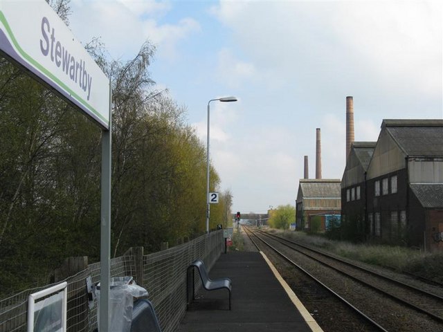
Stewartby railway station
- Stewartby railway station
Infobox UK station
name = Stewartby
manager = London Midland
locale = Stewartby
borough = Bedford
start = ?
platforms = 2
lowusage0405= 16,529
lowusage0506= 18,637
lowusage0607= 19,135Stewartby railway station serves the village of Stewartby in Bedfordshire, England.
Also nearby is the Marston Vale Millennium Country Park.
ervices
Community Rail Partnership
Stewartby, in common with other stations on the Marston Vale line, is covered by the [http://www.marstonvalecommuityrail.org.uk Marston Vale Community Rail Partnership] . The Partnership aims to increase use of the line by getting local people involved with their local line.
External links
Wikimedia Foundation.
2010.
Look at other dictionaries:
Millbrook (Bedfordshire) railway station — Millbrook Location Place … Wikipedia
Stewartby — infobox UK place country = England latitude= 52.0691 longitude= 0.5139 official name= Stewartby population = 1,212 [cite web | publisher=Office for National Statistics | url=http://neighbourhood.statistics.gov.uk/dissemination/LeadTableView.do?a=3… … Wikipedia
Marston Vale Line — Overview Type Heavy rail System National Rail Status Operational Locale Buckinghamshire Bedfordshire … Wikipedia
Ampthill — Coordinates: 52°01′35″N 0°29′26″W / 52.0263°N 0.4906°W / 52.0263; 0.4906 … Wikipedia
Varsity Line — [v · d · … Wikipedia
Noel Park — This article is about the area in North London. For the Australian politician, see Noel Park (politician). For the railway station sometimes known as Noel Park , see Noel Park and Wood Green railway station. Coordinates: 51°35′47″N 0°06′08″W / … Wikipedia
Linslade — Coordinates: 51°55′27″N 0°40′39″W / 51.9243°N 0.6774°W / 51.9243; 0.6774 … Wikipedia
Bournville — Infobox UK place country = England official name = Bournville latitude = 52.4299 longitude = 1.9355 population = metropolitan borough = Birmingham metropolitan county = West Midlands region = West Midlands constituency westminster = post town =… … Wikipedia
Dunstable — For the town in the United States, see Dunstable, Massachusetts. For the composer, see John Dunstaple. See also: Dunnstable Township, Pennsylvania Coordinates: 51°53′10″N 0°31′16″W / … Wikipedia
Chiltern Green — Coordinates: 51°51′38″N 0°21′12″W / 51.86059°N 0.35328°W / 51.86059; 0.35328 … Wikipedia