- Manly Dam Reserve
-
Manly Dam Reserve (also known as the Manly-Warringah War Memorial Park) is an area of urban bushland in the Northern Beaches region of Sydney, Australia. It is within the suburbs of Allambie Heights and Manly Vale in Warringah.
Contents
Area
The Reserve adjoins the south-eastern edge of Garigal National Park, and to the reserve's east lies Wakehurst golf course.
Dam
The Reserve is centred around a man-made lake officially called 'Manly Reservoir', but it is more widely known as 'Manly Dam' after the dam that created it.
Curl Curl Creek was originally dammed in 1892 to create a deep freshwater lake. It was intended to provide a permanent supply of fresh water for the nearby village of Manly. The original dam wall was subsequently raised in 1909 and in 1922 to 35.1 metres (115 ft) to provide up to 1.7 gigalitres (370,000,000 imp gal) of drinking water. However as the population of the area grew, the dam's capacity became insufficient.
Water supply from Manly Dam was phased out by 1930 when piping began from the Pymble reservoir. Briefly in 1942 after a period of drought, pumps were reinstalled and Manly Dam was brought back into service for nearly 10 months.[1]
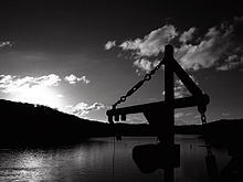
In the early 1990s engineers installed a large enclosed powered propeller against the dam wall on the reservoir side to prevent silt building up against the wall and causing damage to the structure.
War Memorial
On the southern side of the dam there is a war memorial to those who have fallen in all wars.
Tracks
Manly Dam is home to a wide variety of well maintained walking tracks, and a single mountain bike circuit of around 9km. The mountain bike circuit is one of the only legal "Single Tracks" available in Sydney, which makes it a very popular destination for Sydney mountain bike riders. [2] [3]
Due to the popularity of the cycling circuit local park rangers have installed a number of wooden boardwalks at various points and ask riders via emails and communication with clubs to stay off the track during and immediately after periods of rain.
In February 2010 Warringah Council abruptly closed sections of the cycling track, which caused a major uproar in the Sydney Mountain bike community. Local councillors have publicly stated that the closure was due to a technicality,[4] which was overturned after a strong show of opposition from the Cycling community. [5]
Hydraulics Laboratories
Manly Hydraulics Laboratory (run by the NSW Department of Commerce) and the Water Research Laboratory (run by the University of New South Wales), are at the southern end of the Reserve, just below the actual Dam.
References
"Manly Dam". Warringah Council. http://www.warringah.nsw.gov.au/community/manly_dam.aspx. Retrieved 2008-05-19.
"Caring for the Manly Dam Catchment" (PDF) (Press release). Warringah Council. http://www.warringah.nsw.gov.au/environment/documents/manlydamactivities.pdf. Retrieved 2008-05-09.
- ^ "History of Manly Dam" (PDF). Warringah Council. http://www.warringah.nsw.gov.au/environment/documents/manlydamhistory.pdf. Retrieved 2008-06-01.
- ^ Warringah Council Trail Information [1]
- ^ NobMob trail details [2]
- ^ Councillors pledge to revert ban [3]
- ^ Manly Daily Article discussing Cyclists using Manly Dam
External links
- Manly Dam Reserve is at coordinates 33°46′33″S 151°14′52″E / 33.775803°S 151.247769°ECoordinates: 33°46′33″S 151°14′52″E / 33.775803°S 151.247769°E
- The Northern Beaches Mountain Biking Group (NoBMoB) have details of trails in Manly Dam Reserve
- Manly Hydraulics Laboratory
- Water Research Laboratory
- "Manly Dam and Surrounds" - Aussie Heritage website
Categories:- Geography of Sydney
- Sydney geography stubs
Wikimedia Foundation. 2010.

