Hadano, Kanagawa

Hadano, Kanagawa

Japanese city
Name=Hadano
JapaneseName=秦野市
Prefecture=Kanagawa
Region=Kantō
Area_km2=103.61
Population=169,111
PopDate=2008
Density_km2=1632
Coords=
LatitudeDegrees= 35
LatitudeMinutes= 22
LatitudeSeconds=
LongtitudeDegrees= 139
LongtitudeMinutes= 13
LongtitudeSeconds=
Postal code=257-0003
Area code=
Mayor =Furuya Yoshiyuki
Tree =Sasanqua
Flower =Hydrangea
Bird =Nightingale
Symbol
!border| SymbolDescription= Flag
CityHallPostalCode =
CityHallAddress=
CityHallPhone=
CityHallLink = [http://www.city.hadano.kanagawa.jp/ Hadano] | City
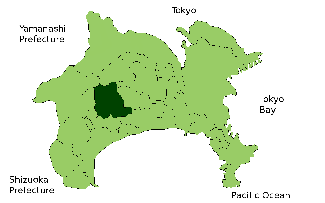


Elevation=

Hadano (Japanese: 秦野市; -shi) is a "shi" (city) in Kanagawa Prefecture, Japan.

As of March 2008, Hadano has an estimated population of 169,111 and a population density of 1,632.19 persons per km²; it has a total area of 103.61 km².

Hadano was a regional commercial center during the Edo period following the introduction of tobacco cultivation to the area. The curtains closed on the industry's 300-year history in 1984, and the city no longer has any tobacco farmers. A former tobacco-trading center and processing plant belonging to Japan Tobacco and Salt Public Corporation (now Japan Tobacco) has been replaced by a large shopping mall.

Hadano became a city as defined by Japanese law on January 1, 1955.

Transportation

*Route 246, to central Tokyo or Numazu
*Route 255, to Odawara
*Hadano-Nakai Interchange, Tomei Expressway
*Odakyu line (rail), Hadano station, to Shinjuku and Odawara

Tourist Attractions

*Tanzawa Mountains
*Tsurumaki Hot Spring
*Ōyama

Other Institutions

*Tokai University

External links

* [http://www.city.hadano.kanagawa.jp/ Official website] ja icon


Wikimedia Foundation. 2010.

Игры ⚽ Нужна курсовая?

Look at other dictionaries:

  • Hadano (Kanagawa) — 秦野市 Hadano shi Geographische Lage in Japan …   Deutsch Wikipedia

  • Hadano — shi 秦野市 Geographische Lage in Japan …   Deutsch Wikipedia

  • Hadano Station — (秦野駅) is a station on the Odakyu Odawara Line, a railway stretching from Tokyo to Odawara, Japan. It is located in Hadano, Kanagawa Prefecture.Lines*Odakyu Electric Railway **Odakyu Odawara LineBuildingThe station has two island platforms and… …   Wikipedia

  • Hadano — shi (秦野市) Panorama de Hadano Administration Pays Japon Région Kantō Préfecture Kana …   Wikipédia en Français

  • Kanagawa Prefectural Board of Education — (神奈川県教育委員会) is the board of education of the Kanagawa Prefecture, Japan.The board consists of six members; one of them is elected as the chair (教育委員長), and one of them is appointed by the board as the superintendent (教育長).The board administers to …   Wikipedia

  • Kanagawa — Préfecture de Kanagawa Préfecture de Kanagawa · 神奈川県 Kanagawa ken Carte du Japon avec la Préfecture de Kanagawa mise en évidence. Pays  Japon …   Wikipédia en Français

  • Kanagawa Prefecture — Infobox Prefecture Japan Name = Kanagawa JapaneseName = 神奈川県 Rōmaji = Kanagawa ken Symbol = PrefSymbol Kanagawa.png Capital = Yokohama Region = Kantō Island = Honshū TotalArea = 2,415.42 AreaRank = 43rd PCWater = 2.3 PopDate = September 1, 2007… …   Wikipedia

  • Hadano — ▪ Japan also spelled  Hatano        city, Kanagawa ken (prefecture), Honshu, Japan, stretching between Tanzawa yama (Mt. Tanzawa; north; 5,141 ft [1,567 m]) and the Hadano basin (south). It was a regional commercial centre during the Tokugawa era …   Universalium

  • Prefectura de Kanagawa — Kanagawa 神奈川県 Kanagawa ken Prefectura de Japón …   Wikipedia Español

  • Naka District, Kanagawa — Map of Naka District with Meiji period area in yellow, modern area in green; 1= Ōiso Town; 2=Ninomiya Town Naka District (中郡, Naka gun?) is an administrative …   Wikipedia

Share the article and excerpts

Direct link
Do a right-click on the link above
and select “Copy Link”