- Mücheln
-
Mücheln 
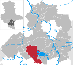
Coordinates 51°18′0″N 11°48′0″E / 51.3°N 11.8°ECoordinates: 51°18′0″N 11°48′0″E / 51.3°N 11.8°E Administration Country Germany State Saxony-Anhalt District Saalekreis Town subdivisions 10 Mayor Udo Wurzel Basic statistics Area 98.6 km2 (38.1 sq mi) Elevation 164 m (538 ft) Population 9,368 (31 December 2010)[1] - Density 95 /km2 (246 /sq mi) Other information Time zone CET/CEST (UTC+1/+2) Licence plate SK Postal codes 06249, 06268 Area code 034632 Website www.muecheln.de  Mücheln (help·info) is a town in the Saalekreis district, in Saxony-Anhalt, Germany. It is situated approx. 15 km west of Merseburg.
Towns and municipalities in the district of Saalekreis Bad Dürrenberg | Bad Lauchstädt | Barnstädt | Braunsbedra | Farnstädt | Kabelsketal | Landsberg | Leuna | Merseburg | Mücheln | Nemsdorf-Göhrendorf | Obhausen | Petersberg | Querfurt | Salzatal | Schkopau | Schraplau | Steigra | Teutschenthal | Wettin-LöbejünReferences
- ^ "Bevölkerung der Gemeinden nach Landkreisen" (in German). Statistisches Landesamt Sachsen-Anhalt. 31 December 2010. http://www.statistik.sachsen-anhalt.de/download/stat_berichte/6A102_hj_2010_02.pdf.
Categories:- Towns in Saxony-Anhalt
- Saalekreis geography stubs
Wikimedia Foundation. 2010.


