- Colby railway station
-
Colby Railway Station
Stashoon Colby
Isle of Man Railway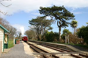
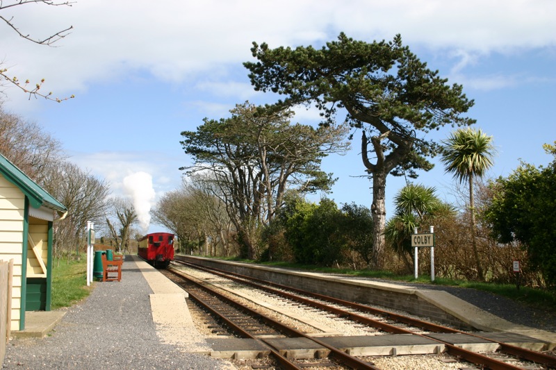
Station statistics Address Colby, Isle Of Man Coordinates 54°05′40″N 4°42′15″W Lines Port Erin Line Structure Open Shelter Platforms Two (Raised) Parking Nearby Other information Opened 1874 Closed 1965 (Seasonal Since) Rebuilt 1991 Owned by Isle Of Man Heritage Railways Formerly Isle Of Man Railway Co. Traffic Passenger Only (Since 1958, Goods Previously) Services Waiting Shelter Colby Station is a small station on the southern edge of the village of Colby in the south of the Isle of Man served by the Isle of Man Railway; it forms part of the sole remaining section of the network which once covered over 46 miles island-wide.

Contents
Origins
Since the station was established in 1874 it consisted of a simple passing loop and goods siding, with waiting room and station master's office. The building was of the same design as the one at Ballasalla Station which was demolished in 1985, and the one still extant at Santon Station.
Location
Trains approach the station from the north on a right curve and depart in a southerly direction in a straight section that lasts until The Level road crossing via Kentraugh Farm occupational crossing.
Rationalisation
The building here survived through nationalisation and was demolished in 1980, leaving no shelter for waiting passengers. The former goods platform is still distinguishable on the westerly side of the station, the siding itself being long-since lifted. Until 1991 the pointwork was still in place at the northerly end of the station but this was removed when remedial works were carried out at this time.
Shelter
In 1991 the shelter from Braddan Bridge on the long-abandoned line to Peel was refurbished and relocated here, but since the station received platforms on both up and down sides of the loop in conjunction with an all-island sewerage network in 2002, the waiting shelter is no longer at platform height, being left in-situ at a lower point giving it an unusual appearance in respect of the actual platforms.
Translation
The station is unique in being the only one on the line to not carry bi-lingual station nameboards because the name translated carries exactly the same spelling, but this does lead to an inconsistency of naming along the line.
Locale
The station is located on the outskirts of the village, and the houses that back onto the perimeter of the station on one side are that of the local authority.
Traffic
The station is a mandatory stopping place and one of the busiest on the line for local traffic, popular with locals who travel by train to do their shopping in either Douglas or Port Erin.
Hostelry
The village has its own public house, the Colby Glen which is visible in the trees to the north of the station, and the housing can be seen from the passing trains.
Route
Preceding station Isle of Man Railway Following station Level Port Erin Line Ballabeg See also
References
- James I.C. Boyd Isle Of Man Railway, Volume 3, The Routes & Rolling Stock (1996) ISBN 0-85361-479-2
- Norman Jones Scenes From The Past: Isle Of Man Railway (1994) ISBN 0-54351-955-6
- Robert Hendry Rails In The Isle Of Man: A Colour Celebration (1993) ISBN 0-59624-884-1
- A.M Goodwyn Manx Transport Kalidescope, 2nd Edition (1995) ISBN 0-85361-479-2
External links
Sources
 Categories:
- Railway stations in the Isle of Man


Wikimedia Foundation. 2010.