- Northern Pacific Bridge Number 9
-
Northern Pacific Bridge #9 
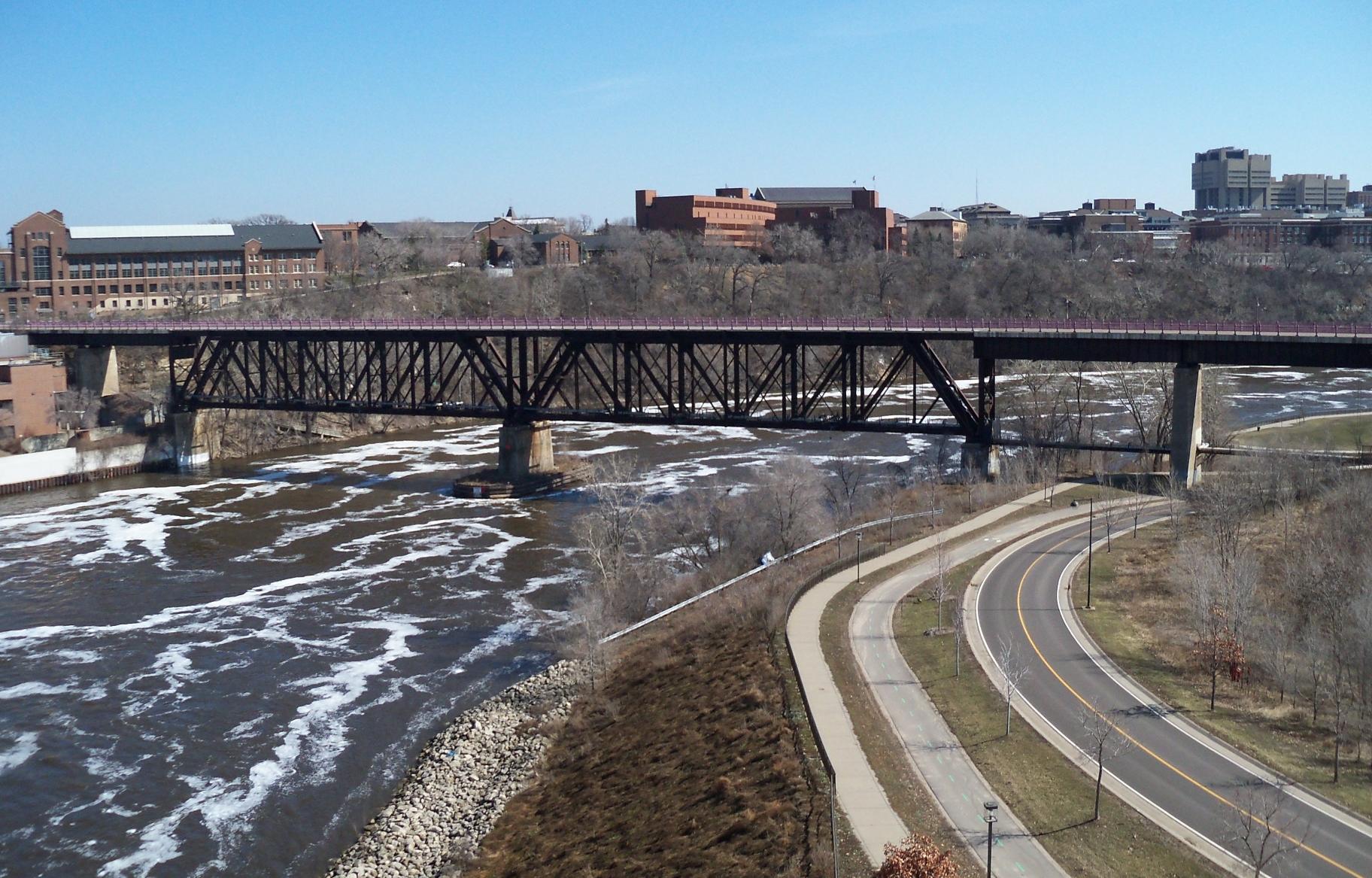
Bridge #9 as seen from the 10th Avenue Bridge over the Mississippi River.Carries Bike and pedestrian lanes; formerly two railroad tracks Crosses Mississippi River Locale Minneapolis, Minnesota Maintained by City of Minneapolis ID number 94246 Design Truss bridge Total length 952 feet Width 24 feet Longest span 245 feet Clearance below 39 feet Opened 1924 Bridges over the Mississippi in Minneapolis/St. Paul.
#9 is about center on this image, between 10th Ave. Bridge and Washington Ave. Bridge
Coordinates 44°58′39″N 93°14′28″W / 44.9775°N 93.24111°W Northern Pacific Bridge #9 is a deck truss bridge that spans the Mississippi River in Minneapolis, Minnesota, between the Seven Corners area and the University of Minnesota campus. It was built in 1924 and was designed by Frederick W. Cappelen. Railroad use of the bridge ended in 1981, and in 1999 the bridge was opened to bicycles and pedestrians. It replaced the former Northern Pacific "A Line" bridge.
History
The Northern Pacific Railway "A line" tracks once formed the southern boundary of the University of Minnesota East Bank campus. but as the University grew, the campus expanded southward around the railroad. The railroad noise, congestion, and pollution caused problems around the campus. In response, the Northern Pacific Railway built a new bridge that angled north of the campus, connecting with an existing railroad line going through Dinkytown. This enabled campus expansion and allowed the Northrop Mall to be built.
Today, the bridge is open to bicyclists and pedestrians. The bridge is accessible from the west side, where there is a connection to the West River Parkway trail, and on the east side via a service road up to East River Parkway near the Mineral Resources Research Center. Historic markers on either side of the bridge describe how the bridge was built and its importance to the area.
The City of Minneapolis plans to connect the bridge to the proposed U of M bicycle and pedestrian trail through Dinkytown in 2011. As part of the construction of the new St. Anthony Falls (35W) Bridge approach, a culvert has been installed that will allow the non-motorized trail to continue west into downtown Minneapolis.
On the south side of the deck, the words "North Coast Lim" can be seen. It formerly read North Coast Limited to advertise the Chicago to Seattle passenger train of that name.
See also
References
- Costello, Mary Charlotte (2002). Climbing the Mississippi River Bridge by Bridge, Volume Two: Minnesota. Cambridge, MN: Adventure Publications. ISBN 0-9644518-2-4.
- Weeks, John (2005). "Northern Pacific Bridge #9, Minneapolis, MN". The Bridges Of Minneapolis And St. Paul. http://www.johnweeks.com/bridges/pages/b02.html. Retrieved 2006-04-19.
Bridges of the Mississippi River Upstream
10th Avenue BridgeNorthern Pacific Bridge Number 9 Downstream
Washington Avenue BridgeCategories:- Truss bridges
- Bridges in Minneapolis, Minnesota
- Bridges over the Mississippi River
- Northern Pacific Railway
- Railroad bridges in Minnesota
- Bridges completed in 1924
- Former railway bridges in the United States
- Pedestrian bridges in Minnesota
- Cyclist bridges

Wikimedia Foundation. 2010.