- Concordia (Karakoram)
-
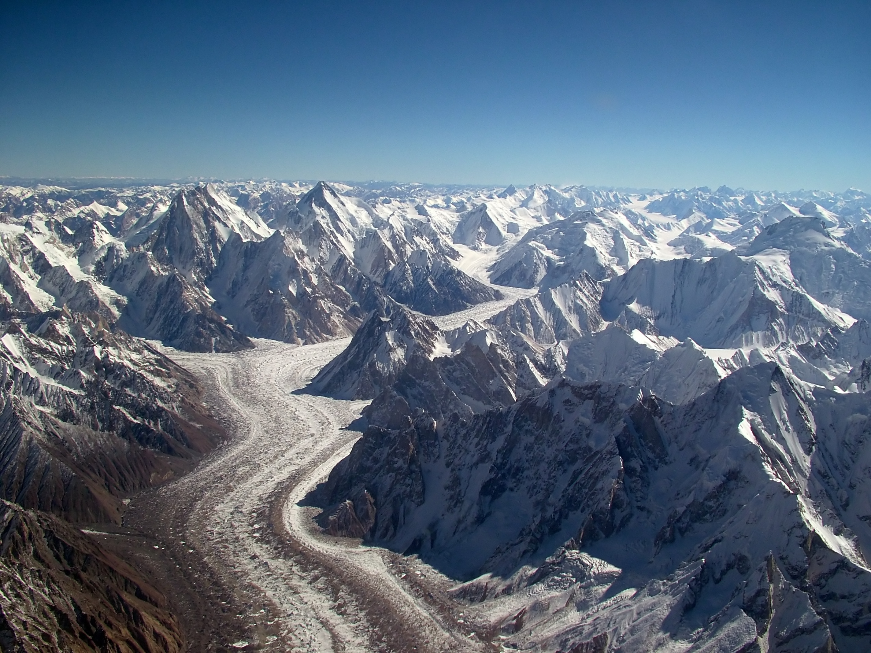
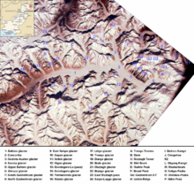 Baltoro region from space, Concordia: 2
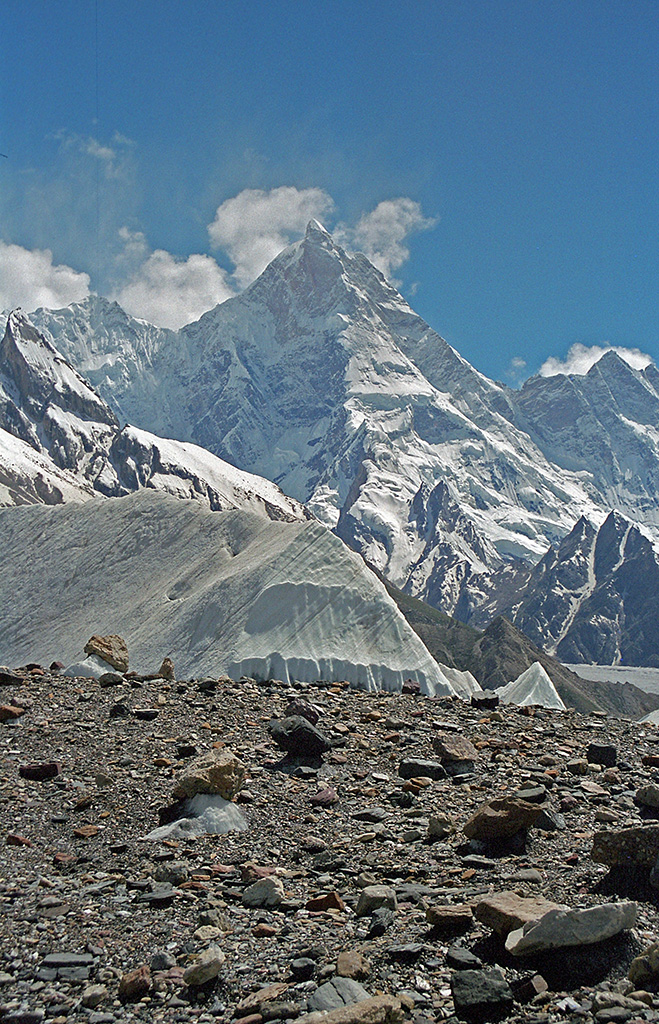
 (From L-R): Marbal Peak, Gasherbrum IV, Gasherbrum II(behind Gasherbrum IV), Concordia, Gasherbrum I, Mitre Peak, Golden Throne, and Chogolisa (or Bride Peak).
Concordia is the name for the confluence of the Baltoro Glacier and the Godwin-Austen Glacier, in the heart of the Karakoram range of Pakistan. It is located in Baltistan region of Pakistan. The name was applied by European explorers, and comes from this location's similarity to a glacial confluence, also named Concordia, in the Bernese Oberland, part of the Central Alps.
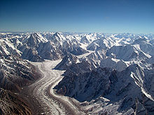
Around Concordia are clustered some of the highest peaks in the world. Four of the world's fourteen "eight-thousanders" are in this region, as well as a number of important lower peaks.
Concordia offers the region's best place to camp for mountain enthusiasts not involved in climbing. With breathtaking views, it also offers short hikes to several important base camps: K2 (three hours), Broad Peak (two hours) and the Gasherbrums (three hours). An alternative exit to returning down the Baltoro Glacier is available by climbing the Gondogoro Pass (5450 meters). Visitors to the region are advised to carefully monitor their water intake with concern. To avoid often painful and sometimes debilitating stomach upsets at high altitude, water should be obtained from clear water sources and brought to a rolling boil, or purified before consumption. Notable peaks in this area include:
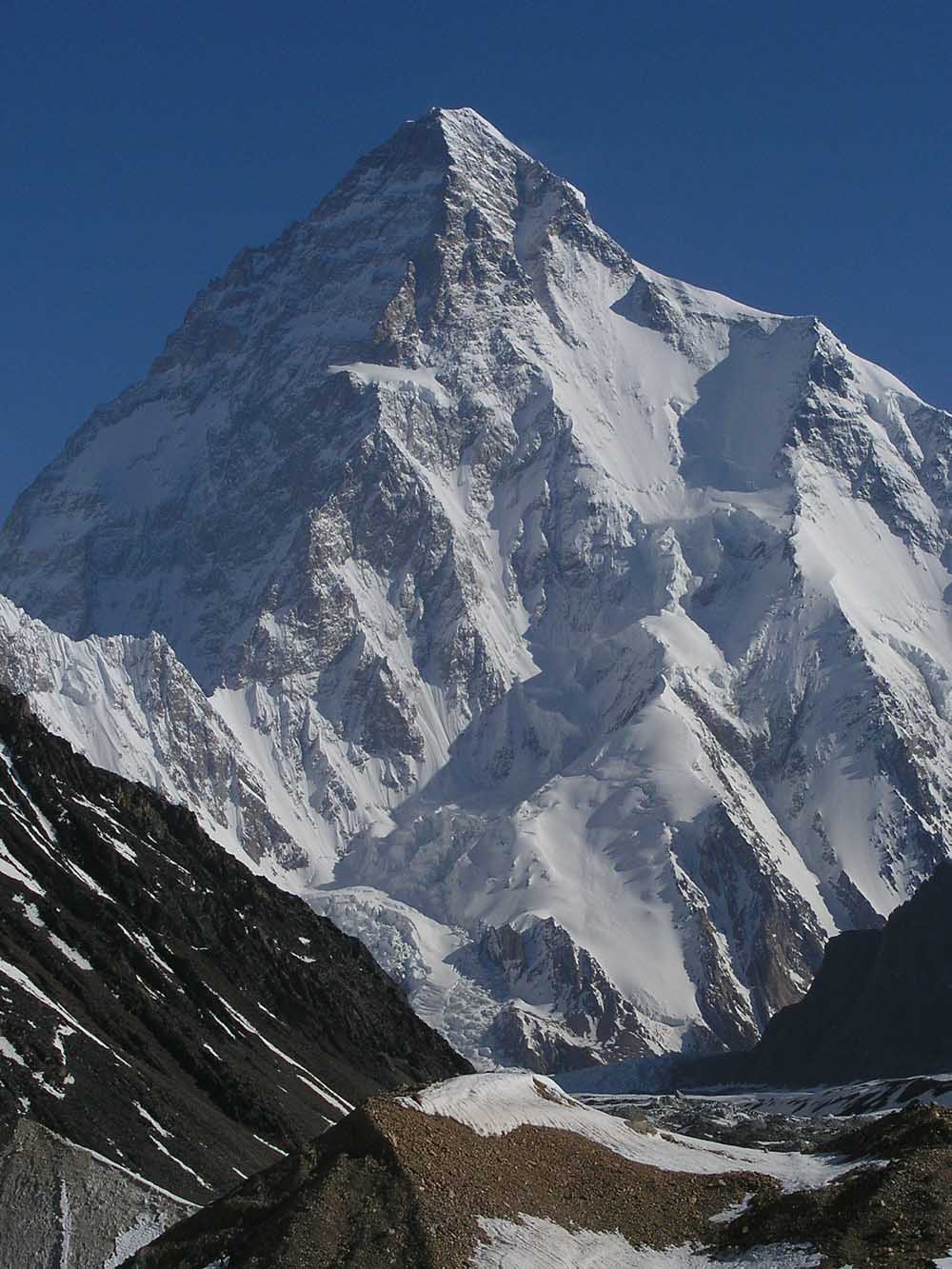
- K2, second highest in the world at 8,611m.
- Gasherbrum I, 11th highest in the world at 8,080m.
- Broad Peak, 12th highest in the world at 8,047m.
- Gasherbrum II, 13th highest in the world at 8,035m.
- Gasherbrum III, 7,952m.
- Gasherbrum IV, 17th highest in the world at 7,925m.
- Masherbrum (K1), 22nd highest in the world at 7,821m.
- Chogolisa, 36th highest in the world at 7,665m.
- Muztagh Tower, 7,273m.
- Snow Dome, 7,160m.
- Biarchedi, 6,781 m
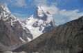
- Mitre Peak, 6,010m.
See also
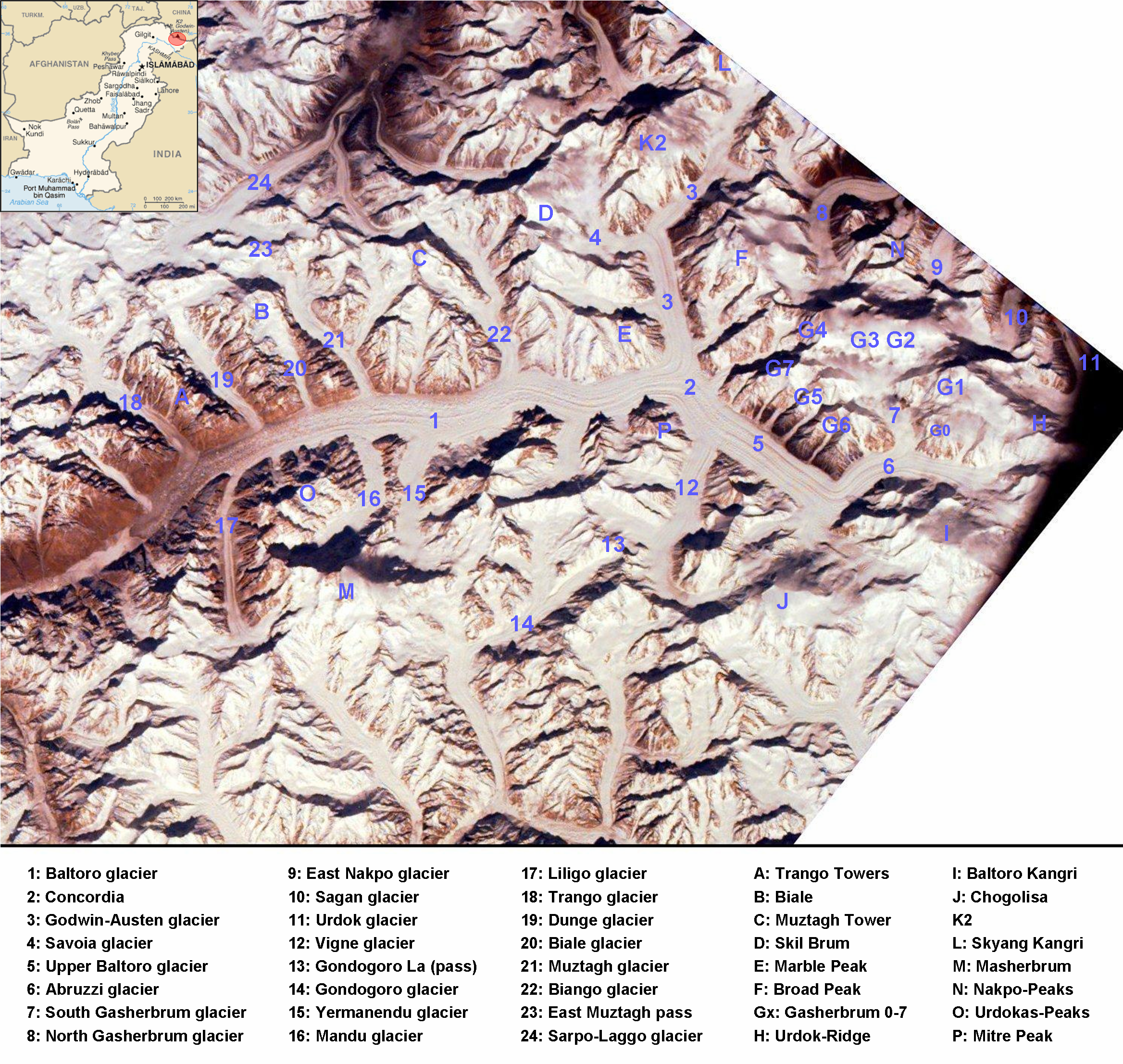
- Baltoro Glacier
- Deosai National Park
- Godwin-Austen Glacier
- Northern Areas
- Sarpo Laggo Glacier
- Trango Towers
- Eight-thousander
- List of mountains in Pakistan
- List of highest mountains
Image gallery
-

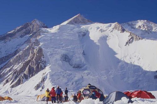
Broad Peak (8,047m) from Concordia
-

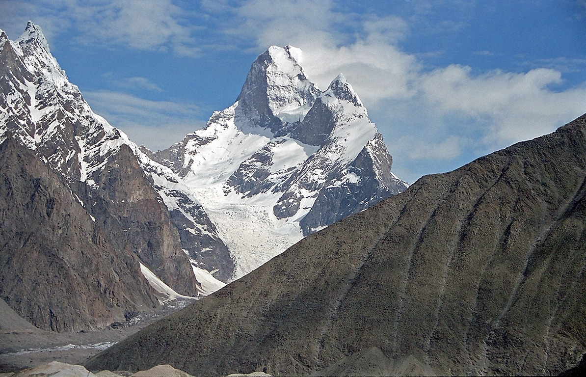
Masherbrum (7,821m), Pakistan
-

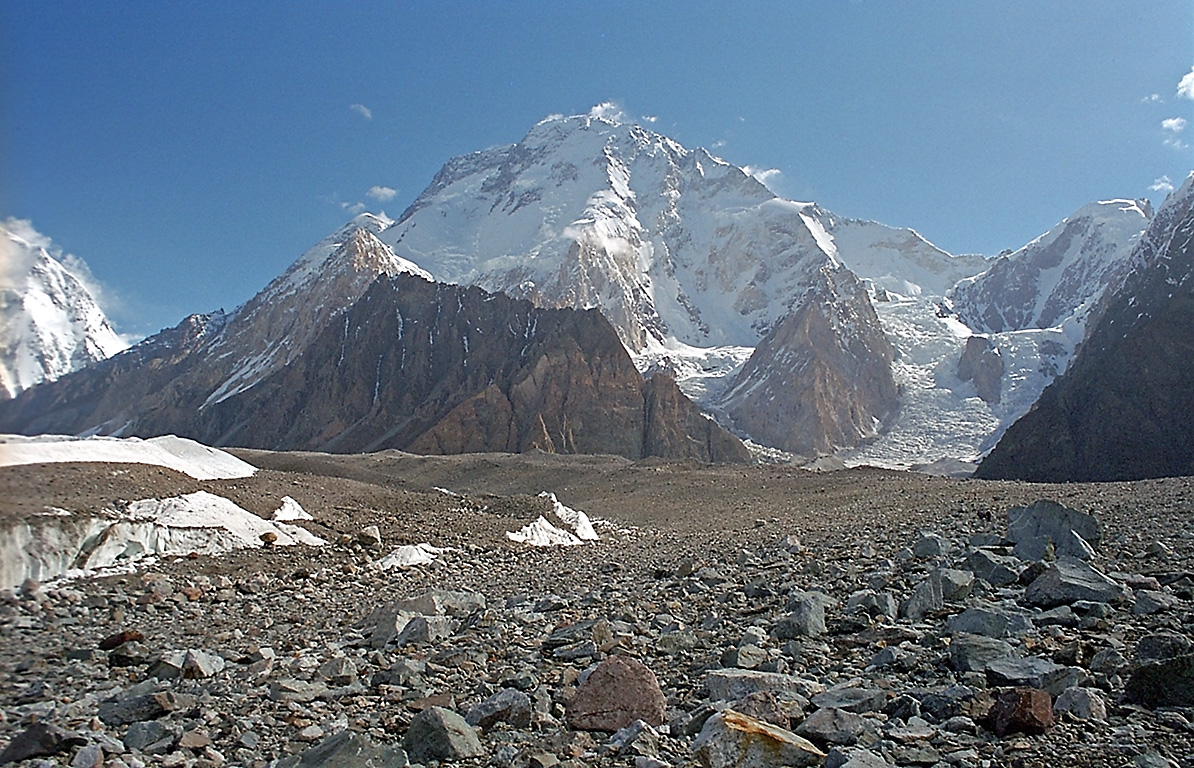
Gasherbrum II (8,035m), Pakistan
-
Muztagh Tower (7,273m), Pakistan
-

Way to Concordia from Skardu
Coordinates: 35°44′N 76°31′E / 35.733°N 76.517°E
Concordia is the only radius point in the world from where four 8000m above peaks can be viewed (K2, Broad Peak, Geshabaram I & II)
External links
Categories:

Wikimedia Foundation. 2010.