River Dee, Galloway

River Dee, Galloway
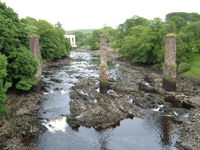
River Dee
River
View of the Dee at Tongland
Country Scotland
Region Galloway
Tributaries
 - left Tarff Water
 - right Water of Ken
Settlements Kirkcudbright, Tongland, Bridge of Dee, Glenlochar, Crossmichael, Parton
Source Loch Dee
Mouth Kirkcudbright Bay
Length 61 km (38 mi)
Basin 1,050 km2 (405 sq mi)

The River Dee, in south-west Scotland, flows from its source in Loch Dee amongst the Galloway Hills, firstly to Clatteringshaws Loch, then in to Loch Ken, where it joins the Water of Ken. From there, the Dee flows 15 miles (24 km) southwards to Kirkcudbright, and into Kirkcudbright Bay to reach the Solway. The distance is just over 38 miles (61 km) in total. Together with its tributaries, the Dee's total catchment area is over 400 square miles (1,000 km2).[1]

The river is dammed at Tongland, two miles (3 km) upriver from Kirkcudbright. This was constructed as part of the Galloway hydro-electric power scheme in the 1930s. Also at this site is Tongland Bridge, built in 1806 by Thomas Telford.

The ruins of Threave Castle stand on an island on the lower part of the Dee.

The Dee has also been known as the Black Water of Dee because of its dark colour in the stretch above Loch Ken. In Ptolemy's 2nd century work Geography it is listed as the river Deva.[2]

Loch Ken and the Dee Marshes were together designated a Ramsar site on August 21, 1992.

Tarff Water

The Tarff Water enters the Dee as a right-bank tributary near Tongland in the tidal stretch of the river. The headwater streams of the Tarff drain the tract of country between the villages of Laurieston and Ringford including Loch Mannoch. The river should not be confused with the similarly named Tarf Water which is a tributary of the River Bladnoch further west in Galloway.

See also

  • Rivers of Scotland

References

  1. ^ "Description of river systems in Galloway:". Galloway Fisheries Trust. http://www.gallowayfisheriestrust.org/rivers-dumfries-galloway.asp. 
  2. ^ Henry, Robert; Laing, Malcom (1800). The History of Great Britain: From the First Invasion of it by the Romans. Great Britain: A. Strahan. pp. 397. 

Coordinates: 54°48′12″N 4°04′11″W / 54.8034°N 4.06975°W / 54.8034; -4.06975


Wikimedia Foundation. 2010.

Игры ⚽ Нужно решить контрольную?

Look at other dictionaries:

  • River Dee — may refer to: River Dee, Aberdeenshire (Uisge Dè), Scotland, which flows from the Cairngorms to Aberdeen River Dee (Wales) (Afon Dyfrdwy), Flows through North Wales and Cheshire River Dee (Lune), rising on the border between Cumbria and North… …   Wikipedia

  • Galloway (car) — Galloway was a British car maker founded in 1920 as a subsidiary company to Arrol Johnston. It was based at first at Tongland, Kirkcudbrightshire, and from 1923 at Heathall, Dumfries. It closed in 1928.HistoryThe company was very unusual in the… …   Wikipedia

  • Galloway hydro-electric power scheme — The Galloway hydro electric power scheme is a network of dams and hydro electric power stations in Galloway, south west Scotland. It was built between 1930 and 1936. The generating stations draw water from the River Ken, River Dee and River Doon… …   Wikipedia

  • Galloway — (Gaelic: Gall Ghaidhealaibh , pronounced|əŋ ɡauɫ̪ɣəɫ̪əv or Gallobha , Lowland Scots Gallowa ) is an area in southwestern Scotland. It usually refers to the former counties of Wigtown (or historically West Galloway) and Kirkcudbright (or… …   Wikipedia

  • Dumfries and Galloway — See also: Dumfries and Galloway (UK Parliament constituency) Dumfries and Galloway Dumfries an Gallowa Dùn Phris is Gall Ghaidhealaibh Logo Location …   Wikipedia

  • Old Dee Bridge — For the bridge and district in Aberdeen, see Bridge of Dee. For the village in Dumfries and Galloway, see Bridge of Dee, Galloway. Old Dee Bridge Old Dee Bridge Carries Vehicles and pedestrians …   Wikipedia

  • Parton, Dumfries and Galloway — Parton is a village situated on the banks of the River Dee in Dumfries and Galloway, Scotland.Prominent mathematical physicist James Clerk Maxwell lived at the nearby Glenlair House. He was famous for developing formulae governing electricity and …   Wikipedia

  • Fergus of Galloway — was King, or Lord, of Galloway from an unknown date (probably in the 1110s), until his death in 1161. He was the founder of that sub kingdom, the resurrector of the Bishopric of Whithorn, the patron of new abbeys (e.g. Dundrennan Abbey), and much …   Wikipedia

  • List of rivers of Scotland — List of rivers in Scotland is a list of rivers in Scotland, organised geographically, taken anti clockwise, from Berwick upon Tweed. Tributaries are listed down the page in an upstream direction.For simplicity, they are divided here by the nation …   Wikipedia

  • Liste Des Cours D'eau D'Écosse — La liste des cours d eau d Écosse recense les principaux fleuves d Écosse, classés de manière géographique dans le sens inverse des aiguilles d une montre à partir de Berwick upon Tweed. Les affluents sont eux classés dans le sens de leur courant …   Wikipédia en Français

Share the article and excerpts

Direct link
Do a right-click on the link above
and select “Copy Link”