- Oude Niedorp
-
Oude Niedorp — Town — 

Coat of arms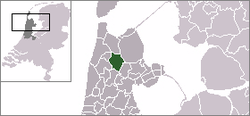 Oude Niedorp in the municipality of Niedorp.
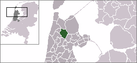
Coordinates: 52°43′4″N 4°52′19″E / 52.71778°N 4.87194°ECoordinates: 52°43′4″N 4°52′19″E / 52.71778°N 4.87194°E Country Netherlands Province North Holland Municipality Niedorp Population (1 January 2005) – Total 420 Time zone CET (UTC+1) – Summer (DST) CEST (UTC+2) Postal code Oude Niedorp (West Frisian: Ouwe Nierup) is a village in the Dutch province of North Holland. It is a part of the municipality of Niedorp, and lies about 6 kilometres (3.7 mi) northeast of Heerhugowaard.
Oude Niedorp was a separate municipality until 1970, when it merged with Nieuwe Niedorp and Winkel.[1]
The statistical area "Oude Niedorp", which also can include the surrounding countryside, has a population of around 420.[2]
References
- ^ Ad van der Meer and Onno Boonstra, Repertorium van Nederlandse gemeenten, KNAW, 2006.
- ^ Statistics Netherlands (CBS), Statline: Kerncijfers wijken en buurten 2003-2005. As of 1 January 2005.
External links
- J. Kuyper, Gemeente Atlas van Nederland, 1865-1870, "Oude Niedorp". Map of the former municipality, around 1868.
Categories:- Former municipalities of North Holland
- Populated places in North Holland
- North Holland geography stubs


Wikimedia Foundation. 2010.