- Nieuwe Niedorp
-
Nieuwe Niedorp — Town — 

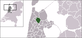
Coat of arms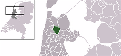 The village centre (dark green) and the statistical district (light green) of Nieuwe Niedorp in the municipality of Niedorp.
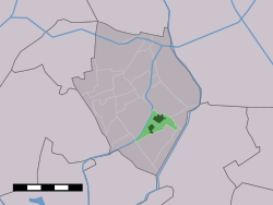
Coordinates: 52°44′29″N 4°54′2″E / 52.74139°N 4.90056°ECoordinates: 52°44′29″N 4°54′2″E / 52.74139°N 4.90056°E Country Netherlands Province North Holland Municipality Niedorp Population – Total 3,160 Time zone CET (UTC+1) – Summer (DST) CEST (UTC+2) Postal code 1733 Dialing code 0226 Nieuwe Niedorp (West Frisian: Naaie Nierup) is a village in the Dutch province of North Holland. It is a part of the municipality of Niedorp, and lies about 9 kilometres (5.6 mi) northeast of Heerhugowaard.
Nieuwe Niedorp was a separate municipality until 1970, when it merged with Oude Niedorp and Winkel.[1]
In 2007, the village of Nieuwe Niedorp had 3160 inhabitants. The built-up area of the village was 0.53 km², and contained 760 residences.[2] The statistical area "Nieuwe-Niedorp", which also can include the peripheral parts of the village, as well as the surrounding countryside, has a population of around 3200.[3]
It has a remarkably leaning church tower.
Contents
Famous Inhabitants
- Dirck Rembrantsz van Nierop 1610-1682
- Pieter Rembrantsz van Nierop 1658-1708
References
- ^ Ad van der Meer and Onno Boonstra, "Repertorium van Nederlandse gemeenten", KNAW, 2006. [1]
- ^ Statistics Netherlands (CBS), Bevolkingskernen in Nederland 2001. (Statistics are for the continuous built-up area).
- ^ Statistics Netherlands (CBS), Statline: Kerncijfers wijken en buurten 2003-2005. As of 1 January 2005.
See also
- Zeeuws spek
External links
- J. Kuyper, Gemeente Atlas van Nederland, 1865-1870, "Nieuwe-Niedorp". Map of the former municipality in 1868.
Categories:- Former municipalities of North Holland
- Populated places in North Holland
- North Holland geography stubs


Wikimedia Foundation. 2010.