- 's-Heerenhoek
-
's-Heerenhoek — Town — 's-Heerenhoek, church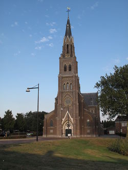
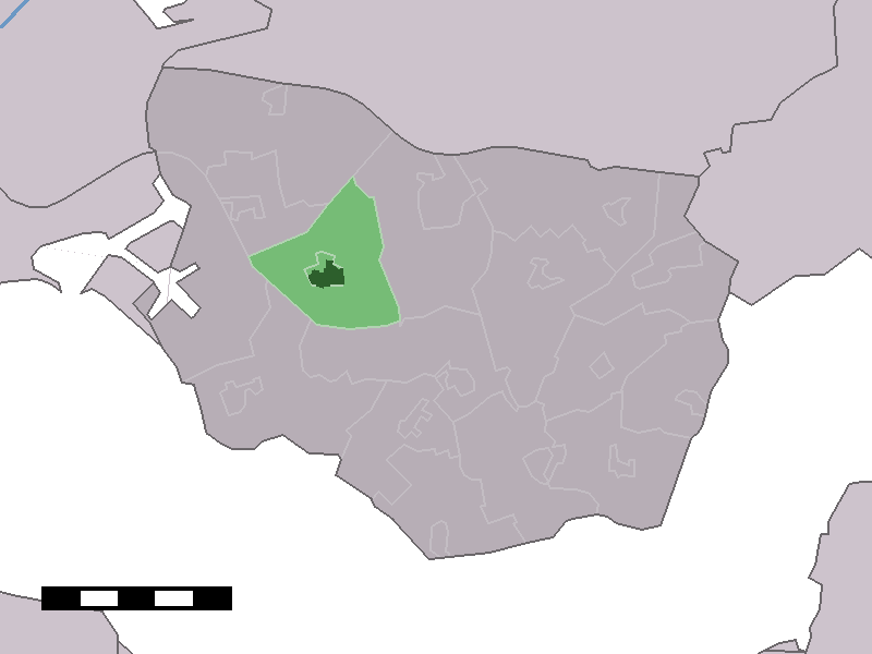
Coat of arms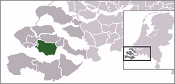 The town centre (dark green) and the statistical district (light green) of 's-Heerenhoek in the municipality of Borsele.
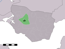
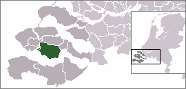
Coordinates: 51°27′12″N 3°46′10″E / 51.45333°N 3.76944°ECoordinates: 51°27′12″N 3°46′10″E / 51.45333°N 3.76944°E Country Netherlands Province Zeeland Municipality Borsele Population (1 January 2010) - Total 1,939 Time zone CET (UTC+1) - Summer (DST) CEST (UTC+2) Postal code 's-Heerenhoek is a town in the Dutch province of Zeeland. It is a part of the municipality of Borsele, and lies about 12 km east of Middelburg.
's-Heerenhoek was a separate municipality until 1970.[1]
In 2001, the town of 's-Heerenhoek had 1335 inhabitants. The built-up area of the town was 0.41 km², and contained 603 residences.[2] The statistical area "'s-Heerenhoek", which also can include the peripheral parts of the village, as well as the surrounding countryside, has a population of around 1970.[3]
References
- ^ Ad van der Meer and Onno Boonstra, Repertorium van Nederlandse gemeenten, KNAW, 2006.
- ^ Statistics Netherlands (CBS), Bevolkingskernen in Nederland 2001. (Statistics are for the continuous built-up area).
- ^ Statistics Netherlands (CBS), Statline: Kerncijfers wijken en buurten 2003-2005. As of 1 January 2005. Archived 24 July 2006 at WebCite
External links
- J. Kuyper, Gemeente Atlas van Nederland, 1865-1870, "'s-Heerenhoek". Map of the former municipality, around 1868.
Categories:- Zeeland geography stubs
- Former municipalities of Zeeland
- Populated places in Zeeland

Wikimedia Foundation. 2010.