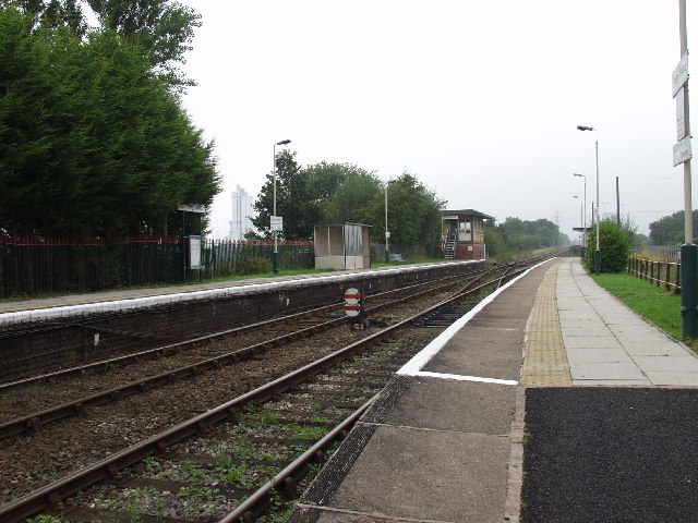
Penyffordd railway station
- Penyffordd railway station
Infobox UK station
name = Penyffordd
other_name=
code = PNF
caption =
manager = Arriva Trains Wales
locale = Penyffordd
borough = Flintshire
lowusage0405 = 18,234
lowusage0506 = 18,754
lowusage0607 = 16,910
platforms =
years =
events =Penyffordd railway station serves the village of Penyffordd in Flintshire, Wales. The station is 12 km (7¼ miles) north of Wrexham Central on the Borderlands Line.
ervices
The station is a request stop and there is potentially an hourly service (providing passengers request it) southbound to Wrexham General and northbound to Bidston for connections to Liverpool via the Wirral Lines.
Sundays there is generally a two-hourly service in each direction.
External links
###@@@KEYEND@@@###
Wikimedia Foundation.
2010.
Look at other dictionaries:
Penyffordd — infobox UK place country= Wales welsh name= Penyffordd constituency welsh assembly= Alyn and Deeside official name= Penyffordd population = 3,715 (2001)citeweb|url=http://neighbourhood.statistics.gov.uk/dissemination/LeadTableView.do?a=7 b=800997 … Wikipedia
Mold and Denbigh Junction Railway — [v · d · … Wikipedia
Mold Railway — [v · d · … Wikipedia
PNF — could refer to:* National Fascist Party ( Partito Nazionale Fascista ), Italy * Penyffordd railway station, Wales; National Rail station code PNF * PIMCO New York Municipal Income Fund; NYSE symbol PNF * PNF stretching * Proprioceptive… … Wikipedia
Wrexham — infobox UK place country = Wales welsh name=Wrecsam constituency welsh assembly=Wrexham, Clwyd South latitude=53.03 longitude= 2.98 official name= Wrexham unitary wales= Wrexham population= 63,084 (2001) lieutenancy wales= Clwyd constituency… … Wikipedia
A55 road — The A55 at Warren Mountain. Route information … Wikipedia
Mold, Flintshire — Coordinates: 53°09′58″N 3°07′59″W / 53.166°N 3.133°W / 53.166; 3.133 … Wikipedia
Nannerch — Coordinates: 53°12′58″N 3°15′00″W / 53.216°N 3.25°W / 53.216; 3.25 … Wikipedia
Connah's Quay — Coordinates: 53°13′04″N 3°03′26″W / 53.2179°N 3.0573°W / 53.2179; 3.0573 … Wikipedia
Coed Talon — Former Calvinistic Methodist chapel in Coed Talon Coed Talon (also spelt Coed talon ) is a small, formerly industrial village between Leeswood and Treuddyn in Flintshire, North Wales. Its name is derived from the Welsh word coed ( wood ) and the… … Wikipedia